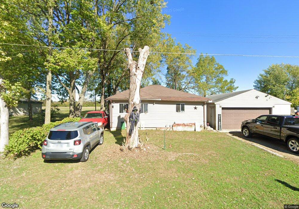
1926 Daugherty Ave Columbus, OH 43207
Obetz-Lockbourne NeighborhoodEstimated Value: $147,844 - $190,000
2
Beds
1
Bath
795
Sq Ft
$207/Sq Ft
Est. Value
About This Home
This home is located at 1926 Daugherty Ave, Columbus, OH 43207 and is currently estimated at $164,711, approximately $207 per square foot. 1926 Daugherty Ave is a home located in Franklin County with nearby schools including West Elementary School, Hamilton Elementary School, and Hamilton Intermediate School.
Ownership History
Date
Name
Owned For
Owner Type
Purchase Details
Closed on
May 13, 2019
Sold by
Phillips Michelle
Bought by
Sloan Martin
Current Estimated Value
Purchase Details
Closed on
Dec 7, 2017
Sold by
Cable James E
Bought by
Heakthcare It Resource 401K Plan
Purchase Details
Closed on
Jul 26, 2017
Sold by
Cable James E
Bought by
Healthcare It Resources 401K Plan
Purchase Details
Closed on
Aug 7, 1965
Bought by
Cable James E
Create a Home Valuation Report for This Property
The Home Valuation Report is an in-depth analysis detailing your home's value as well as a comparison with similar homes in the area
Home Values in the Area
Average Home Value in this Area
Purchase History
| Date | Buyer | Sale Price | Title Company |
|---|---|---|---|
| Sloan Martin | $45,000 | Northwest Select Ttl Agcy Ll | |
| Heakthcare It Resource 401K Plan | -- | None Available | |
| Healthcare It Resources 401K Plan | $43,000 | None Available | |
| Cable James E | -- | -- |
Source: Public Records
Tax History Compared to Growth
Tax History
| Year | Tax Paid | Tax Assessment Tax Assessment Total Assessment is a certain percentage of the fair market value that is determined by local assessors to be the total taxable value of land and additions on the property. | Land | Improvement |
|---|---|---|---|---|
| 2024 | $1,602 | $35,070 | $8,820 | $26,250 |
| 2023 | $1,594 | $35,070 | $8,820 | $26,250 |
| 2022 | $532 | $9,810 | $2,700 | $7,110 |
| 2021 | $539 | $9,810 | $2,700 | $7,110 |
| 2020 | $549 | $9,810 | $2,700 | $7,110 |
| 2019 | $635 | $9,810 | $2,700 | $7,110 |
| 2018 | $996 | $21,220 | $2,700 | $18,520 |
| 2017 | $1,299 | $21,220 | $2,700 | $18,520 |
| 2016 | $671 | $19,120 | $950 | $18,170 |
| 2015 | $636 | $19,120 | $950 | $18,170 |
| 2014 | $633 | $19,120 | $950 | $18,170 |
| 2013 | $367 | $21,245 | $1,050 | $20,195 |
Source: Public Records
Map
Nearby Homes
- 1962 Reese Ave
- 1987 Reese Ave
- 1817 Marlboro Ave
- 1632 Marlboro Ave
- 4417 Lancaster Ave
- 4383 Lancaster Ave
- 1559 Obetz Ave
- 1341 Halfhill Way
- 4410 Holstein Dr
- 4412 Catamaran Dr
- 4231 Umiak Dr
- 1597 Metcalfe Ave
- 1583 Metcalfe Ave
- 1187 Rendezvous Ln
- 1193 Rendezvous Ln
- 4241 Gelbray Ct
- 1099 Secrest Ave
- 1292 Webb Dr Unit Lot 83
- 1315 Webb Dr Unit Lot 93
- 4175 Holstein Dr
- 1940 Daugherty Ave
- 1922 Daugherty Ave
- 0 Daugherty Ave
- 1950 Daugherty Ave
- 1950 Daugherty Ave
- 1918 Daugherty Ave
- 4701 Wood St
- 1932 Todd Ave
- 1932 Todd Ave
- 1912 Daugherty Ave
- 1928 Todd Ave
- 1934 Todd Ave
- 1926 Todd Ave
- 1938 Todd Ave
- 1920 Todd Ave
- 1957 Daugherty Ave
- 1954 Daugherty Ave
- 1954 Daugherty Ave
- 1916 Todd Ave
- 1914 Todd Ave