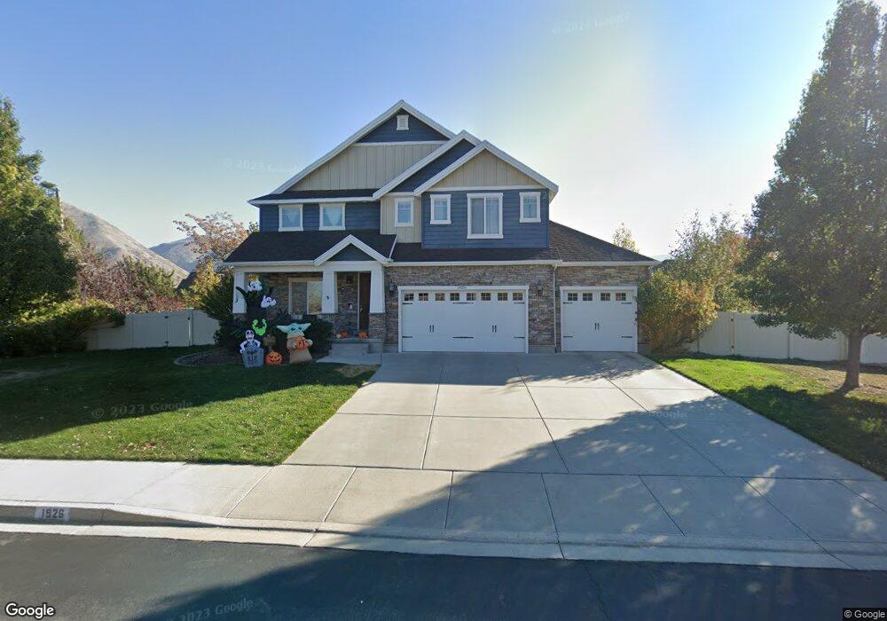
1926 N 1350 W Unit 28 Mapleton, UT 84664
Estimated Value: $762,000 - $1,046,000
4
Beds
3
Baths
2,787
Sq Ft
$306/Sq Ft
Est. Value
About This Home
This home is located at 1926 N 1350 W Unit 28, Mapleton, UT 84664 and is currently estimated at $852,821, approximately $305 per square foot. 1926 N 1350 W Unit 28 is a home located in Utah County with nearby schools including Mapleton School, Mapleton Junior High School, and Maple Mountain High School.
Ownership History
Date
Name
Owned For
Owner Type
Purchase Details
Closed on
Nov 6, 2014
Sold by
Berthold Brian and Berthold Cyndi
Bought by
Rogers Amber M and Rogers David S
Current Estimated Value
Home Financials for this Owner
Home Financials are based on the most recent Mortgage that was taken out on this home.
Original Mortgage
$374,784
Outstanding Balance
$288,887
Interest Rate
4.17%
Mortgage Type
VA
Estimated Equity
$563,934
Purchase Details
Closed on
Apr 26, 2012
Sold by
Dr Horton Inc
Bought by
Berthold Brian and Berthold Cyndi
Home Financials for this Owner
Home Financials are based on the most recent Mortgage that was taken out on this home.
Original Mortgage
$209,990
Interest Rate
3.9%
Mortgage Type
New Conventional
Purchase Details
Closed on
Jun 16, 2011
Sold by
Sweet Iron Development Llc
Bought by
D R Horton Inc
Create a Home Valuation Report for This Property
The Home Valuation Report is an in-depth analysis detailing your home's value as well as a comparison with similar homes in the area
Home Values in the Area
Average Home Value in this Area
Purchase History
| Date | Buyer | Sale Price | Title Company |
|---|---|---|---|
| Rogers Amber M | -- | Keystone Title Ins Agen | |
| Berthold Brian | -- | Provo Land Title Co | |
| D R Horton Inc | -- | Highland Title |
Source: Public Records
Mortgage History
| Date | Status | Borrower | Loan Amount |
|---|---|---|---|
| Open | Rogers Amber M | $374,784 | |
| Previous Owner | Berthold Brian | $209,990 |
Source: Public Records
Tax History
| Year | Tax Paid | Tax Assessment Tax Assessment Total Assessment is a certain percentage of the fair market value that is determined by local assessors to be the total taxable value of land and additions on the property. | Land | Improvement |
|---|---|---|---|---|
| 2025 | $3,614 | $406,175 | -- | -- |
| 2024 | $3,614 | $354,035 | $0 | $0 |
| 2023 | $3,758 | $370,480 | $0 | $0 |
| 2022 | $3,840 | $374,330 | $0 | $0 |
| 2021 | $3,247 | $485,900 | $163,100 | $322,800 |
| 2020 | $3,227 | $467,100 | $144,300 | $322,800 |
| 2019 | $2,836 | $419,100 | $138,400 | $280,700 |
| 2018 | $2,798 | $393,600 | $116,600 | $277,000 |
| 2017 | $2,845 | $212,355 | $0 | $0 |
| 2016 | $2,808 | $208,340 | $0 | $0 |
| 2015 | $2,692 | $198,550 | $0 | $0 |
| 2014 | $2,494 | $180,620 | $0 | $0 |
Source: Public Records
Map
Nearby Homes
- 1121 W 1800 N
- 1403 S 625 E
- 1518 S 600 E
- 949 S 1060 E
- 1525 S 400 E Unit 36
- 1264 E 1150 S
- 1410 W 1200 N
- 899 E 800 S
- 598 W 1600 N
- 1697 N 500 W
- 405 W 1200 N Unit 4
- 487 W 1200 N Unit 1
- 677 E 800 South St
- 1853 S 375 E
- 579 E 800 St S
- 629 E 800 St S
- 942 Sage Creek Cir
- 1518 E Pheasant Run Dr
- 145 W Carnesecca Ct
- 645 Swenson Ave Unit 5
- 1926 N 1350 W
- 1892 N 1350 W Unit 27
- 1892 N 1350 W
- 1345 W 2000 N
- 1925 N 1250 W
- 1313 W 2000 N
- 1941 N 1350 W Unit 2
- 1941 N 1350 W
- 1897 N 1250 W Unit 22
- 1901 N 1350 W Unit 3
- 1901 N 1350 W
- 1255 W 2000 N
- 1864 N 1350 W Unit 26
- 1864 N 1350 W
- 1385 W 2000 N
- 1873 N 1250 W Unit 23
- 1873 N 1250 W
- 1869 N 1350 W
- 1922 Apple Orchard Ln
- 1948 Apple Orchard Ln
Your Personal Tour Guide
Ask me questions while you tour the home.