Estimated Value: $353,000 - $398,000
4
Beds
3
Baths
2,058
Sq Ft
$186/Sq Ft
Est. Value
About This Home
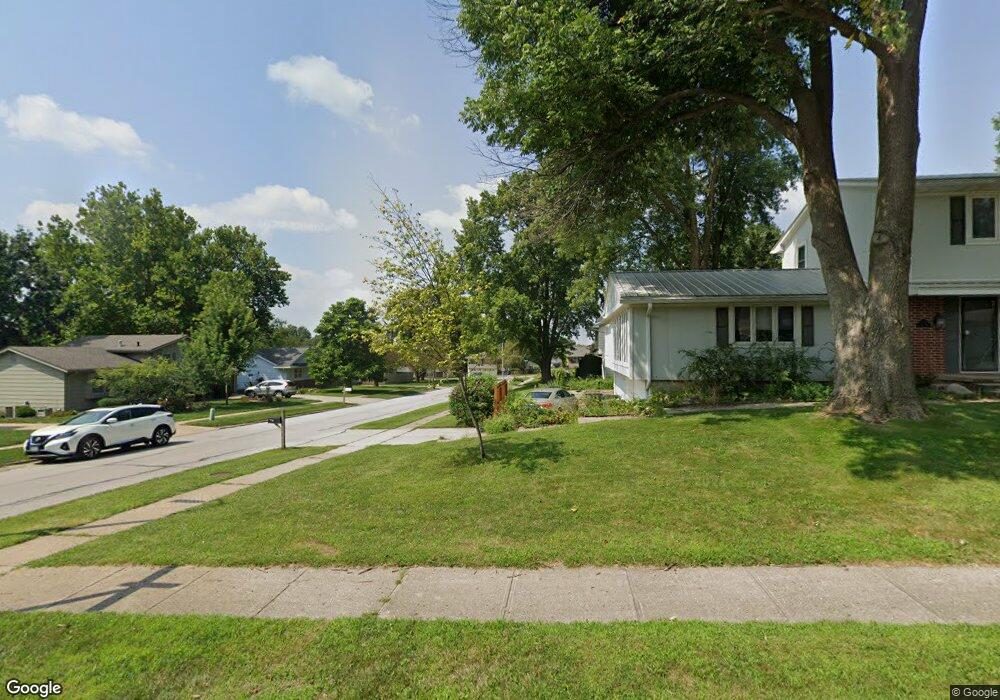
This home is located at 1926 NW 89th St, Clive, IA 50325 and is currently estimated at $382,795, approximately $186 per square foot. 1926 NW 89th St is a home located in Polk County with nearby schools including Crestview Elementary School, Indian Hills Junior High School, and Valley Southwoods Freshman High School.
Ownership History
Date
Name
Owned For
Owner Type
Purchase Details
Closed on
Jul 6, 2006
Sold by
Rabedeaux Neal R and Johnson Madonna J
Bought by
Pilling Nick W and Fink Jessica A
Current Estimated Value
Home Financials for this Owner
Home Financials are based on the most recent Mortgage that was taken out on this home.
Original Mortgage
$176,000
Outstanding Balance
$104,340
Interest Rate
6.72%
Mortgage Type
Purchase Money Mortgage
Estimated Equity
$278,455
Create a Home Valuation Report for This Property
The Home Valuation Report is an in-depth analysis detailing your home's value as well as a comparison with similar homes in the area
Home Values in the Area
Average Home Value in this Area
Purchase History
| Date | Buyer | Sale Price | Title Company |
|---|---|---|---|
| Pilling Nick W | $219,500 | None Available |
Source: Public Records
Mortgage History
| Date | Status | Borrower | Loan Amount |
|---|---|---|---|
| Open | Pilling Nick W | $176,000 |
Source: Public Records
Tax History Compared to Growth
Tax History
| Year | Tax Paid | Tax Assessment Tax Assessment Total Assessment is a certain percentage of the fair market value that is determined by local assessors to be the total taxable value of land and additions on the property. | Land | Improvement |
|---|---|---|---|---|
| 2025 | $5,900 | $427,700 | $60,500 | $367,200 |
| 2024 | $5,900 | $397,000 | $55,400 | $341,600 |
| 2023 | $5,918 | $397,000 | $55,400 | $341,600 |
| 2022 | $5,846 | $324,700 | $46,600 | $278,100 |
| 2021 | $5,590 | $324,700 | $46,600 | $278,100 |
| 2020 | $5,504 | $295,400 | $42,300 | $253,100 |
| 2019 | $5,018 | $295,400 | $42,300 | $253,100 |
| 2018 | $4,916 | $260,400 | $36,500 | $223,900 |
| 2017 | $4,836 | $260,400 | $36,500 | $223,900 |
| 2016 | $4,554 | $250,400 | $34,900 | $215,500 |
| 2015 | $4,554 | $241,500 | $34,900 | $206,600 |
| 2014 | $4,098 | $223,700 | $30,400 | $193,300 |
Source: Public Records
Map
Nearby Homes
- 1901 NW 89th St
- 8826 Franklin Ave
- 1824 NW 90th St
- 1841 NW 89th Ct
- 8833 Luin Dr
- 1667 NW 93rd Ct
- 9452 Lincoln Ave
- 17686 Townsend Dr
- 17769 Townsend Dr
- TBD Hickman Rd
- 17662 Hammontree Dr
- 17686 Hammontree Dr
- 17736 Hammontree Dr
- 1837 NW 81st St
- 8115 Cobblestone Ct
- 1630 Parkside Ln
- 1600 Parkside Ln
- 1590 Parkside Ln
- 1550 Parkside Ln
- 8075 Garrison Rd
- 1914 NW 89th St
- 1930 NW 89th St
- 1915 NW 90th St
- 1925 NW 90th St
- 1903 NW 90th St
- 1940 NW 89th St
- 1937 NW 89th St
- 1902 NW 89th St
- 1927 NW 89th St
- 1935 NW 90th St
- 1915 NW 89th St
- 8880 Primrose Ln
- 1855 NW 90th St
- 1950 NW 89th St
- 1947 NW 90th St
- 8842 Primrose Ln
- 1912 NW 90th St
- 1891 NW 89th St
- 1900 NW 90th St
- 1922 NW 90th St