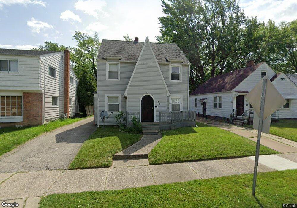
1926 Perth St Toledo, OH 43607
Ottawa NeighborhoodEstimated Value: $124,000 - $133,000
4
Beds
2
Baths
1,418
Sq Ft
$91/Sq Ft
Est. Value
About This Home
This home is located at 1926 Perth St, Toledo, OH 43607 and is currently estimated at $128,347, approximately $90 per square foot. 1926 Perth St is a home located in Lucas County with nearby schools including Old Orchard Elementary School, Start High School, and Explorers Academy.
Ownership History
Date
Name
Owned For
Owner Type
Purchase Details
Closed on
Aug 15, 2023
Sold by
Mhs Investments Llc
Bought by
Madadi Nithin
Current Estimated Value
Purchase Details
Closed on
Aug 25, 2011
Sold by
Stubbs Michael C and Stubbs Heather E
Bought by
Mhs Investments Llc
Purchase Details
Closed on
Sep 13, 2005
Sold by
Stubbs Michael C and Stubbs Heather E
Bought by
Stubbs Michael C and Stubbs Heather E
Purchase Details
Closed on
May 9, 2005
Sold by
Comer Sheila J
Bought by
Deutsche Bank National Trust Co and Bankers Trust Co Of California Na
Purchase Details
Closed on
May 4, 2005
Sold by
Deutsche Bank National Trust Co
Bought by
Stubbs Michael C and Stubbs Heather
Purchase Details
Closed on
Apr 28, 1992
Sold by
Comer Jerry J
Create a Home Valuation Report for This Property
The Home Valuation Report is an in-depth analysis detailing your home's value as well as a comparison with similar homes in the area
Home Values in the Area
Average Home Value in this Area
Purchase History
| Date | Buyer | Sale Price | Title Company |
|---|---|---|---|
| Madadi Nithin | $90,000 | None Listed On Document | |
| Mhs Investments Llc | -- | Attorney | |
| Stubbs Michael C | -- | -- | |
| Deutsche Bank National Trust Co | $44,000 | Resource Title Agency Inc | |
| Stubbs Michael C | $65,000 | Resource Title Agency Inc | |
| -- | -- | -- |
Source: Public Records
Tax History
| Year | Tax Paid | Tax Assessment Tax Assessment Total Assessment is a certain percentage of the fair market value that is determined by local assessors to be the total taxable value of land and additions on the property. | Land | Improvement |
|---|---|---|---|---|
| 2025 | -- | $32,515 | $8,925 | $23,590 |
| 2024 | $2,126 | $32,515 | $8,925 | $23,590 |
| 2023 | $1,313 | $19,530 | $5,285 | $14,245 |
| 2022 | $1,315 | $19,530 | $5,285 | $14,245 |
| 2021 | $1,343 | $19,530 | $5,285 | $14,245 |
| 2020 | $1,319 | $16,835 | $4,515 | $12,320 |
| 2019 | $1,282 | $16,835 | $4,515 | $12,320 |
| 2018 | $1,285 | $16,835 | $4,515 | $12,320 |
| 2017 | $1,316 | $16,450 | $4,410 | $12,040 |
| 2016 | $1,317 | $47,000 | $12,600 | $34,400 |
| 2015 | $1,305 | $47,000 | $12,600 | $34,400 |
| 2014 | $1,220 | $18,870 | $4,410 | $14,460 |
| 2013 | $1,220 | $18,870 | $4,410 | $14,460 |
Source: Public Records
Map
Nearby Homes
- 1917 Alvin St
- 1901 Alvin St
- 1814 Alvin St
- 1732 Evansdale Ave
- 2127 Perth St
- 2143 Alvin St
- 2547 Greenway St
- 1408 Roosevelt Ave
- 1723 Potomac Dr
- 2145 Dorr St
- 1424 Addington Rd
- 1318 Addington Rd
- 2033 Crosswell Place
- 1215 Woodstock Ave
- 1938 Fernwood Ave
- 2157 Shenandoah Rd
- 1914 Upton Ave
- 913 Coventry Ave
- 1420 Upton Ave
- 824 N University Ave
- 1930 Perth St
- 1922 Perth St
- 1914 Perth St
- 1938 Perth St
- 1925 Evansdale Ave
- 1927 Evansdale Ave
- 1923 Evansdale Ave
- 1912 Perth St
- 1929 Evansdale Ave
- 1919 Evansdale Ave
- 1939 Evansdale Ave
- 1927 Perth St
- 1923 Perth St
- 1915 Evansdale Ave
- 1931 Perth St
- 1919 Perth St
- 1935 Perth St
- 1908 Perth St
- 1911 Evansdale Ave
- 1915 Perth St
Your Personal Tour Guide
Ask me questions while you tour the home.