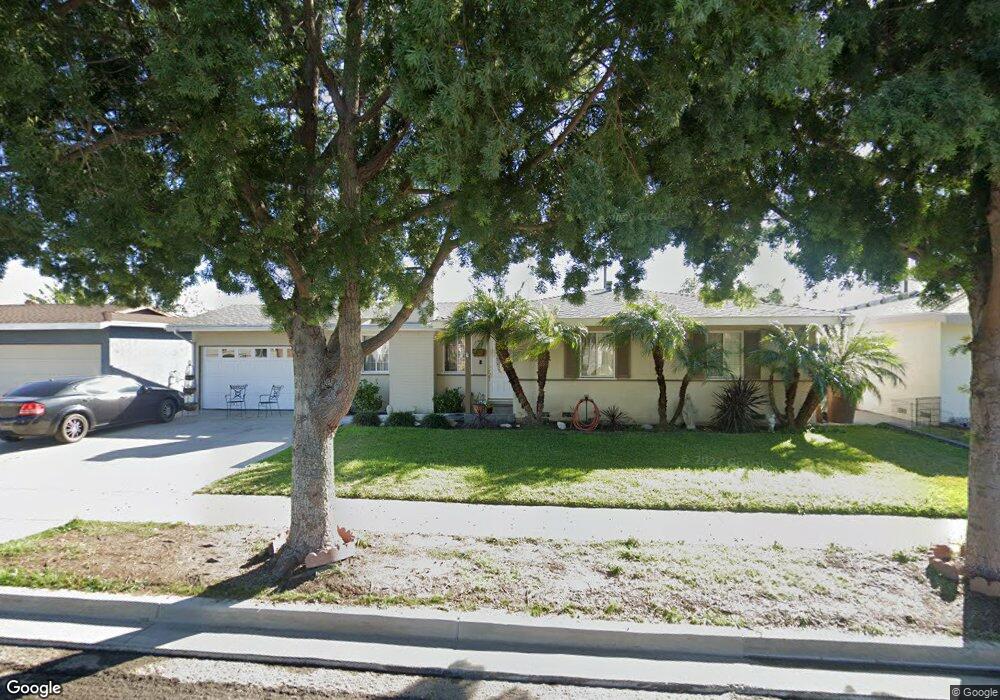
1926 W Sloop Ave Anaheim, CA 92804
West Anaheim NeighborhoodEstimated Value: $797,000 - $981,000
3
Beds
2
Baths
1,126
Sq Ft
$798/Sq Ft
Est. Value
About This Home
This home is located at 1926 W Sloop Ave, Anaheim, CA 92804 and is currently estimated at $898,484, approximately $797 per square foot. 1926 W Sloop Ave is a home located in Orange County with nearby schools including James Madison Elementary School, Ball Junior High School, and Loara High School.
Ownership History
Date
Name
Owned For
Owner Type
Purchase Details
Closed on
Oct 8, 2020
Sold by
Cortez Carlos
Bought by
Partida Norma A
Current Estimated Value
Home Financials for this Owner
Home Financials are based on the most recent Mortgage that was taken out on this home.
Original Mortgage
$330,000
Outstanding Balance
$293,517
Interest Rate
2.9%
Mortgage Type
New Conventional
Estimated Equity
$604,967
Purchase Details
Closed on
Aug 30, 2011
Sold by
Partida Norma A
Bought by
Cortez Carlos and Partida Norma A
Home Financials for this Owner
Home Financials are based on the most recent Mortgage that was taken out on this home.
Original Mortgage
$341,500
Interest Rate
4.51%
Mortgage Type
New Conventional
Purchase Details
Closed on
Feb 26, 2009
Sold by
Cortez Carlos
Bought by
Partida Norma
Purchase Details
Closed on
May 28, 2008
Sold by
Cortez Marcela
Bought by
Cortez Carlos
Home Financials for this Owner
Home Financials are based on the most recent Mortgage that was taken out on this home.
Original Mortgage
$350,000
Interest Rate
6%
Mortgage Type
Purchase Money Mortgage
Purchase Details
Closed on
May 9, 2008
Sold by
Countrywide Bank Fsb
Bought by
Cortez Carlos
Home Financials for this Owner
Home Financials are based on the most recent Mortgage that was taken out on this home.
Original Mortgage
$350,000
Interest Rate
6%
Mortgage Type
Purchase Money Mortgage
Purchase Details
Closed on
Dec 7, 2007
Sold by
Wright Charles Matthew and Wright Vanessa Leigh
Bought by
Countrywide Bank Fsb
Purchase Details
Closed on
Apr 14, 1997
Sold by
Wells Fargo Bank Na
Bought by
Wright Charles Matthew and Wright Vanessa Leigh
Home Financials for this Owner
Home Financials are based on the most recent Mortgage that was taken out on this home.
Original Mortgage
$153,918
Interest Rate
7.96%
Mortgage Type
FHA
Purchase Details
Closed on
Feb 14, 1997
Sold by
Tejada Jose M and Tejada Rosa E
Bought by
Wells Fargo Bank Na
Home Financials for this Owner
Home Financials are based on the most recent Mortgage that was taken out on this home.
Original Mortgage
$153,918
Interest Rate
7.96%
Mortgage Type
FHA
Create a Home Valuation Report for This Property
The Home Valuation Report is an in-depth analysis detailing your home's value as well as a comparison with similar homes in the area
Home Values in the Area
Average Home Value in this Area
Purchase History
| Date | Buyer | Sale Price | Title Company |
|---|---|---|---|
| Partida Norma A | -- | Wfg Title Company Of Ca | |
| Partida Norma A | -- | Wfg Title Company Of Ca | |
| Cortez Carlos | -- | Servicelink | |
| Partida Norma | -- | None Available | |
| Cortez Carlos | -- | Landsafe Title Of California | |
| Cortez Carlos | $450,000 | Landsafe Title Of California | |
| Countrywide Bank Fsb | $531,000 | None Available | |
| Wright Charles Matthew | $160,500 | Fidelity National Title Ins | |
| Wells Fargo Bank Na | $135,000 | North American Title Co |
Source: Public Records
Mortgage History
| Date | Status | Borrower | Loan Amount |
|---|---|---|---|
| Open | Partida Norma A | $330,000 | |
| Previous Owner | Cortez Carlos | $341,500 | |
| Previous Owner | Cortez Carlos | $350,000 | |
| Previous Owner | Wright Charles Matthew | $153,918 |
Source: Public Records
Tax History
| Year | Tax Paid | Tax Assessment Tax Assessment Total Assessment is a certain percentage of the fair market value that is determined by local assessors to be the total taxable value of land and additions on the property. | Land | Improvement |
|---|---|---|---|---|
| 2025 | $5,184 | $444,871 | $297,335 | $147,536 |
| 2024 | $5,184 | $436,149 | $291,505 | $144,644 |
| 2023 | $5,075 | $427,598 | $285,790 | $141,808 |
| 2022 | $5,011 | $419,214 | $280,186 | $139,028 |
| 2021 | $5,020 | $410,995 | $274,693 | $136,302 |
| 2020 | $4,999 | $406,781 | $271,876 | $134,905 |
| 2019 | $4,850 | $398,805 | $266,545 | $132,260 |
| 2018 | $4,751 | $390,986 | $261,319 | $129,667 |
| 2017 | $4,564 | $383,320 | $256,195 | $127,125 |
| 2016 | $4,551 | $375,804 | $251,171 | $124,633 |
| 2015 | $4,512 | $370,160 | $247,399 | $122,761 |
| 2014 | $4,066 | $347,304 | $229,762 | $117,542 |
Source: Public Records
Map
Nearby Homes
- 1632 S Songish St
- 1447 S Easy Way
- 1669 S Heritage Cir Unit C
- 2011 W Katella Ave Unit 3
- 2106 W Forest Ln
- 11052 Faye Ave
- 10622 Tibbs Cir
- 1250 S Brookhurst St Unit 2050
- 1250 S Brookhurst St Unit 1109
- 1250 S Brookhurst St Unit 2080
- 1250 S Brookhurst St Unit 2033
- 1250 S Brookhurst St
- 1250 S Brookhurst St Unit 1059
- 10511 Dewey Dr
- 1645 S Euclid St
- 1765 S Biscayne Ct
- 11151 Clarissa St
- 1770 W Goodhue Ave
- 1675 W Mells Ln
- 9802 Chanticleer Rd
- 1932 W Sloop Ave
- 1922 W Sloop Ave
- 1927 W Cris Ave
- 1931 W Cris Ave
- 1923 W Cris Ave
- 1936 W Sloop Ave
- 1916 W Sloop Ave
- 1927 W Sloop Ave
- 1937 W Cris Ave
- 1923 W Sloop Ave
- 1917 W Cris Ave
- 1937 W Sloop Ave
- 1912 W Sloop Ave
- 1942 W Sloop Ave
- 1917 W Sloop Ave
- 2001 W Cris Ave
- 1913 W Cris Ave
- 1926 W Harle Ave
- 1941 W Sloop Ave
- 1930 W Harle Ave
Your Personal Tour Guide
Ask me questions while you tour the home.