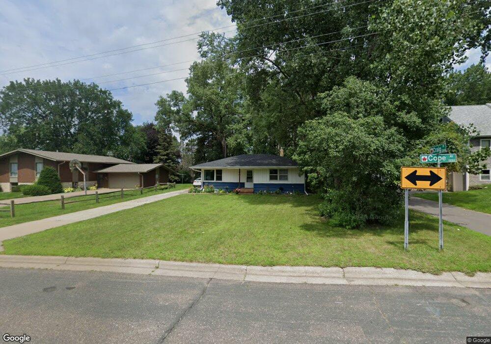
1927 Cope Ave E Saint Paul, MN 55109
Sherwood Glen NeighborhoodEstimated Value: $261,000 - $309,000
3
Beds
1
Bath
2,064
Sq Ft
$135/Sq Ft
Est. Value
About This Home
This home is located at 1927 Cope Ave E, Saint Paul, MN 55109 and is currently estimated at $277,731, approximately $134 per square foot. 1927 Cope Ave E is a home located in Ramsey County with nearby schools including Cowern Elementary School, John Glenn Middle School, and Lionsgate Academy AIM.
Ownership History
Date
Name
Owned For
Owner Type
Purchase Details
Closed on
Apr 17, 2020
Sold by
Cope Property Llc
Bought by
Hughes Michelle L
Current Estimated Value
Home Financials for this Owner
Home Financials are based on the most recent Mortgage that was taken out on this home.
Original Mortgage
$181,115
Outstanding Balance
$160,141
Interest Rate
3.3%
Mortgage Type
FHA
Estimated Equity
$117,590
Purchase Details
Closed on
Sep 21, 2019
Sold by
Pham Hieu Duc and Pham Thanhthao Thi Tran
Bought by
Cope Property Llc
Purchase Details
Closed on
Sep 21, 2015
Sold by
Pham Hieu Duc and Pham Thanh Thao Thi Tran
Bought by
Cope Property Llc
Purchase Details
Closed on
Jun 2, 2015
Sold by
Holdren Patricia K
Bought by
Pham Hieu Duc
Create a Home Valuation Report for This Property
The Home Valuation Report is an in-depth analysis detailing your home's value as well as a comparison with similar homes in the area
Home Values in the Area
Average Home Value in this Area
Purchase History
| Date | Buyer | Sale Price | Title Company |
|---|---|---|---|
| Hughes Michelle L | $198,000 | Onsite Title | |
| Cope Property Llc | -- | None Available | |
| Cope Property Llc | $515 | Attorney | |
| Pham Hieu Duc | $51,515 | Attorney |
Source: Public Records
Mortgage History
| Date | Status | Borrower | Loan Amount |
|---|---|---|---|
| Open | Hughes Michelle L | $181,115 |
Source: Public Records
Tax History
| Year | Tax Paid | Tax Assessment Tax Assessment Total Assessment is a certain percentage of the fair market value that is determined by local assessors to be the total taxable value of land and additions on the property. | Land | Improvement |
|---|---|---|---|---|
| 2025 | $4,206 | $265,600 | $48,700 | $216,900 |
| 2023 | $4,206 | $244,900 | $48,700 | $196,200 |
| 2022 | $2,954 | $226,200 | $48,700 | $177,500 |
| 2021 | $3,020 | $196,200 | $48,700 | $147,500 |
| 2020 | $2,664 | $205,100 | $48,700 | $156,400 |
| 2019 | $2,084 | $186,500 | $48,700 | $137,800 |
| 2018 | $2,086 | $154,300 | $48,700 | $105,600 |
| 2017 | $2,132 | $147,600 | $48,700 | $98,900 |
| 2016 | $1,760 | $0 | $0 | $0 |
| 2015 | $1,800 | $127,800 | $44,700 | $83,100 |
| 2014 | $1,598 | $0 | $0 | $0 |
Source: Public Records
Map
Nearby Homes
- 2190 German St
- 2445 Crestwood Dr
- 1995 11th Ave E Unit 2
- 1995 11th Ave E Unit 1
- 2068 Shryer Ct E
- 2214 Gateway Curve N
- 2230 Gateway Curve N
- 1579 Grandview Ave E
- 2278 Polar Way
- 2280 Polar Way
- 2303 7th Ave E
- 2217 Gateway Hill Rd N
- 2189 Gateway Hill Rd N
- 2615 Flandrau St
- 2125 Hazelwood St
- 1984 Prosperity Rd
- 2354 Burke Ave E
- 2231 N Penn Place Unit 322
- 2231 N Penn Place Unit 208
- 2231 N Penn Place Unit 209
- 1937 Cope Ave E
- 1917 Cope Ave E
- 2271 Craig Place
- 2272 Craig Place
- 1949 Cope Ave E
- 2272 N Hazel St
- 2272 Hazel St N
- 2263 Craig Place
- 1940 Cope Ave E
- 1922 Castle Ave E
- 2281 Castle Place N
- 2283 Castle Place N
- 1928 Castle Ave E
- 1953 Cope Ave E
- 2264 Hazel St N
- 1930 Castle Ave E
- 2262 Craig Place
- 2255 Craig Place
- 1948 Cope Ave E
- 1946 Castle Ave E
Your Personal Tour Guide
Ask me questions while you tour the home.