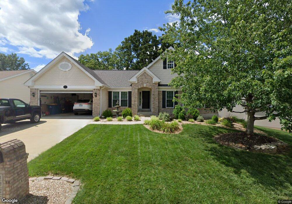
1927 Hawk Pointe Dr Festus, MO 63028
Festus/Crystal City NeighborhoodEstimated Value: $341,945 - $449,000
Studio
1
Bath
1,717
Sq Ft
$227/Sq Ft
Est. Value
About This Home
This home is located at 1927 Hawk Pointe Dr, Festus, MO 63028 and is currently estimated at $389,736, approximately $226 per square foot. 1927 Hawk Pointe Dr is a home located in Jefferson County with nearby schools including Festus Intermediate School, Festus Elementary School, and Festus Middle School.
Ownership History
Date
Name
Owned For
Owner Type
Purchase Details
Closed on
Jul 12, 2002
Sold by
The J Ridge Corp
Bought by
Nolen Thomas L and Nolen Patricia R
Current Estimated Value
Home Financials for this Owner
Home Financials are based on the most recent Mortgage that was taken out on this home.
Original Mortgage
$34,000
Outstanding Balance
$13,873
Interest Rate
6.73%
Estimated Equity
$375,863
Create a Home Valuation Report for This Property
The Home Valuation Report is an in-depth analysis detailing your home's value as well as a comparison with similar homes in the area
Home Values in the Area
Average Home Value in this Area
Purchase History
| Date | Buyer | Sale Price | Title Company |
|---|---|---|---|
| Nolen Thomas L | -- | Commonwealth Title |
Source: Public Records
Mortgage History
| Date | Status | Borrower | Loan Amount |
|---|---|---|---|
| Open | Nolen Thomas L | $34,000 |
Source: Public Records
Tax History
| Year | Tax Paid | Tax Assessment Tax Assessment Total Assessment is a certain percentage of the fair market value that is determined by local assessors to be the total taxable value of land and additions on the property. | Land | Improvement |
|---|---|---|---|---|
| 2025 | $2,519 | $48,000 | $9,600 | $38,400 |
| 2024 | $2,519 | $44,500 | $9,600 | $34,900 |
| 2023 | $2,519 | $44,500 | $9,600 | $34,900 |
| 2022 | $2,360 | $41,900 | $7,000 | $34,900 |
| 2021 | $2,399 | $41,900 | $7,000 | $34,900 |
| 2020 | $2,315 | $37,900 | $6,100 | $31,800 |
| 2019 | $2,314 | $37,900 | $6,100 | $31,800 |
| 2018 | $2,091 | $37,900 | $6,100 | $31,800 |
| 2017 | $2,090 | $37,900 | $6,100 | $31,800 |
| 2016 | $1,965 | $35,400 | $6,000 | $29,400 |
| 2015 | $1,858 | $35,400 | $6,000 | $29,400 |
| 2013 | $1,858 | $34,800 | $6,000 | $28,800 |
Source: Public Records
Map
Nearby Homes
- 0
- 0 Bailey School Rd
- 1829 Belmont Ct
- 0 Tbb Birchwood Overlook - Maple
- 1816 Belmont Ct
- 0 Tbb Birchwood Overlook-Dogwood Unit MAR24022693
- 1868 Sunset Ridge
- 0 Tbb Birchwood Overlook Birchwo Unit MAR24022701
- 530 Cedar Ln
- 610 Edgewood Ln
- 0 Tbb Birchwood Overlook-Red Bud Unit MAR24022708
- TBD Cedar Ln
- 0 Tbb Bichwood Overlook-Sycamore Unit MAR24022712
- 1833 Sunset Ridge
- 1810 Valley View Cir
- 707 Jerome Dr
- 202 Sunshine Dr
- 2310 Peterein Ct
- 1206 N 3rd St
- 1114 N 5th St
- 1923 Hawk Pointe Dr
- 1931 Hawk Pointe Dr
- 1932 Hawk Pointe Dr
- 1919 Hawk Pointe Dr
- 1935 Hawk Pointe Dr
- 1928 Hawk Pointe Dr
- 1924 Hawk Pointe Dr
- 10991 Bailey School Rd
- 1915 Hawk Pointe Dr
- 10967 Bailey School Rd
- 1916 Hawk Pointe Dr
- 1920 Hawk Pointe Dr
- 10965 Bailey School Rd
- 1911 Hawk Pointe Dr
- 1912 Hawk Pointe Dr
- 1840 Orchard Ln
- 10937 Bailey School Rd
- 10944 Bailey School Rd
- 10960 Bailey School Rd
- 1907 Hawk Pointe Dr
Your Personal Tour Guide
Ask me questions while you tour the home.