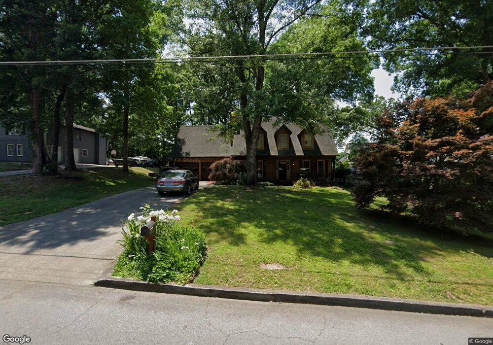
1927 Kensington High St SW Unit 1 Lilburn, GA 30047
Estimated Value: $327,270 - $368,000
3
Beds
3
Baths
1,222
Sq Ft
$280/Sq Ft
Est. Value
About This Home
This home is located at 1927 Kensington High St SW Unit 1, Lilburn, GA 30047 and is currently estimated at $342,318, approximately $280 per square foot. 1927 Kensington High St SW Unit 1 is a home located in Gwinnett County with nearby schools including Head Elementary School, Five Forks Middle School, and Brookwood High School.
Ownership History
Date
Name
Owned For
Owner Type
Purchase Details
Closed on
Aug 15, 2003
Sold by
Mcclung Leigh R
Bought by
Wheeler Bob E
Current Estimated Value
Home Financials for this Owner
Home Financials are based on the most recent Mortgage that was taken out on this home.
Original Mortgage
$137,837
Outstanding Balance
$62,389
Interest Rate
6.24%
Mortgage Type
FHA
Estimated Equity
$279,929
Purchase Details
Closed on
Apr 29, 1996
Sold by
Madsen Ronald T Charlotte
Bought by
Mcclung Leigh R
Create a Home Valuation Report for This Property
The Home Valuation Report is an in-depth analysis detailing your home's value as well as a comparison with similar homes in the area
Home Values in the Area
Average Home Value in this Area
Purchase History
| Date | Buyer | Sale Price | Title Company |
|---|---|---|---|
| Wheeler Bob E | $140,000 | -- | |
| Mcclung Leigh R | $114,900 | -- |
Source: Public Records
Mortgage History
| Date | Status | Borrower | Loan Amount |
|---|---|---|---|
| Open | Wheeler Bob E | $137,837 | |
| Closed | Mcclung Leigh R | $0 |
Source: Public Records
Tax History Compared to Growth
Tax History
| Year | Tax Paid | Tax Assessment Tax Assessment Total Assessment is a certain percentage of the fair market value that is determined by local assessors to be the total taxable value of land and additions on the property. | Land | Improvement |
|---|---|---|---|---|
| 2025 | $3,498 | $121,720 | $22,200 | $99,520 |
| 2024 | $3,290 | $105,800 | $30,000 | $75,800 |
| 2023 | $3,290 | $103,400 | $26,400 | $77,000 |
| 2022 | $3,039 | $95,560 | $26,400 | $69,160 |
| 2021 | $2,445 | $65,760 | $16,800 | $48,960 |
| 2020 | $2,459 | $65,760 | $16,800 | $48,960 |
| 2019 | $2,322 | $63,080 | $16,800 | $46,280 |
| 2018 | $2,139 | $57,400 | $14,800 | $42,600 |
| 2016 | $1,910 | $50,240 | $14,800 | $35,440 |
| 2015 | $1,689 | $43,560 | $11,200 | $32,360 |
| 2014 | $1,696 | $43,560 | $11,200 | $32,360 |
Source: Public Records
Map
Nearby Homes
- 1905 Embassy Walk Ln
- 4000 Embassy Way
- 3728 Kelin Ct SW
- 4353 Pond Edge Rd
- 1776 Bear Cave SW
- 3725 Hunting Ridge Dr SW
- 2047 Cliffton Terrace
- 3588 Kelin Ct SW
- 3868 Buckland Dr SW
- 3594 Hedgestone Ln
- 1725 Spindle Top Ct SW
- 1547 Paxton Dr SW
- 1697 Paxton Dr SW
- 1732 Beauregard Dr SW
- 4268 Rocky Ledge Way
- 1893 Hedgestone Ct
- 1640 Killian Hill Rd SW
- 1917 Kensington High St SW Unit 1
- 1931 Kensington High St SW
- 0 Kensington High St Unit 7256993
- 0 Kensington High St Unit 7149820
- 0 Kensington High St Unit 7065543
- 0 Kensington High St Unit 7021149
- 0 Kensington High St Unit 3217343
- 0 Kensington High St Unit 3188844
- 0 Kensington High St Unit 8775445
- 0 Kensington High St Unit 8444193
- 0 Kensington High St Unit 7342301
- 0 Kensington High St
- 1890 Embassy Walk Ln
- 1880 Embassy Walk Ln
- 1907 Kensington High St SW
- 1937 Kensington High St SW
- 1870 Embassy Walk Ln
- 1900 Embassy Walk Ln
- 1916 Kensington High St SW
- 1926 Kensington High St SW