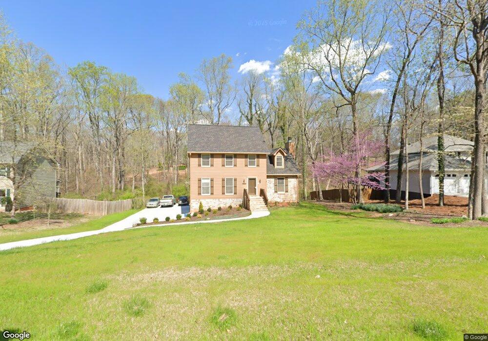
1927 McEachern Manor Dr SW Unit 1 Marietta, GA 30064
West Cobb NeighborhoodEstimated Value: $424,956 - $465,000
3
Beds
3
Baths
2,197
Sq Ft
$200/Sq Ft
Est. Value
About This Home
This home is located at 1927 McEachern Manor Dr SW Unit 1, Marietta, GA 30064 and is currently estimated at $438,489, approximately $199 per square foot. 1927 McEachern Manor Dr SW Unit 1 is a home located in Cobb County with nearby schools including Dowell Elementary School, Lovinggood Middle School, and Hillgrove High School.
Ownership History
Date
Name
Owned For
Owner Type
Purchase Details
Closed on
Mar 23, 1999
Sold by
Petrosky Thomas H and Petrosky Gloria J
Bought by
Bradshaw William L
Current Estimated Value
Home Financials for this Owner
Home Financials are based on the most recent Mortgage that was taken out on this home.
Original Mortgage
$168,817
Outstanding Balance
$42,011
Interest Rate
7.08%
Mortgage Type
VA
Estimated Equity
$396,478
Create a Home Valuation Report for This Property
The Home Valuation Report is an in-depth analysis detailing your home's value as well as a comparison with similar homes in the area
Home Values in the Area
Average Home Value in this Area
Purchase History
| Date | Buyer | Sale Price | Title Company |
|---|---|---|---|
| Bradshaw William L | $163,900 | -- |
Source: Public Records
Mortgage History
| Date | Status | Borrower | Loan Amount |
|---|---|---|---|
| Open | Bradshaw William L | $168,817 |
Source: Public Records
Tax History Compared to Growth
Tax History
| Year | Tax Paid | Tax Assessment Tax Assessment Total Assessment is a certain percentage of the fair market value that is determined by local assessors to be the total taxable value of land and additions on the property. | Land | Improvement |
|---|---|---|---|---|
| 2025 | $798 | $163,760 | $36,000 | $127,760 |
| 2024 | $763 | $150,772 | $12,800 | $137,972 |
| 2023 | $556 | $150,772 | $12,800 | $137,972 |
| 2022 | $727 | $138,856 | $12,800 | $126,056 |
| 2021 | $626 | $105,240 | $12,800 | $92,440 |
| 2020 | $626 | $105,240 | $12,800 | $92,440 |
| 2019 | $595 | $94,880 | $12,800 | $82,080 |
| 2018 | $577 | $88,748 | $12,800 | $75,948 |
| 2017 | $502 | $81,780 | $14,000 | $67,780 |
| 2016 | $1,678 | $73,420 | $14,000 | $59,420 |
| 2015 | $1,713 | $73,420 | $14,000 | $59,420 |
| 2014 | $1,105 | $46,012 | $0 | $0 |
Source: Public Records
Map
Nearby Homes
- 2040 Hardwood Cir SW Unit 3
- 1946 MacLand Rd SW
- 1830 MacLand Rd SW
- 1952 Freestone Way
- Monteluce Plan at Freestone Station
- Hillside Plan at Freestone Station
- Oakshire Plan at Freestone Station
- Hendricks Plan at Freestone Station
- Hedgerow Plan at Freestone Station
- Antioch Plan at Freestone Station
- 2002 MacLand Square Dr Unit 1
- 1985 Freestone Way
- 2028 MacLand Square Dr Unit 4
- 1646 Desford Ct SW
- 2009 Freestone Way
- 2093 Breconridge Dr SW
- 2409 Caneridge Point SW
- 1976 Grove Field Ln
- 1976 Grove Field Ln Unit BLDG 33
- 2268 Grove Valley Way Unit 9
- 1923 McEachern Manor Dr SW
- 1930 McEachern Manor Dr SW
- 1919 McEachern Manor Dr SW
- 1920 McEachern Manor Dr SW
- 1940 McEachern Manor Dr SW
- 1980 Moccasin Trail SW
- 1913 McEachern Manor Dr SW Unit 44
- 1913 McEachern Manor Dr SW
- 2080 Moccasin Way SW
- 1941 McEachern Manor Dr SW
- 1910 McEachern Manor Dr SW
- 1941 Rollingwoods Way SW
- 1970 Moccasin Trail SW
- 1909 McEachern Manor Dr SW
- 1948 McEachern Manor Dr SW
- 2031 Hardwood Cir SW
- 2090 Moccasin Way SW
- 2071 Moccasin Way SW
- 2041 Hardwood Cir SW
- 1945 McEachern Manor Dr SW