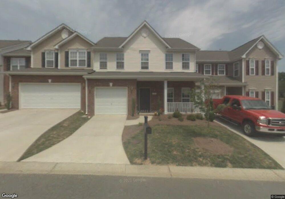
1927 Munn Pointe Dr Whitsett, NC 27377
Estimated Value: $277,000 - $317,000
2
Beds
2
Baths
2,112
Sq Ft
$137/Sq Ft
Est. Value
About This Home
This home is located at 1927 Munn Pointe Dr, Whitsett, NC 27377 and is currently estimated at $289,552, approximately $137 per square foot. 1927 Munn Pointe Dr is a home located in Guilford County with nearby schools including Sedalia Elementary School, Eastern Guilford Middle School, and Eastern Guilford High School.
Ownership History
Date
Name
Owned For
Owner Type
Purchase Details
Closed on
Jul 11, 2005
Sold by
K Hovnanian Homes Of North Carolina Inc
Bought by
Staples Gina E
Current Estimated Value
Home Financials for this Owner
Home Financials are based on the most recent Mortgage that was taken out on this home.
Original Mortgage
$132,300
Outstanding Balance
$68,526
Interest Rate
5.54%
Mortgage Type
Fannie Mae Freddie Mac
Estimated Equity
$221,026
Create a Home Valuation Report for This Property
The Home Valuation Report is an in-depth analysis detailing your home's value as well as a comparison with similar homes in the area
Home Values in the Area
Average Home Value in this Area
Purchase History
| Date | Buyer | Sale Price | Title Company |
|---|---|---|---|
| Staples Gina E | $147,000 | None Available |
Source: Public Records
Mortgage History
| Date | Status | Borrower | Loan Amount |
|---|---|---|---|
| Open | Staples Gina E | $132,300 |
Source: Public Records
Tax History Compared to Growth
Tax History
| Year | Tax Paid | Tax Assessment Tax Assessment Total Assessment is a certain percentage of the fair market value that is determined by local assessors to be the total taxable value of land and additions on the property. | Land | Improvement |
|---|---|---|---|---|
| 2025 | $1,521 | $187,600 | $30,000 | $157,600 |
| 2024 | $1,521 | $187,600 | $30,000 | $157,600 |
| 2023 | $1,521 | $187,600 | $30,000 | $157,600 |
| 2022 | $1,521 | $187,600 | $30,000 | $157,600 |
| 2021 | $1,048 | $129,300 | $20,000 | $109,300 |
| 2020 | $1,048 | $129,300 | $20,000 | $109,300 |
| 2019 | $1,048 | $129,300 | $0 | $0 |
| 2018 | $1,043 | $129,300 | $0 | $0 |
| 2017 | $1,043 | $129,300 | $0 | $0 |
| 2016 | $1,121 | $134,200 | $0 | $0 |
| 2015 | $1,127 | $134,200 | $0 | $0 |
| 2014 | $1,141 | $134,200 | $0 | $0 |
Source: Public Records
Map
Nearby Homes
- 1963 Whisper Lake Dr
- 1942 Whisper Lake Dr
- 1915 Wake Bridge Dr
- 1911 Whisper Lake Dr Unit A
- 1903 Osterville Ct
- 2016 Heron Pointe Dr
- 6710 Breeze Pointe Dr
- 1904 Brant Pointe Ct
- 6717 Barton Creek Dr
- 6731 Barton Creek Dr
- 1431 Rock Creek Dairy Rd
- 6506 Donahue Dr
- 1132 Brooksridge Way
- 1130 Brooksridge Way
- 1128 Brooksridge Way
- 1126 Brooksridge Way
- 1112 Brooksridge Way
- 1108 Brooksridge Way
- 1104 Brooksridge Way
- 1051 Oak Blossom Way
- 1929 Munn Pointe Dr Unit 16
- 1925 Munn Pointe Dr
- 1923 Munn Pointe Dr
- 1931 Munn Pointe Dr Unit 17
- 1928 Munn Cir
- 1933 Munn Pointe Dr Unit 18
- 1921 Munn Pointe Dr Unit 12
- 1926 Munn Cir Unit 40
- 1930 Munn Pointe Dr Unit 38
- 1935 Munn Pointe Dr
- 1935 Munn Pointe Dr Unit 19
- 1923 Munn Cir
- 1919 Munn Pointe Dr
- 1924 Munn Cir Unit 3942
- 1918 Munn Pointe Dr
- 1932 Munn Pointe Dr
- 6711 Gabrielle Point
- 1917 Munn Pointe Dr
- 1922 Munn Cir
- 6713 Gabrielle Point Unit 21