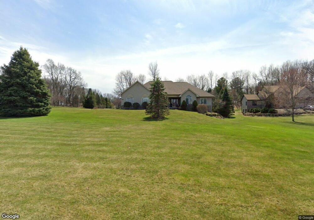
1927 Sundance Ridge Howell, MI 48843
Estimated Value: $507,000 - $680,000
5
Beds
3
Baths
1,850
Sq Ft
$308/Sq Ft
Est. Value
About This Home
This home is located at 1927 Sundance Ridge, Howell, MI 48843 and is currently estimated at $569,481, approximately $307 per square foot. 1927 Sundance Ridge is a home located in Livingston County with nearby schools including Parker Middle School and Howell High School.
Ownership History
Date
Name
Owned For
Owner Type
Purchase Details
Closed on
Jan 7, 2011
Sold by
Bunt Eugene and Bunt Patricia
Bought by
Brauer Nicole M
Current Estimated Value
Purchase Details
Closed on
Aug 19, 2004
Sold by
Dw Development Llc
Bought by
Spencer David L and Mason Spencer April S
Purchase Details
Closed on
Jan 2, 1998
Sold by
New Corp
Bought by
Dw Development Llc
Purchase Details
Closed on
Dec 30, 1997
Sold by
Cox Malcolm
Bought by
New Corp
Create a Home Valuation Report for This Property
The Home Valuation Report is an in-depth analysis detailing your home's value as well as a comparison with similar homes in the area
Home Values in the Area
Average Home Value in this Area
Purchase History
| Date | Buyer | Sale Price | Title Company |
|---|---|---|---|
| Brauer Nicole M | $240,000 | -- | |
| Spencer David L | $347,525 | -- | |
| Dw Development Llc | $42,900 | Select Title | |
| New Corp | $4,050 | Select Title |
Source: Public Records
Tax History Compared to Growth
Tax History
| Year | Tax Paid | Tax Assessment Tax Assessment Total Assessment is a certain percentage of the fair market value that is determined by local assessors to be the total taxable value of land and additions on the property. | Land | Improvement |
|---|---|---|---|---|
| 2025 | $2,744 | $265,400 | $0 | $0 |
| 2024 | $2,666 | $266,300 | $0 | $0 |
| 2023 | $2,547 | $244,000 | $0 | $0 |
| 2022 | $3,463 | $205,700 | $0 | $0 |
| 2021 | $3,377 | $205,700 | $0 | $0 |
| 2020 | $3,441 | $201,900 | $0 | $0 |
| 2019 | $3,391 | $196,800 | $0 | $0 |
| 2018 | $3,349 | $176,200 | $0 | $0 |
| 2017 | $3,306 | $158,100 | $0 | $0 |
| 2016 | $3,287 | $149,700 | $0 | $0 |
| 2014 | $2,737 | $143,700 | $0 | $0 |
| 2012 | $2,737 | $123,700 | $0 | $0 |
Source: Public Records
Map
Nearby Homes
- 4428 Sundance Cir
- 2214 White Hawk Trail
- 1 Brighton Rd
- 0000 Brighton Rd
- 150 Brighton Rd
- 2763 Clivedon Rd
- 2568 W Coon Lake Rd
- 2878 Clivedon Rd
- 2705 Black Eagle Ridge Unit 49
- 3031 Cedar Point Rd
- 4681 Roya Trail
- 04 Prince Edward Dr
- 05 Prince Edward Dr
- 1286 Gray Fox Ct
- 2105 Webster Park Dr
- 2686 Magnolia Garden Dr Unit 31
- 4789 Lakeshire Dr
- 2146 Webster Park Dr
- 3760 Southwick Dr
- 3456 Beattie Rd
- 1939 Sundance Ridge
- 4600 Sierra Dr
- 4581 Sierra Dr
- 1951 Sundance Ridge
- 4620 Sierra Dr
- 1934 Sundance Ridge Unit Bldg-Unit
- 1934 Sundance Ridge
- 1922 Sundance Ridge
- 1910 Sundance Ridge
- 4601 Sierra Dr
- 1897 Sundance Ridge
- 1963 Sundance Ridge
- 4621 Sierra Dr
- 4421 Sundance Cir Unit Bldg-Unit
- 4421 Sundance Cir
- 4640 Sierra Dr
- 1898 Sundance Ridge
- 1875 Sundance Ridge
- 1975 Sundance Ridge
- 4399 Sundance Cir