Estimated Value: $263,000 - $310,000
4
Beds
2
Baths
2,116
Sq Ft
$136/Sq Ft
Est. Value
About This Home
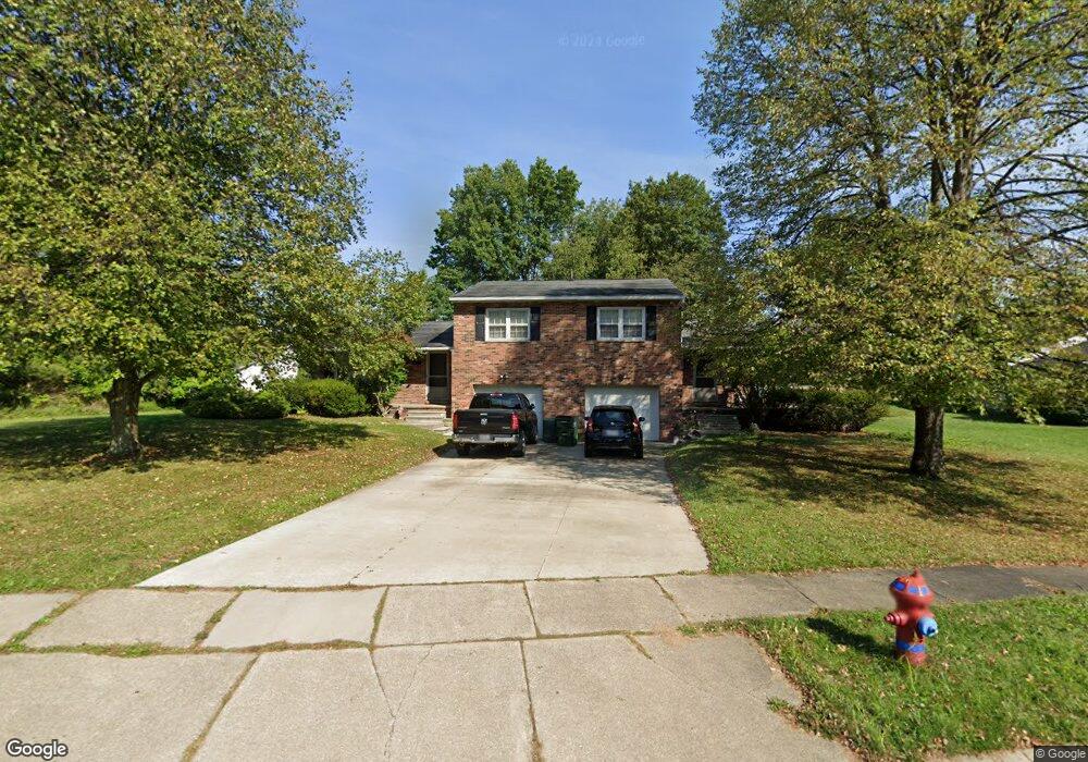
This home is located at 1927 Willowdale Dr Unit 1931, Stow, OH 44224 and is currently estimated at $287,925, approximately $136 per square foot. 1927 Willowdale Dr Unit 1931 is a home located in Summit County with nearby schools including Stow-Munroe Falls High School, Primrose School of Hudson, and Holy Family Elementary School.
Ownership History
Date
Name
Owned For
Owner Type
Purchase Details
Closed on
Dec 20, 2003
Sold by
Hillyer John T and Hillyer Carol Y
Bought by
Willowdale Two Llc
Current Estimated Value
Purchase Details
Closed on
Jul 31, 2003
Sold by
Davis Stephen M and Davis Elizabeth C
Bought by
Hillyer John T and Hillyer Carol Y
Home Financials for this Owner
Home Financials are based on the most recent Mortgage that was taken out on this home.
Original Mortgage
$114,800
Interest Rate
5.3%
Mortgage Type
Purchase Money Mortgage
Create a Home Valuation Report for This Property
The Home Valuation Report is an in-depth analysis detailing your home's value as well as a comparison with similar homes in the area
Home Values in the Area
Average Home Value in this Area
Purchase History
| Date | Buyer | Sale Price | Title Company |
|---|---|---|---|
| Willowdale Two Llc | -- | -- | |
| Hillyer John T | $143,500 | Covenant Title Agency Ltd |
Source: Public Records
Mortgage History
| Date | Status | Borrower | Loan Amount |
|---|---|---|---|
| Previous Owner | Hillyer John T | $114,800 |
Source: Public Records
Tax History Compared to Growth
Tax History
| Year | Tax Paid | Tax Assessment Tax Assessment Total Assessment is a certain percentage of the fair market value that is determined by local assessors to be the total taxable value of land and additions on the property. | Land | Improvement |
|---|---|---|---|---|
| 2025 | $4,452 | $76,979 | $15,246 | $61,733 |
| 2024 | $4,452 | $76,979 | $15,246 | $61,733 |
| 2023 | $4,452 | $76,979 | $15,246 | $61,733 |
| 2022 | $3,795 | $57,880 | $11,463 | $46,417 |
| 2021 | $3,408 | $57,880 | $11,463 | $46,417 |
| 2020 | $3,352 | $57,880 | $11,460 | $46,420 |
| 2019 | $3,393 | $54,810 | $11,460 | $43,350 |
| 2018 | $3,340 | $54,810 | $11,460 | $43,350 |
| 2017 | $3,145 | $54,810 | $11,460 | $43,350 |
| 2016 | $3,234 | $50,080 | $11,460 | $38,620 |
| 2015 | $3,145 | $50,080 | $11,460 | $38,620 |
| 2014 | $3,148 | $50,080 | $11,460 | $38,620 |
| 2013 | $3,313 | $53,100 | $11,460 | $41,640 |
Source: Public Records
Map
Nearby Homes
- 4462 Timberdale Dr
- 4424 Timberdale Dr Unit 4428
- 1808 Higby Dr Unit A
- 4630 Red Willow Rd
- 4322 Lorwood Dr
- 1784 Clearbrook Dr
- 2055-2059 Bryn Mawr Dr
- 2279 Becket Cir
- 0 Hibbard Dr
- 2188 Duxbury
- 0 Stow Rd Unit 5102979
- 1514 & 1516 Robin Ln
- 4877 Cedar Crest Ln
- 1664 Cypress Ct
- 2410 Wrens Dr S
- 4846 Garnet Cir
- 4891 Cedar Crest Ln
- 5112 Commanche Trail
- 1525 Spruce Hill Dr
- 2260 E Gilwood Dr
- 4388 Larkdale Dr Unit 4392
- 4390 Larkdale Dr
- 1932 Willowdale Dr Unit 1936
- 1922 Willowdale Dr Unit 1926
- 4394 Larkdale Dr Unit 4398
- 1946 Willowdale Dr
- 1959 Willowdale Dr
- 4398 Larkdale Dr
- 1956 Willowdale Dr
- 4393 Darrow Rd
- 4406 4410 Larkdale Dr
- 4406 Larkdale Dr Unit 4410
- 4406 Larkdale Dr Unit 4406 Larkdale
- 1969 Willowdale Dr
- 4393 Larkdale Dr Unit 4397
- 4407 4411 Larkdale Dr
- 1966 Willowdale Dr
- 4359 Darrow Rd
- 4379 Darrow Rd
- 4416 Larkdale Dr Unit 4420