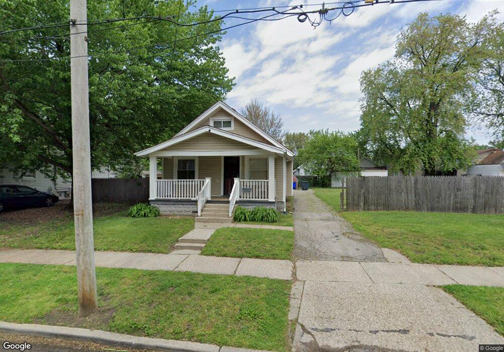
1928 Barrows St Toledo, OH 43613
DeVeaux NeighborhoodEstimated Value: $75,000 - $79,000
2
Beds
1
Bath
756
Sq Ft
$102/Sq Ft
Est. Value
About This Home
This home is located at 1928 Barrows St, Toledo, OH 43613 and is currently estimated at $76,821, approximately $101 per square foot. 1928 Barrows St is a home located in Lucas County with nearby schools including DeVeaux Elementary School, Start High School, and Horizon Science Academy - Toledo High School.
Ownership History
Date
Name
Owned For
Owner Type
Purchase Details
Closed on
Jan 18, 2011
Sold by
Fannie Mae
Bought by
Adams Christopher F
Current Estimated Value
Purchase Details
Closed on
Nov 5, 2010
Sold by
Stone Charen L
Bought by
Federal National Mortgage Association
Purchase Details
Closed on
Mar 26, 2004
Sold by
Page James B and Page June
Bought by
Stone Charen L
Home Financials for this Owner
Home Financials are based on the most recent Mortgage that was taken out on this home.
Original Mortgage
$62,040
Interest Rate
5.65%
Mortgage Type
Purchase Money Mortgage
Create a Home Valuation Report for This Property
The Home Valuation Report is an in-depth analysis detailing your home's value as well as a comparison with similar homes in the area
Home Values in the Area
Average Home Value in this Area
Purchase History
| Date | Buyer | Sale Price | Title Company |
|---|---|---|---|
| Adams Christopher F | $12,000 | Ohio Title Corporation | |
| Federal National Mortgage Association | -- | Ohio Title Corp | |
| Stone Charen L | $62,100 | Mta |
Source: Public Records
Mortgage History
| Date | Status | Borrower | Loan Amount |
|---|---|---|---|
| Previous Owner | Stone Charen L | $62,040 |
Source: Public Records
Tax History Compared to Growth
Tax History
| Year | Tax Paid | Tax Assessment Tax Assessment Total Assessment is a certain percentage of the fair market value that is determined by local assessors to be the total taxable value of land and additions on the property. | Land | Improvement |
|---|---|---|---|---|
| 2024 | $627 | $18,025 | $7,805 | $10,220 |
| 2023 | $1,207 | $16,450 | $5,705 | $10,745 |
| 2022 | $1,201 | $16,450 | $5,705 | $10,745 |
| 2021 | $1,223 | $16,450 | $5,705 | $10,745 |
| 2020 | $1,334 | $15,925 | $5,495 | $10,430 |
| 2019 | $1,302 | $15,925 | $5,495 | $10,430 |
| 2018 | $1,314 | $15,925 | $5,495 | $10,430 |
| 2017 | $1,835 | $15,540 | $5,355 | $10,185 |
| 2016 | $2,174 | $44,400 | $15,300 | $29,100 |
| 2015 | $1,327 | $44,400 | $15,300 | $29,100 |
| 2014 | $1,424 | $15,550 | $5,360 | $10,190 |
| 2013 | $1,005 | $15,550 | $5,360 | $10,190 |
Source: Public Records
Map
Nearby Homes
- 1921 Brussels St
- 1959 Brussels St
- 2012 Berdan Ave
- 2026 Berkshire Place
- 2035 Barrows St
- 1834 Berdan Ave
- 2002 Brame Place
- 1939 Balkan Place
- 1820 Barrows St
- 1818 Barrows St
- 1846 Balkan Place
- 2050 Berdan Ave
- 2041 Brame Place
- 1828 Brame Place
- 1815 Berdan Ave
- 1935 Talbot St
- 1814 Balkan Place
- 1840 Talbot St
- 1749 Berdan Ave
- 1741 Barrows St
- 1922 Barrows St
- 1930 Barrows St
- 1918 Barrows St
- 1934 Barrows St
- 1925 Berkshire Place
- 1929 Berkshire Place
- 1923 Berkshire Place
- 1931 Berkshire Place
- 1936 Barrows St
- 1919 Berkshire Place
- 1935 Berkshire Place
- 1912 Barrows St
- 1917 Berkshire Place
- 1937 Berkshire Place
- 1925 Barrows St
- 1929 Barrows St
- 1921 Barrows St
- 1942 Barrows St
- 1935 Barrows St
- 1913 Berkshire Place