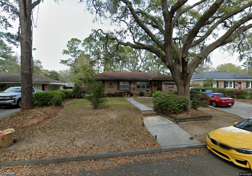
1928 Brogdon St Savannah, GA 31406
Magnolia Park-Blueberry Hill NeighborhoodEstimated Value: $299,000 - $312,000
3
Beds
2
Baths
1,316
Sq Ft
$233/Sq Ft
Est. Value
About This Home
This home is located at 1928 Brogdon St, Savannah, GA 31406 and is currently estimated at $306,746, approximately $233 per square foot. 1928 Brogdon St is a home located in Chatham County with nearby schools including Myers Middle School, Jenkins High School, and Hancock Day School.
Ownership History
Date
Name
Owned For
Owner Type
Purchase Details
Closed on
Jul 26, 2019
Sold by
Miley Anne E
Bought by
Starling Craig M
Current Estimated Value
Home Financials for this Owner
Home Financials are based on the most recent Mortgage that was taken out on this home.
Original Mortgage
$151,210
Outstanding Balance
$132,514
Interest Rate
3.73%
Mortgage Type
FHA
Estimated Equity
$174,232
Purchase Details
Closed on
Dec 28, 2016
Sold by
Anne E
Bought by
Miley Kelie L and Schneider Anna E
Purchase Details
Closed on
Sep 24, 2010
Sold by
Miley Frederick Edward
Bought by
Miley Anne E and Giles John O
Purchase Details
Closed on
Aug 20, 2010
Sold by
Miley Kelie L
Bought by
Miley Anne E and Giles John O
Create a Home Valuation Report for This Property
The Home Valuation Report is an in-depth analysis detailing your home's value as well as a comparison with similar homes in the area
Home Values in the Area
Average Home Value in this Area
Purchase History
| Date | Buyer | Sale Price | Title Company |
|---|---|---|---|
| Starling Craig M | $154,000 | -- | |
| Miley Kelie L | -- | -- | |
| Miley Anne E | -- | -- | |
| Miley Anne E | -- | -- |
Source: Public Records
Mortgage History
| Date | Status | Borrower | Loan Amount |
|---|---|---|---|
| Open | Starling Craig M | $151,210 |
Source: Public Records
Tax History Compared to Growth
Tax History
| Year | Tax Paid | Tax Assessment Tax Assessment Total Assessment is a certain percentage of the fair market value that is determined by local assessors to be the total taxable value of land and additions on the property. | Land | Improvement |
|---|---|---|---|---|
| 2025 | $2,884 | $107,000 | $26,000 | $81,000 |
| 2024 | $2,884 | $90,320 | $24,000 | $66,320 |
| 2023 | $988 | $80,960 | $17,400 | $63,560 |
| 2022 | $911 | $74,680 | $17,400 | $57,280 |
| 2021 | $2,494 | $58,400 | $13,400 | $45,000 |
| 2020 | $1,901 | $60,200 | $13,400 | $46,800 |
| 2019 | $2,675 | $60,200 | $13,400 | $46,800 |
| 2018 | $3,176 | $53,400 | $13,400 | $40,000 |
| 2017 | $2,133 | $52,840 | $13,400 | $39,440 |
| 2016 | $1,474 | $50,520 | $11,520 | $39,000 |
| 2015 | $2,154 | $51,640 | $11,520 | $40,120 |
| 2014 | $2,904 | $52,360 | $0 | $0 |
Source: Public Records
Map
Nearby Homes
- 1940 Speir St
- 2006 Cokesbury Dr
- 1844 Cokesbury Dr
- 5435 Speir St
- 2114 Teresa Dr
- 6 Redland Dr
- 2133 Bacon Park Dr
- 5507 Woodland Dr
- 5415 Barry St
- 2221 Walz Dr
- 2229 Walz Dr
- 1105 E Derenne Ave
- 113 Walz Cir
- 2332 Walz Dr
- 128 Walz Cir
- 2327 Toussaint Ave
- 2207 Mason Dr
- 5544 Emory Dr
- 2208 Lorraine Ct
- 2113 Glynnwood Dr
- 1922 Brogdon St
- 1934 Brogdon St
- 1914 Brogdon St
- 1940 Brogdon St
- 1931 Brogdon St
- 1917 Brogdon St
- 1919 Brogdon St
- 1944 Brogdon St
- 1929 Speir St
- 1935 Brogdon St
- 1908 Brogdon St
- 1923 Speir St
- 1915 Brogdon St
- 1941 Brogdon St
- 1919 Speir St
- 1935 Speir St
- 1947 Brogdon St
- 2307 Speir St
- 1911 Speir St
- 0 Brogdon St