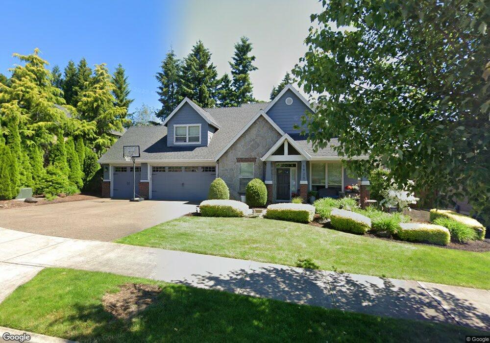
1928 Furlong Dr West Linn, OR 97068
Hidden Springs NeighborhoodEstimated Value: $911,529 - $984,000
3
Beds
3
Baths
2,570
Sq Ft
$372/Sq Ft
Est. Value
About This Home
This home is located at 1928 Furlong Dr, West Linn, OR 97068 and is currently estimated at $956,132, approximately $372 per square foot. 1928 Furlong Dr is a home located in Clackamas County with nearby schools including Trillium Creek Primary School, Rosemont Ridge Middle School, and West Linn High School.
Ownership History
Date
Name
Owned For
Owner Type
Purchase Details
Closed on
May 26, 2010
Sold by
Skg Development Inc
Bought by
Cornell Aaron M and Cornell Amber M
Current Estimated Value
Home Financials for this Owner
Home Financials are based on the most recent Mortgage that was taken out on this home.
Original Mortgage
$416,998
Outstanding Balance
$279,223
Interest Rate
5.03%
Mortgage Type
VA
Estimated Equity
$676,909
Create a Home Valuation Report for This Property
The Home Valuation Report is an in-depth analysis detailing your home's value as well as a comparison with similar homes in the area
Home Values in the Area
Average Home Value in this Area
Purchase History
| Date | Buyer | Sale Price | Title Company |
|---|---|---|---|
| Cornell Aaron M | $480,000 | Chicago Title Insurance Co |
Source: Public Records
Mortgage History
| Date | Status | Borrower | Loan Amount |
|---|---|---|---|
| Open | Cornell Aaron M | $416,998 |
Source: Public Records
Tax History Compared to Growth
Tax History
| Year | Tax Paid | Tax Assessment Tax Assessment Total Assessment is a certain percentage of the fair market value that is determined by local assessors to be the total taxable value of land and additions on the property. | Land | Improvement |
|---|---|---|---|---|
| 2025 | $10,701 | $555,296 | -- | -- |
| 2024 | $10,301 | $539,123 | -- | -- |
| 2023 | $10,301 | $523,421 | $0 | $0 |
| 2022 | $9,723 | $508,176 | $0 | $0 |
| 2021 | $9,229 | $493,375 | $0 | $0 |
| 2020 | $9,232 | $479,005 | $0 | $0 |
| 2019 | $8,852 | $465,054 | $0 | $0 |
| 2018 | $8,438 | $451,509 | $0 | $0 |
| 2017 | $8,137 | $438,358 | $0 | $0 |
| 2016 | $7,816 | $425,590 | $0 | $0 |
| 2015 | $7,400 | $413,194 | $0 | $0 |
| 2014 | $6,976 | $401,159 | $0 | $0 |
Source: Public Records
Map
Nearby Homes
- 2024 Conestoga Ln
- 6135 Cheyenne Terrace
- 6296 Belmont Way
- 20111 Hoodview Ave
- 20322 Noble Ln
- 5135 Heron Dr
- 6275 Clubhouse Cir
- 20349 Noble Ln
- 2343 Appaloosa Way
- 6233 Meridian Cir
- 4057 Heron Dr
- 3029 Club House Ct
- 3088 Club House Ct
- 22987 Bland Cir
- 2038 Titan Terrace
- 21955 Chelan Loop
- 19874 Bennington Ct
- 2583 Pimlico Dr
- 2086 Sunray Cir
- 3235 Journeay Ct
- 1936 Furlong Dr
- 1924 Furlong Dr
- 1901 Churchill Ct
- 1944 Furlong Dr
- 1923 Furlong Dr
- 1920 Furlong Dr
- 1946 Furlong Dr
- 1946 Furlong Place
- 66103 Canter Ln
- 1903 Churchill Ct
- 1916 Furlong Dr
- 1900 Churchill Ct
- 1900 Furlong Dr
- 1935 Furlong Dr
- 1954 Furlong Ct
- 6119 Canter Ln
- 1948 Furlong Dr
- 1912 Furlong Dr
- 1947 Furlong Dr
- 1902 Churchill Ct