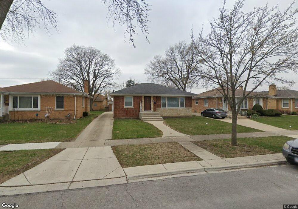
1928 Manchester Ave Westchester, IL 60154
Estimated Value: $329,000 - $372,000
3
Beds
1
Bath
1,160
Sq Ft
$300/Sq Ft
Est. Value
About This Home
This home is located at 1928 Manchester Ave, Westchester, IL 60154 and is currently estimated at $348,096, approximately $300 per square foot. 1928 Manchester Ave is a home located in Cook County with nearby schools including Westchester Primary School, Westchester Intermediate School, and Westchester Middle School.
Ownership History
Date
Name
Owned For
Owner Type
Purchase Details
Closed on
Apr 19, 2005
Sold by
Carmignani Scott B and Carmignani Traci L
Bought by
Kulnig Paul and Kulnig Catherine
Current Estimated Value
Home Financials for this Owner
Home Financials are based on the most recent Mortgage that was taken out on this home.
Original Mortgage
$220,000
Outstanding Balance
$114,339
Interest Rate
5.89%
Mortgage Type
Fannie Mae Freddie Mac
Estimated Equity
$233,757
Purchase Details
Closed on
Aug 29, 1997
Sold by
Meccia Daniel D
Bought by
Carmignani Scott B and Carmignani Traci L
Home Financials for this Owner
Home Financials are based on the most recent Mortgage that was taken out on this home.
Original Mortgage
$137,833
Interest Rate
7.54%
Mortgage Type
FHA
Purchase Details
Closed on
Jul 31, 1989
Sold by
Cosmopolitan National Bank Of Chicago
Bought by
Meccia Daniel D
Create a Home Valuation Report for This Property
The Home Valuation Report is an in-depth analysis detailing your home's value as well as a comparison with similar homes in the area
Home Values in the Area
Average Home Value in this Area
Purchase History
| Date | Buyer | Sale Price | Title Company |
|---|---|---|---|
| Kulnig Paul | $275,000 | Ticor Title Insurance Compan | |
| Carmignani Scott B | $93,333 | -- | |
| Meccia Daniel D | -- | -- | |
| Meccia Daniel D | -- | Rei Title Services |
Source: Public Records
Mortgage History
| Date | Status | Borrower | Loan Amount |
|---|---|---|---|
| Open | Kulnig Paul | $220,000 | |
| Previous Owner | Carmignani Scott B | $137,833 | |
| Closed | Kulnig Paul | $41,250 |
Source: Public Records
Tax History Compared to Growth
Tax History
| Year | Tax Paid | Tax Assessment Tax Assessment Total Assessment is a certain percentage of the fair market value that is determined by local assessors to be the total taxable value of land and additions on the property. | Land | Improvement |
|---|---|---|---|---|
| 2024 | $6,478 | $28,000 | $4,841 | $23,159 |
| 2023 | $5,150 | $28,000 | $4,841 | $23,159 |
| 2022 | $5,150 | $20,302 | $4,150 | $16,152 |
| 2021 | $5,012 | $20,301 | $4,149 | $16,152 |
| 2020 | $4,962 | $20,301 | $4,149 | $16,152 |
| 2019 | $4,883 | $20,713 | $3,803 | $16,910 |
| 2018 | $4,817 | $20,713 | $3,803 | $16,910 |
| 2017 | $4,741 | $20,713 | $3,803 | $16,910 |
| 2016 | $4,464 | $17,802 | $3,458 | $14,344 |
| 2015 | $4,370 | $17,802 | $3,458 | $14,344 |
| 2014 | $4,284 | $17,802 | $3,458 | $14,344 |
| 2013 | $4,335 | $19,875 | $3,458 | $16,417 |
Source: Public Records
Map
Nearby Homes
- 1900 Manchester Ave
- 1907 Suffolk Ave
- 1840 Gardner Rd
- 1623 Manchester Ave
- 1932 Newcastle Ave
- 1601 Bristol Ave
- 2128 Hull Ave
- 1500 Bristol Ave
- 1433 Bristol Ave
- 10072 Drury Ln
- 1542 Homestead Rd
- 2320 S 22nd Ave
- 1119 Newcastle Ave
- 1245 S Mannheim Rd Unit 2
- 1247 S Mannheim Rd Unit 3
- 10567 Waterford Dr
- 10531 Camelot St
- 10524 Camelot St
- 2237 S 22nd Ave
- 1427 Homestead Rd Unit H
- 1934 Manchester Ave
- 1924 Manchester Ave
- 1940 Manchester Ave
- 1920 Manchester Ave
- 1927 Norfolk Ave
- 1933 Norfolk Ave
- 1923 Norfolk Ave
- 1946 Manchester Ave
- 1916 Manchester Ave
- 1919 Norfolk Ave
- 1927 Manchester Ave
- 1952 Manchester Ave
- 1945 Norfolk Ave
- 1910 Manchester Ave
- 1915 Norfolk Ave
- 1933 Manchester Ave
- 1923 Manchester Ave
- 1939 Manchester Ave
- 1919 Manchester Ave
- 1953 Norfolk Ave