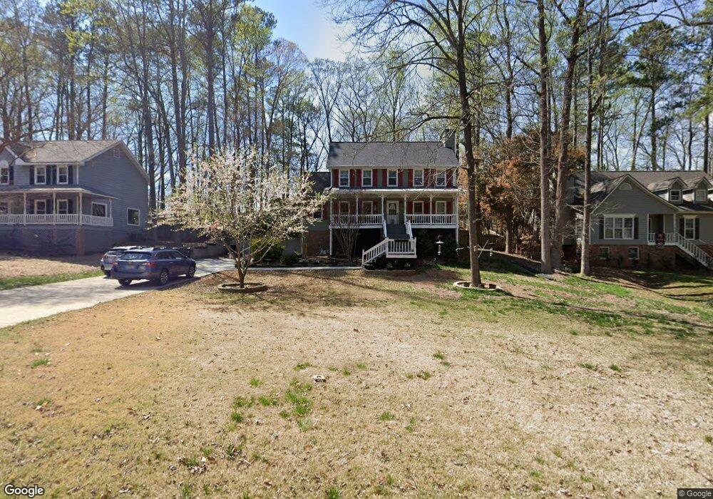
1928 Rollingwoods Way SW Unit 3 Marietta, GA 30064
West Cobb NeighborhoodEstimated Value: $448,000 - $512,000
3
Beds
4
Baths
2,750
Sq Ft
$171/Sq Ft
Est. Value
About This Home
This home is located at 1928 Rollingwoods Way SW Unit 3, Marietta, GA 30064 and is currently estimated at $470,875, approximately $171 per square foot. 1928 Rollingwoods Way SW Unit 3 is a home located in Cobb County with nearby schools including Dowell Elementary School, Lovinggood Middle School, and Hillgrove High School.
Ownership History
Date
Name
Owned For
Owner Type
Purchase Details
Closed on
Mar 31, 2016
Sold by
Luster Terry
Bought by
Vaughn Caroline and Vaughn William
Current Estimated Value
Home Financials for this Owner
Home Financials are based on the most recent Mortgage that was taken out on this home.
Original Mortgage
$232,425
Outstanding Balance
$184,405
Interest Rate
3.64%
Mortgage Type
VA
Estimated Equity
$286,470
Create a Home Valuation Report for This Property
The Home Valuation Report is an in-depth analysis detailing your home's value as well as a comparison with similar homes in the area
Home Values in the Area
Average Home Value in this Area
Purchase History
| Date | Buyer | Sale Price | Title Company |
|---|---|---|---|
| Vaughn Caroline | $225,000 | -- |
Source: Public Records
Mortgage History
| Date | Status | Borrower | Loan Amount |
|---|---|---|---|
| Open | Vaughn Caroline | $232,425 |
Source: Public Records
Tax History Compared to Growth
Tax History
| Year | Tax Paid | Tax Assessment Tax Assessment Total Assessment is a certain percentage of the fair market value that is determined by local assessors to be the total taxable value of land and additions on the property. | Land | Improvement |
|---|---|---|---|---|
| 2025 | $5,100 | $169,272 | $36,000 | $133,272 |
| 2024 | $4,619 | $153,192 | $12,800 | $140,392 |
| 2023 | $4,619 | $153,192 | $12,800 | $140,392 |
| 2022 | $4,378 | $144,256 | $12,800 | $131,456 |
| 2021 | $3,288 | $108,344 | $12,800 | $95,544 |
| 2020 | $3,288 | $108,344 | $12,800 | $95,544 |
| 2019 | $3,161 | $104,156 | $12,800 | $91,356 |
| 2018 | $2,986 | $98,372 | $12,800 | $85,572 |
| 2017 | $2,504 | $87,100 | $14,000 | $73,100 |
| 2016 | $1,879 | $79,292 | $14,000 | $65,292 |
| 2015 | $1,921 | $79,292 | $14,000 | $65,292 |
| 2014 | $1,180 | $48,564 | $0 | $0 |
Source: Public Records
Map
Nearby Homes
- 2040 Hardwood Cir SW Unit 3
- 2093 Breconridge Dr SW
- 1946 MacLand Rd SW
- 1646 Desford Ct SW
- 1830 MacLand Rd SW
- 1952 Freestone Way
- Monteluce Plan at Freestone Station
- Hillside Plan at Freestone Station
- Oakshire Plan at Freestone Station
- Hendricks Plan at Freestone Station
- Hedgerow Plan at Freestone Station
- Antioch Plan at Freestone Station
- 1985 Freestone Way
- 2002 MacLand Square Dr Unit 1
- 2009 Freestone Way
- 2028 MacLand Square Dr Unit 4
- 2409 Caneridge Point SW
- 1533 Fallen Leaf Dr SW
- 1505 Old John Ward Rd SW
- 1976 Grove Field Ln
- 1928 Rollingwoods Way SW
- 1926 Rollingwoods Way SW
- 1926 Rollingwoods Way SW
- 1930 Rollingwoods Way SW
- 1932 Rollingwoods Way SW Unit 1
- 1797 Walker Ridge Dr SW
- 1924 Rollingwoods Way SW
- 2051 Hardwood Cir SW Unit 3
- 1801 Walker Ridge Dr SW
- 2050 Hardwood Cir SW
- 1795 Walker Ridge Dr SW
- 1803 Walker Ridge Dr SW
- 2041 Hardwood Cir SW
- 1938 Rollingwoods Way SW Unit 1
- 1793 Walker Ridge Dr SW
- 1805 Walker Ridge Dr SW
- 1909 McEachern Manor Dr SW
- 2141 Kensington Ct SW
- 2031 Hardwood Cir SW
- 1940 Rollingwoods Way SW