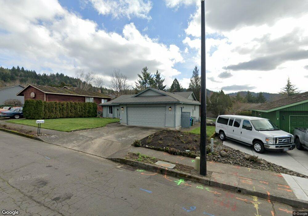
1928 SW 25th St Gresham, OR 97080
Southwest Gresham NeighborhoodEstimated Value: $466,000 - $501,000
3
Beds
2
Baths
1,488
Sq Ft
$325/Sq Ft
Est. Value
About This Home
This home is located at 1928 SW 25th St, Gresham, OR 97080 and is currently estimated at $484,327, approximately $325 per square foot. 1928 SW 25th St is a home located in Multnomah County with nearby schools including Dexter McCarty Middle School, Gresham High School, and Portland Adventist Elementary School.
Ownership History
Date
Name
Owned For
Owner Type
Purchase Details
Closed on
Mar 26, 2009
Sold by
Walker Tom
Bought by
Walker Thomas R and Walker Lisa G
Current Estimated Value
Home Financials for this Owner
Home Financials are based on the most recent Mortgage that was taken out on this home.
Original Mortgage
$185,500
Outstanding Balance
$117,572
Interest Rate
5.15%
Mortgage Type
Stand Alone Refi Refinance Of Original Loan
Estimated Equity
$366,755
Purchase Details
Closed on
Apr 29, 1996
Sold by
Erickson Donald L
Bought by
Walker Tom and Walker Lisa
Home Financials for this Owner
Home Financials are based on the most recent Mortgage that was taken out on this home.
Original Mortgage
$131,100
Interest Rate
7.84%
Mortgage Type
Purchase Money Mortgage
Create a Home Valuation Report for This Property
The Home Valuation Report is an in-depth analysis detailing your home's value as well as a comparison with similar homes in the area
Home Values in the Area
Average Home Value in this Area
Purchase History
| Date | Buyer | Sale Price | Title Company |
|---|---|---|---|
| Walker Thomas R | -- | Fidelity Natl Title Co Of Or | |
| Walker Tom | $138,000 | Fidelity National Title Co |
Source: Public Records
Mortgage History
| Date | Status | Borrower | Loan Amount |
|---|---|---|---|
| Open | Walker Thomas R | $185,500 | |
| Closed | Walker Tom | $131,100 |
Source: Public Records
Tax History
| Year | Tax Paid | Tax Assessment Tax Assessment Total Assessment is a certain percentage of the fair market value that is determined by local assessors to be the total taxable value of land and additions on the property. | Land | Improvement |
|---|---|---|---|---|
| 2025 | $5,598 | $275,070 | -- | -- |
| 2024 | $5,358 | $267,060 | -- | -- |
| 2023 | $4,882 | $259,290 | $0 | $0 |
| 2022 | $4,745 | $251,740 | $0 | $0 |
| 2021 | $4,626 | $244,410 | $0 | $0 |
| 2020 | $4,353 | $237,300 | $0 | $0 |
| 2019 | $4,239 | $230,390 | $0 | $0 |
| 2018 | $4,041 | $223,680 | $0 | $0 |
| 2017 | $3,877 | $217,170 | $0 | $0 |
| 2016 | $3,419 | $210,850 | $0 | $0 |
| 2015 | $3,345 | $204,710 | $0 | $0 |
| 2014 | $3,263 | $198,750 | $0 | $0 |
Source: Public Records
Map
Nearby Homes
- 2160 SW 26th St
- 1645 SW 27th St
- 2520 SW Towle Ave
- 1441 SW 23rd Ct
- 3120 SW Orchard Place
- 1421 SW Binford Lake Pkwy
- 1278 SW 27th Ct
- 0 SW Battaglia Ave
- 1320 SW 31st St
- 2294 SW Wallula Ln
- 2715 SW 31st St
- 1963 SW Myers Place
- 3506 SW Battaglia Ave
- 2398 SW Tegart Ave
- 3512 SW Battaglia Ave
- 3536 SW Battaglia Ave
- 3079 SW 22nd St
- 1960 SW 13th Ct
- 3510 SW Binford Ave
- 3542 SW Binford Ave
- 1910 SW 25th St
- 1934 SW 25th St
- 1929 SW 26th Ct
- 1941 SW 26th Ct
- 1960 SW 25th St
- 1931 SW 25th St
- 1904 SW 25th St
- 1904 SW 26th Ct
- 1915 SW 25th St
- 2675 SW Willowbrook Ave
- 1949 SW 25th St
- 1955 SW 26th Ct
- 2555 SW Willowbrook Ave
- 1961 SW 25th St
- 2695 SW Willowbrook Ave
- 1968 SW 25th St
- 1912 SW 26th Ct
- 1975 SW 25th St
- 1942 SW 24th Ct
- 2533 SW Willowbrook Ave
Your Personal Tour Guide
Ask me questions while you tour the home.