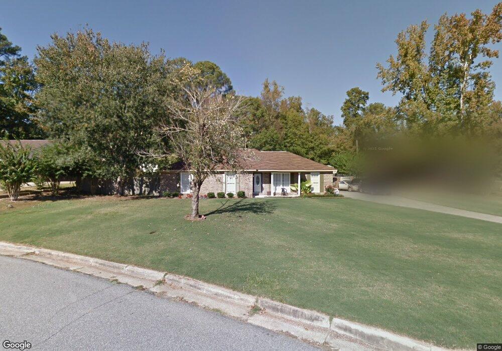
1928 Yorktown Dr Columbus, GA 31907
Eastern Columbus NeighborhoodEstimated Value: $166,000 - $198,248
4
Beds
3
Baths
1,726
Sq Ft
$107/Sq Ft
Est. Value
About This Home
This home is located at 1928 Yorktown Dr, Columbus, GA 31907 and is currently estimated at $185,062, approximately $107 per square foot. 1928 Yorktown Dr is a home located in Muscogee County with nearby schools including Dawson Elementary School, East Columbus Magnet Academy, and Spencer High School.
Ownership History
Date
Name
Owned For
Owner Type
Purchase Details
Closed on
May 10, 2011
Sold by
Sec Of Housing & U
Bought by
Benn Voronica
Current Estimated Value
Home Financials for this Owner
Home Financials are based on the most recent Mortgage that was taken out on this home.
Original Mortgage
$80,963
Outstanding Balance
$57,843
Interest Rate
5.5%
Mortgage Type
FHA
Estimated Equity
$127,219
Purchase Details
Closed on
Nov 8, 2010
Sold by
Suntrust Mortgage Inc
Bought by
Secretary Of Housing & Urban Development
Purchase Details
Closed on
Sep 5, 2008
Sold by
Hud
Bought by
Suntrust Mortgage Inc
Purchase Details
Closed on
Feb 6, 2007
Sold by
Suntrust Mortgage Inc
Bought by
Hud
Create a Home Valuation Report for This Property
The Home Valuation Report is an in-depth analysis detailing your home's value as well as a comparison with similar homes in the area
Home Values in the Area
Average Home Value in this Area
Purchase History
| Date | Buyer | Sale Price | Title Company |
|---|---|---|---|
| Benn Voronica | $77,000 | -- | |
| Secretary Of Housing & Urban Development | -- | None Available | |
| Suntrust Mortgage Inc | -- | None Available | |
| Hud | -- | None Available | |
| Suntrust Mortgage Inc | $114,544 | None Available |
Source: Public Records
Mortgage History
| Date | Status | Borrower | Loan Amount |
|---|---|---|---|
| Open | Benn Voronica | $80,963 |
Source: Public Records
Tax History Compared to Growth
Tax History
| Year | Tax Paid | Tax Assessment Tax Assessment Total Assessment is a certain percentage of the fair market value that is determined by local assessors to be the total taxable value of land and additions on the property. | Land | Improvement |
|---|---|---|---|---|
| 2025 | $1,697 | $62,160 | $13,964 | $48,196 |
| 2024 | $1,696 | $62,160 | $13,964 | $48,196 |
| 2023 | $1,012 | $62,160 | $13,964 | $48,196 |
| 2022 | $1,768 | $49,268 | $13,964 | $35,304 |
| 2021 | $1,762 | $44,428 | $13,964 | $30,464 |
| 2020 | $1,762 | $44,428 | $13,964 | $30,464 |
| 2019 | $1,770 | $44,428 | $13,964 | $30,464 |
| 2018 | $1,770 | $44,428 | $13,964 | $30,464 |
| 2017 | $1,777 | $44,428 | $13,964 | $30,464 |
| 2016 | $1,785 | $56,538 | $6,052 | $50,486 |
| 2015 | $1,788 | $56,538 | $6,052 | $50,486 |
| 2014 | $1,790 | $56,538 | $6,052 | $50,486 |
| 2013 | -- | $56,538 | $6,052 | $50,486 |
Source: Public Records
Map
Nearby Homes
- 5664 St Marys Rd
- 5728 Lexington Dr
- 5644 Quebec Dr
- 5613 Quebec Dr
- 4462 Walking Stick Way
- 5310 Stoney Point Rd
- 1513 Alamo Dr
- 5336 Gettysburg Way
- 1340 Bunker Ridge Ln
- 1238 Brandywine Dr
- 4408 Walking Stick Way
- 1210 Bunker Hill Rd
- 5219 Argonne Dr
- 5109 Lexington Ln
- 5090 Lexington Ln
- 849 Bunker Hill Rd
- 780 Honey Do Ct
- 4939 Aaron Dr
- 4965 Brightstar Ln
- 1025 Belmar St
- 1970 Yorktown Dr
- 1973 Yorktown Dr
- 5722 Germantown Rd
- 5714 Germantown Rd
- 1980 Yorktown Dr
- 1981 Yorktown Dr
- 5667 Monmouth Dr
- 5659 Monmouth Dr
- 5730 Germantown Rd
- 5651 Monmouth Dr
- 5706 Germantown Rd
- 1989 Yorktown Dr
- 5645 Monmouth Dr
- 5731 Germantown Rd
- 5738 Germantown Rd
- 5639 Monmouth Dr
- 5762 Lexington Dr
- 1997 Yorktown Dr
- 5664 St Marys Rd Unit B
- 5664 Saint Marys Rd