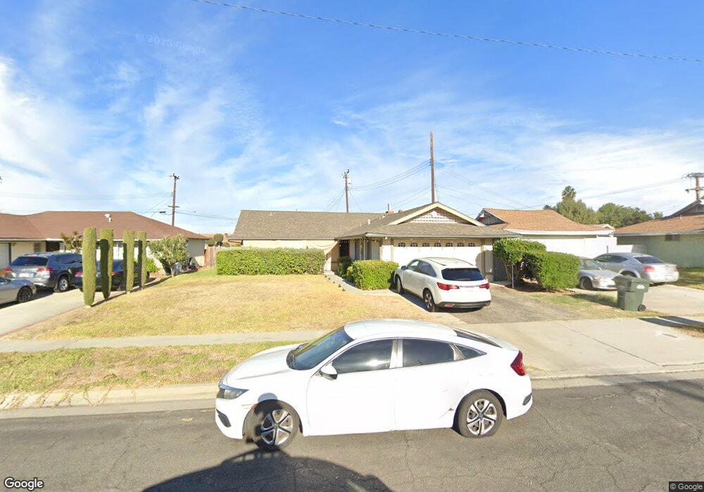
19281 Springport Dr Rowland Heights, CA 91748
Estimated Value: $810,579 - $986,000
3
Beds
2
Baths
1,245
Sq Ft
$703/Sq Ft
Est. Value
About This Home
This home is located at 19281 Springport Dr, Rowland Heights, CA 91748 and is currently estimated at $875,395, approximately $703 per square foot. 19281 Springport Dr is a home located in Los Angeles County with nearby schools including Shelyn Elementary School, Alvarado Intermediate School, and John A. Rowland High School.
Ownership History
Date
Name
Owned For
Owner Type
Purchase Details
Closed on
Apr 6, 2004
Sold by
Fong Darryl A and Fong Suwannee
Bought by
Takahashi Masahiro
Current Estimated Value
Purchase Details
Closed on
Nov 4, 2002
Sold by
Fong Darryl A and Fong Suwannee
Bought by
Fong Darryl A
Home Financials for this Owner
Home Financials are based on the most recent Mortgage that was taken out on this home.
Original Mortgage
$61,000
Interest Rate
5.95%
Mortgage Type
Stand Alone First
Purchase Details
Closed on
May 5, 1994
Sold by
Fong Darryl A and Fong Suwannee
Bought by
Fong Darryl A
Create a Home Valuation Report for This Property
The Home Valuation Report is an in-depth analysis detailing your home's value as well as a comparison with similar homes in the area
Home Values in the Area
Average Home Value in this Area
Purchase History
| Date | Buyer | Sale Price | Title Company |
|---|---|---|---|
| Takahashi Masahiro | $375,000 | First American Title Co Los | |
| Fong Darryl A | -- | American Title | |
| Fong Darryl A | -- | American Title | |
| Fong Darryl A | -- | American Title | |
| Fong Darryl A | -- | -- |
Source: Public Records
Mortgage History
| Date | Status | Borrower | Loan Amount |
|---|---|---|---|
| Previous Owner | Fong Darryl A | $61,000 |
Source: Public Records
Tax History Compared to Growth
Tax History
| Year | Tax Paid | Tax Assessment Tax Assessment Total Assessment is a certain percentage of the fair market value that is determined by local assessors to be the total taxable value of land and additions on the property. | Land | Improvement |
|---|---|---|---|---|
| 2025 | $6,764 | $533,153 | $374,064 | $159,089 |
| 2024 | $6,764 | $522,700 | $366,730 | $155,970 |
| 2023 | $6,537 | $512,452 | $359,540 | $152,912 |
| 2022 | $6,393 | $502,405 | $352,491 | $149,914 |
| 2021 | $6,289 | $492,555 | $345,580 | $146,975 |
| 2019 | $6,099 | $477,947 | $335,331 | $142,616 |
| 2018 | $5,865 | $468,576 | $328,756 | $139,820 |
| 2016 | $5,647 | $450,383 | $315,991 | $134,392 |
| 2015 | $5,554 | $443,619 | $311,245 | $132,374 |
| 2014 | $5,427 | $425,000 | $298,000 | $127,000 |
Source: Public Records
Map
Nearby Homes
- 1560 S Otterbein Ave Unit 44
- 1560 S Otterbein Ave Unit 153
- 1560 S Otterbein Ave Unit 113
- 1560 S Otterbein Ave Unit 170
- 1953 Camwood Ave
- 1560 Otterbein Ave Unit 8
- 1560 Otterbein Ave Unit 12
- 18985 Radby St
- 1703 Hollandale Ave
- 1816 Nowell Ave
- 1842 Bolanos Ave
- 2033 Bolanos Ave
- 2039 Bolanos Ave
- 19527 Cronin Dr
- 1943 Paso Real Ave
- 1337 Brea Canyon Cutoff Rd
- 1441 Paso Real Ave Unit 271
- 1441 Paso Real Ave Unit 316
- 1441 Paso Real Ave Unit 159
- 1441 Paso Real Ave Unit 327
- 19275 Springport Dr
- 1881 Valencia St
- 1887 Valencia St
- 1873 Valencia St
- 1814 Carvin Ave
- 19267 Springport Dr
- 1902 Edmore Ave
- 1867 Valencia St
- 1818 Carvin Ave
- 1903 Valencia St
- 19261 Springport Dr
- 1859 Valencia St
- 1908 Edmore Ave
- 1909 Valencia St
- 19260 Springport Dr
- 19253 Springport Dr
- 1819 Carvin Ave
- 1888 Valencia St
- 1894 Valencia St
- 1909 Edmore Ave