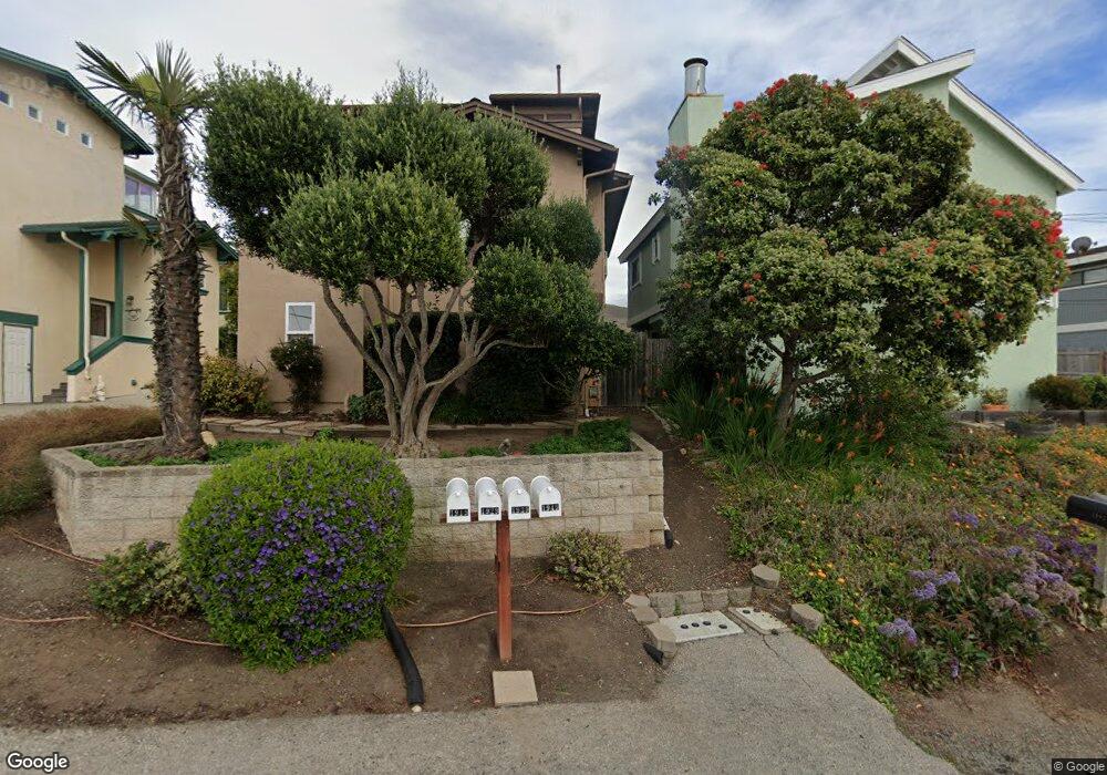
1929 Circle Dr Unit LOT Cayucos, CA 93430
Cayucos NeighborhoodEstimated Value: $1,224,000 - $1,753,000
3
Beds
2
Baths
1,289
Sq Ft
$1,105/Sq Ft
Est. Value
About This Home
This home is located at 1929 Circle Dr Unit LOT, Cayucos, CA 93430 and is currently estimated at $1,424,624, approximately $1,105 per square foot. 1929 Circle Dr Unit LOT is a home located in San Luis Obispo County.
Ownership History
Date
Name
Owned For
Owner Type
Purchase Details
Closed on
Jan 29, 2018
Sold by
Negri Scott R
Bought by
Negri Scott R and Negri Karen M
Current Estimated Value
Home Financials for this Owner
Home Financials are based on the most recent Mortgage that was taken out on this home.
Original Mortgage
$605,000
Outstanding Balance
$511,735
Interest Rate
3.94%
Mortgage Type
New Conventional
Estimated Equity
$912,889
Purchase Details
Closed on
Jun 26, 2003
Sold by
Arnold Norman J and Arnold Brenda B
Bought by
Negri Scott R
Home Financials for this Owner
Home Financials are based on the most recent Mortgage that was taken out on this home.
Original Mortgage
$500,000
Interest Rate
5.46%
Mortgage Type
Purchase Money Mortgage
Create a Home Valuation Report for This Property
The Home Valuation Report is an in-depth analysis detailing your home's value as well as a comparison with similar homes in the area
Home Values in the Area
Average Home Value in this Area
Purchase History
| Date | Buyer | Sale Price | Title Company |
|---|---|---|---|
| Negri Scott R | -- | First Amer Title Co | |
| Negri Scott R | $625,000 | Chicago Title Company |
Source: Public Records
Mortgage History
| Date | Status | Borrower | Loan Amount |
|---|---|---|---|
| Open | Negri Scott R | $605,000 | |
| Previous Owner | Negri Scott R | $500,000 |
Source: Public Records
Tax History Compared to Growth
Tax History
| Year | Tax Paid | Tax Assessment Tax Assessment Total Assessment is a certain percentage of the fair market value that is determined by local assessors to be the total taxable value of land and additions on the property. | Land | Improvement |
|---|---|---|---|---|
| 2025 | $9,247 | $888,600 | $604,252 | $284,348 |
| 2024 | $9,147 | $871,177 | $592,404 | $278,773 |
| 2023 | $9,147 | $854,096 | $580,789 | $273,307 |
| 2022 | $8,993 | $837,350 | $569,401 | $267,949 |
| 2021 | $8,868 | $820,933 | $558,237 | $262,696 |
| 2020 | $8,773 | $812,516 | $552,513 | $260,003 |
| 2019 | $8,601 | $796,585 | $541,680 | $254,905 |
| 2018 | $8,432 | $780,966 | $531,059 | $249,907 |
| 2017 | $8,265 | $765,654 | $520,647 | $245,007 |
| 2016 | $8,102 | $750,642 | $510,439 | $240,203 |
| 2015 | $8,033 | $739,367 | $502,772 | $236,595 |
| 2014 | $7,750 | $724,885 | $492,924 | $231,961 |
Source: Public Records
Map
Nearby Homes
- 1983 Circle Dr
- 1998 Circle Dr
- 41 19th St
- 96 24th St
- 1625 Cass Ave Unit 29
- 1625 Cass Ave Unit 22
- 1625 Cass Ave Unit 41
- 1625 Cass Ave Unit 10
- 0 California 1
- 0 Studio Dr
- 1000 Park Ave
- 2651 Richard Ave
- 833 Park Ave
- 2670 Studio Dr
- 194 6th St
- 534 Pacific Ave
- 2777 Richard Ave
- 60 5th St
- 502 Pacific Ave
- 2813 Orville Ave
- 1929 Circle Dr
- 1919 Circle Dr Unit 1
- 1919 Circle Dr
- 1949 Circle Dr
- 1985 Circle Dr
- 1989 Circle Dr
- 1991 Circle Dr Unit C
- 1991 Circle Dr
- 1987 Circle Dr
- 1895 Circle Ln
- 1893 Circle Ln
- 2007 Circle Dr
- 2009 Circle Dr
- 1924 Circle Dr
- 1950 Circle Dr
- 1974 Circle Dr
- 76 Circle Dr
- 2023 Circle Dr
- 1895 Cass Ave
- 2000 Circle Dr
