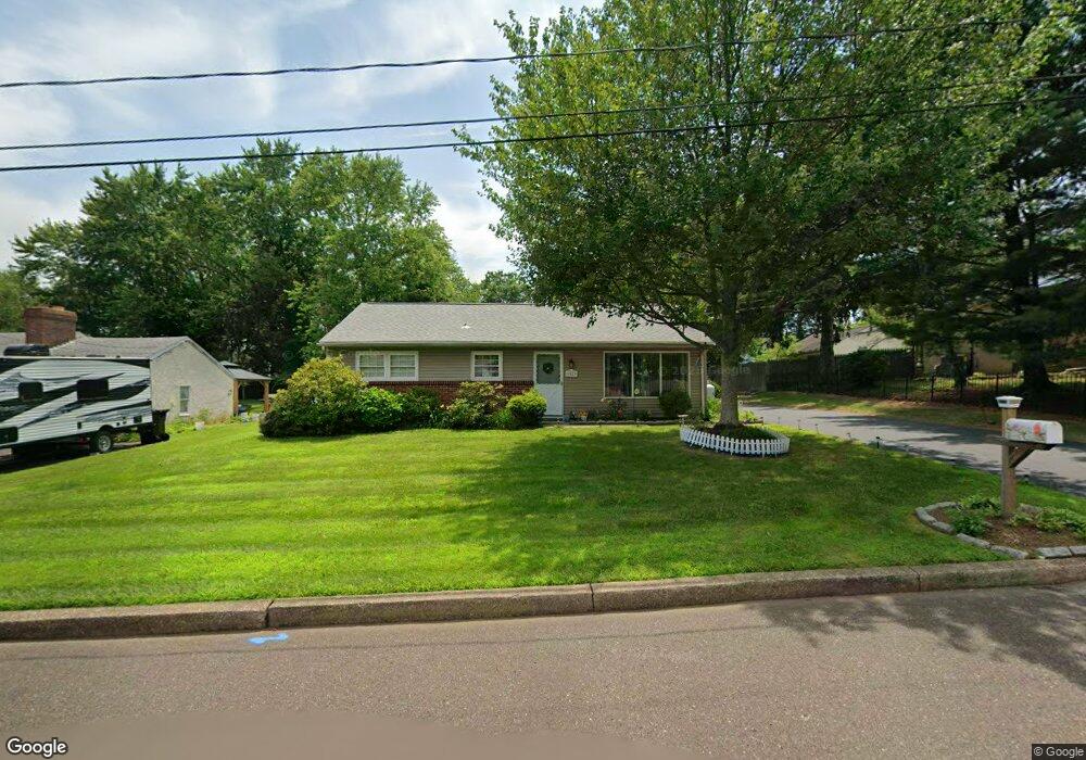
1929 Overbrook Rd Hatfield, PA 19440
Estimated Value: $312,105 - $393,000
1
Bed
1
Bath
1,000
Sq Ft
$352/Sq Ft
Est. Value
About This Home
This home is located at 1929 Overbrook Rd, Hatfield, PA 19440 and is currently estimated at $352,026, approximately $352 per square foot. 1929 Overbrook Rd is a home located in Montgomery County with nearby schools including Hatfield Elementary School, Pennfield Middle School, and North Penn Senior High School.
Ownership History
Date
Name
Owned For
Owner Type
Purchase Details
Closed on
Mar 20, 2006
Sold by
Deussing Carl R and Cook Kathryn M
Bought by
Deussing Carl R and Cook Kathryn M
Current Estimated Value
Purchase Details
Closed on
Jul 29, 2005
Sold by
Roberto Michael F and Roberto Cynthia L
Bought by
Deussing Carl R and Cook Kathryn M
Home Financials for this Owner
Home Financials are based on the most recent Mortgage that was taken out on this home.
Original Mortgage
$125,950
Interest Rate
5.54%
Mortgage Type
New Conventional
Purchase Details
Closed on
May 19, 2000
Sold by
Young Charles M
Bought by
Roberto Michael F and Roberto Cynthia L
Create a Home Valuation Report for This Property
The Home Valuation Report is an in-depth analysis detailing your home's value as well as a comparison with similar homes in the area
Home Values in the Area
Average Home Value in this Area
Purchase History
| Date | Buyer | Sale Price | Title Company |
|---|---|---|---|
| Deussing Carl R | -- | None Available | |
| Deussing Carl R | $229,000 | None Available | |
| Deussing Carl R | $229,000 | -- | |
| Roberto Michael F | $122,000 | T A Title Insurance Company |
Source: Public Records
Mortgage History
| Date | Status | Borrower | Loan Amount |
|---|---|---|---|
| Previous Owner | Deussing Carl R | $125,950 |
Source: Public Records
Tax History
| Year | Tax Paid | Tax Assessment Tax Assessment Total Assessment is a certain percentage of the fair market value that is determined by local assessors to be the total taxable value of land and additions on the property. | Land | Improvement |
|---|---|---|---|---|
| 2025 | $3,757 | $93,830 | $36,860 | $56,970 |
| 2024 | $3,757 | $93,830 | $36,860 | $56,970 |
| 2023 | $3,596 | $93,830 | $36,860 | $56,970 |
| 2022 | $3,478 | $93,830 | $36,860 | $56,970 |
| 2021 | $3,380 | $93,830 | $36,860 | $56,970 |
| 2020 | $3,300 | $93,830 | $36,860 | $56,970 |
| 2019 | $3,245 | $93,830 | $36,860 | $56,970 |
Source: Public Records
Map
Nearby Homes
- 1949 Overbrook Rd
- 2721 Cowpath Rd
- 36 N Maple Ave
- 105 S Main St
- 2331 Cambridge Cir
- 111 Raintree Crossing Unit 6B
- 933 Forty Foot Rd
- 369 Wheatfield Cir
- 29 W Vine St
- 113 Hickory Dr
- 109 Hickory Dr
- 700 Alexander Dr
- 2092 Hawthorne Ln
- 2848 Grant Ave
- 0 Fairmount St
- 2807 Truman Dr
- 2810 Truman Dr
- 1943 Linden Ln
- 1514 Maple Ave
- 2296 Bramble Gate Dr
- 1925 Overbrook Rd
- 1933 Overbrook Rd
- 1923 Overbrook Rd
- 1943 Overbrook Rd
- 33 E School St
- 37 E School St
- 25 E School St
- 45 E School St
- 1928 Overbrook Rd
- 1924 Overbrook Rd
- 1932 Overbrook Rd
- 21 E School St
- 51 E School St
- 1942 Overbrook Rd
- 2625 Cowpath Rd
- 2615 Cowpath Rd
- 57 E School St
- 1948 Overbrook Rd
- 215 N Main St
- 2701 / Front Office Cowpath Rd
Your Personal Tour Guide
Ask me questions while you tour the home.