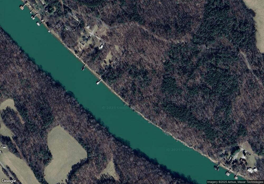
193 Lawson Ln Quebeck, TN 38579
Estimated Value: $167,784 - $288,000
--
Bed
1
Bath
781
Sq Ft
$291/Sq Ft
Est. Value
About This Home
This home is located at 193 Lawson Ln, Quebeck, TN 38579 and is currently estimated at $227,446, approximately $291 per square foot. 193 Lawson Ln is a home located in White County with nearby schools including Doyle Elementary School, White County Middle School, and White County High School.
Ownership History
Date
Name
Owned For
Owner Type
Purchase Details
Closed on
Apr 11, 2013
Bought by
Plummer Revocable Trust
Current Estimated Value
Purchase Details
Closed on
Feb 29, 1996
Sold by
Glen Hale
Bought by
Robert Plummer and Robert Mary
Purchase Details
Closed on
Feb 20, 1996
Bought by
Plummer Robert A and Plummer Mary M
Purchase Details
Closed on
Nov 9, 1993
Bought by
Hale Glen
Purchase Details
Closed on
Mar 17, 1993
Bought by
Reed Jack B and Reed Wiiie J
Purchase Details
Closed on
Mar 10, 1975
Bought by
Hart Richard C
Create a Home Valuation Report for This Property
The Home Valuation Report is an in-depth analysis detailing your home's value as well as a comparison with similar homes in the area
Home Values in the Area
Average Home Value in this Area
Purchase History
| Date | Buyer | Sale Price | Title Company |
|---|---|---|---|
| Plummer Revocable Trust | -- | -- | |
| Robert Plummer | $81,825 | -- | |
| Plummer Robert A | $81,800 | -- | |
| Hale Glen | $8,300 | -- | |
| Reed Jack B | $6,000 | -- | |
| Hart Richard C | -- | -- |
Source: Public Records
Tax History Compared to Growth
Tax History
| Year | Tax Paid | Tax Assessment Tax Assessment Total Assessment is a certain percentage of the fair market value that is determined by local assessors to be the total taxable value of land and additions on the property. | Land | Improvement |
|---|---|---|---|---|
| 2024 | $610 | $29,750 | $14,400 | $15,350 |
| 2023 | $0 | $29,750 | $14,400 | $15,350 |
| 2022 | $610 | $29,750 | $14,400 | $15,350 |
| 2021 | $610 | $29,750 | $14,400 | $15,350 |
| 2020 | $610 | $29,750 | $14,400 | $15,350 |
| 2019 | $521 | $25,425 | $14,400 | $11,025 |
| 2018 | $521 | $25,425 | $14,400 | $11,025 |
| 2017 | $521 | $25,425 | $14,400 | $11,025 |
| 2016 | $521 | $25,425 | $14,400 | $11,025 |
| 2015 | $470 | $25,425 | $14,400 | $11,025 |
| 2014 | -- | $25,425 | $14,400 | $11,025 |
| 2013 | -- | $24,075 | $13,325 | $10,750 |
Source: Public Records
Map
Nearby Homes
- 2541 Sparkman Town Rd
- 0 Sparkman Town Rd
- 0 Sparkmantown Rd Unit RTC2931549
- 9073 McMinnville Hwy
- 3204 Sparkman Town Rd
- 934 Holder Station Rd
- 3204 Sparkmantown Rd
- 118 Ed Phifer Rd
- 0 Rogers Rd Unit RTC2946486
- 1627 Rogers Rd
- 4 Barlow Rd
- 2 Barlow Rd
- Tract 2 Barlow Rd
- 6 Barlow Rd
- Tract 6 Barlow Rd
- Tract4 Barlow Rd
- 5 AC Barlow Rd
- 11716 McMinnville Hwy
- 146 Sparkmantown Rd
- W Rd Unit LotWP001
- 161 Lawson Ln
- 112 Lawson Ln
- 150 Thacker Rd
- 121 Bobby Gribble Rd
- 101 Bobby Gribble Rd
- 104 Bobby Gribble Rd
- 136 Bobby Gribble Rd
- 0 Holder Station Rd
- 510 McElroy Ford Rd
- 200 Holder Rd
- 250 Holder Rd
- 268 Holder Rd
- 926 Buffalo Rd
- 874 Buffalo Rd
- 274 McElroy Ford Rd
- 300 Holder Rd
- 800 Buffalo Rd
- 94 Dow Ln
- 00 Lewis Barlow
- 223 Lewis Barlow Cir
