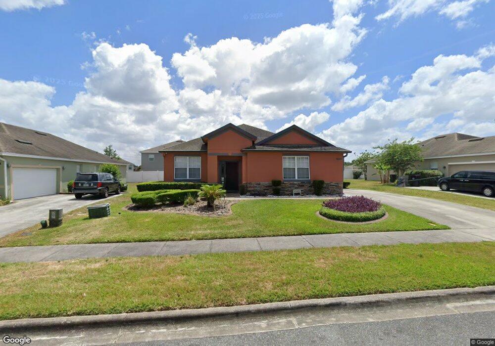
1930 Beardsley Dr Apopka, FL 32703
Estimated Value: $390,890 - $416,000
4
Beds
2
Baths
2,001
Sq Ft
$201/Sq Ft
Est. Value
About This Home
This home is located at 1930 Beardsley Dr, Apopka, FL 32703 and is currently estimated at $401,973, approximately $200 per square foot. 1930 Beardsley Dr is a home located in Orange County with nearby schools including Apopka Elementary School, Wolf Lake Middle School, and Apopka High School.
Ownership History
Date
Name
Owned For
Owner Type
Purchase Details
Closed on
Jul 10, 2024
Sold by
Walker Tara S and Latimer Tara S
Bought by
Redding Ryan Zachary and Redding Ronnika
Current Estimated Value
Home Financials for this Owner
Home Financials are based on the most recent Mortgage that was taken out on this home.
Original Mortgage
$19,490
Outstanding Balance
$19,259
Interest Rate
7.03%
Estimated Equity
$382,714
Purchase Details
Closed on
Feb 5, 2018
Sold by
Walker Tara S
Bought by
Walker Tara S and Walker Davette Latyrce
Purchase Details
Closed on
Feb 29, 2008
Sold by
Lennar Homes Llc
Bought by
Walker Tara S
Home Financials for this Owner
Home Financials are based on the most recent Mortgage that was taken out on this home.
Original Mortgage
$249,030
Interest Rate
5.46%
Mortgage Type
FHA
Create a Home Valuation Report for This Property
The Home Valuation Report is an in-depth analysis detailing your home's value as well as a comparison with similar homes in the area
Home Values in the Area
Average Home Value in this Area
Purchase History
| Date | Buyer | Sale Price | Title Company |
|---|---|---|---|
| Redding Ryan Zachary | $397,000 | Brokers Title | |
| Walker Tara S | -- | None Available | |
| Walker Tara S | $253,000 | North American Title Company |
Source: Public Records
Mortgage History
| Date | Status | Borrower | Loan Amount |
|---|---|---|---|
| Open | Redding Ryan Zachary | $19,490 | |
| Open | Redding Ryan Zachary | $389,809 | |
| Previous Owner | Walker Tara S | $249,030 |
Source: Public Records
Tax History
| Year | Tax Paid | Tax Assessment Tax Assessment Total Assessment is a certain percentage of the fair market value that is determined by local assessors to be the total taxable value of land and additions on the property. | Land | Improvement |
|---|---|---|---|---|
| 2025 | $4,983 | $349,230 | $75,000 | $274,230 |
| 2024 | $2,960 | $336,250 | $75,000 | $261,250 |
| 2023 | $2,960 | $225,629 | $0 | $0 |
| 2022 | $2,833 | $219,057 | $0 | $0 |
| 2021 | $2,789 | $212,677 | $0 | $0 |
| 2020 | $2,670 | $209,741 | $0 | $0 |
| 2019 | $2,714 | $205,025 | $40,000 | $165,025 |
| 2018 | $1,634 | $136,993 | $0 | $0 |
| 2017 | $1,587 | $196,351 | $40,000 | $156,351 |
| 2016 | $1,580 | $176,569 | $25,000 | $151,569 |
| 2015 | $1,568 | $165,244 | $25,000 | $140,244 |
| 2014 | $1,579 | $146,885 | $25,000 | $121,885 |
Source: Public Records
Map
Nearby Homes
- 2056 Clapper Trail
- 1692 Scrub Jay Rd
- 1271 Waterview Ridge Cir
- 771 Cavan Dr
- 1452 Waterview Ridge Cir
- 1272 Hillcrest View Loop
- 425 Orchard Dr
- 1569 Osprey View Dr
- 566 Lake Doe Blvd
- 891 Cavan Dr
- 1991 Sanderlin Point Loop
- 823 Emerald Grove St
- 1709 W Marshall Lake Dr
- 1772 Stonecliff Dr
- 728 Longford Loop
- 1484 Stonecliff Dr
- 185 Winding Cove Ave
- 647 Emerald Grove Dr
- 687 Emerald Grove Dr
- 1485 Stonecliff Dr
- 1924 Beardsley Dr
- 1936 Beardsley Dr
- 1964 Scrub Jay Rd
- 1943 Beardsley Dr
- 1970 Scrub Jay Rd
- 1942 Beardsley Dr
- 1918 Beardsley Dr
- 1976 Scrub Jay Rd
- 1931 Beardsley Dr
- 1937 Beardsley Dr
- 1925 Beardsley Dr
- 1948 Beardsley Dr
- 1919 Beardsley Dr
- 1982 Scrub Jay Rd
- 1963 Scrub Jay Rd
- 1969 Scrub Jay Rd
- 1945 Scrub Jay Rd
- 1957 Scrub Jay Rd
- 1975 Scrub Jay Rd
- 1949 Beardsley Dr
Your Personal Tour Guide
Ask me questions while you tour the home.