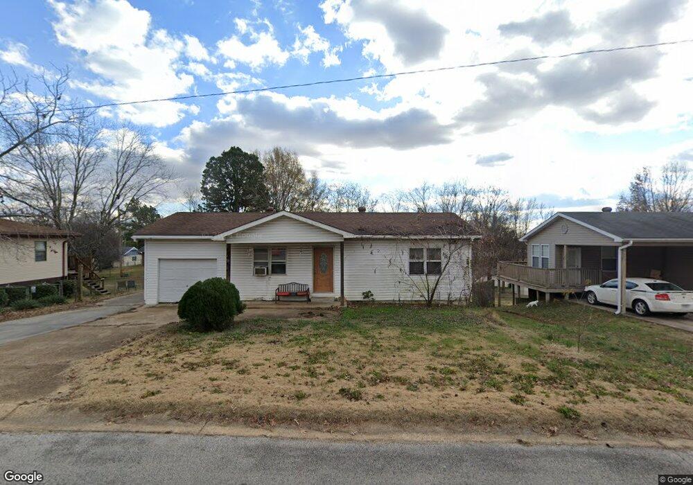
1930 Brentwood Rd Poplar Bluff, MO 63901
Estimated Value: $100,693 - $146,000
--
Bed
--
Bath
1,353
Sq Ft
$96/Sq Ft
Est. Value
About This Home
This home is located at 1930 Brentwood Rd, Poplar Bluff, MO 63901 and is currently estimated at $129,923, approximately $96 per square foot. 1930 Brentwood Rd is a home with nearby schools including Eugene Field Elementary School, Poplar Bluff Fifth & Sixth Grade Center, and Poplar Bluff Junior High School.
Ownership History
Date
Name
Owned For
Owner Type
Purchase Details
Closed on
Sep 5, 2017
Sold by
Scobey Properties Llc
Bought by
Jones Laurel J
Current Estimated Value
Home Financials for this Owner
Home Financials are based on the most recent Mortgage that was taken out on this home.
Original Mortgage
$58,000
Outstanding Balance
$40,055
Interest Rate
3.93%
Mortgage Type
Future Advance Clause Open End Mortgage
Estimated Equity
$89,868
Purchase Details
Closed on
Nov 15, 2012
Sold by
Gray Sottie and Gray Scottie W
Bought by
Scobey Joseph and Scobey Rosemary
Purchase Details
Closed on
Jan 15, 2009
Sold by
Venable Hazel L
Bought by
Gray Scottie W
Purchase Details
Closed on
Oct 25, 2005
Sold by
Venable Hazel L
Bought by
Gray Scottie and Venable Hazel L
Home Financials for this Owner
Home Financials are based on the most recent Mortgage that was taken out on this home.
Original Mortgage
$65,094
Interest Rate
5.73%
Mortgage Type
Future Advance Clause Open End Mortgage
Create a Home Valuation Report for This Property
The Home Valuation Report is an in-depth analysis detailing your home's value as well as a comparison with similar homes in the area
Home Values in the Area
Average Home Value in this Area
Purchase History
| Date | Buyer | Sale Price | Title Company |
|---|---|---|---|
| Jones Laurel J | -- | Alta Commitment For Title In | |
| Scobey Joseph | -- | None Available | |
| Gray Scottie W | -- | -- | |
| Gray Scottie | -- | -- |
Source: Public Records
Mortgage History
| Date | Status | Borrower | Loan Amount |
|---|---|---|---|
| Open | Jones Laurel J | $58,000 | |
| Previous Owner | Gray Scottie | $65,094 |
Source: Public Records
Tax History Compared to Growth
Tax History
| Year | Tax Paid | Tax Assessment Tax Assessment Total Assessment is a certain percentage of the fair market value that is determined by local assessors to be the total taxable value of land and additions on the property. | Land | Improvement |
|---|---|---|---|---|
| 2024 | $6 | $12,370 | $0 | $0 |
| 2023 | $598 | $12,370 | $0 | $0 |
| 2022 | $588 | $12,200 | $0 | $0 |
| 2021 | $589 | $12,200 | $0 | $0 |
| 2020 | $568 | $11,620 | $0 | $0 |
| 2019 | $568 | $11,620 | $0 | $0 |
| 2018 | $568 | $11,620 | $0 | $0 |
| 2017 | -- | $11,620 | $0 | $0 |
| 2016 | -- | $11,620 | $0 | $0 |
| 2015 | -- | $11,620 | $0 | $0 |
| 2014 | -- | $10,880 | $0 | $0 |
| 2012 | $463 | $10,870 | $0 | $0 |
Source: Public Records
Map
Nearby Homes
- 2024 Glendale Rd
- 2801 Bedoll Ave
- 2925 Wayne Ave
- 1110 Commerce St
- 2121 Pike St
- 1039 Franklin St
- 1025 Delano St
- 1315 S 11th St
- 1000 W Victor St
- 2335 Cheshire Blvd
- 712 Nickey St
- 912 Adam St
- 622 Nickey St
- 163 Fairway Dr
- 112 Kaylee Cir
- 0 County Road 301
- 1905 Kentucky Ave
- 792 County Road 466
- 813 Kendall Dr
- 1708 Kentucky Ave
- 1936 Brentwood Rd
- 1924 Brentwood Rd
- 1931 Brentwood Rd
- 1918 Brentwood Rd
- 1942 Brentwood Rd
- 1937 Brentwood Rd
- 1925 Brentwood Rd
- 1943 Brentwood Rd
- 1919 Brentwood Rd
- 1935 Glendale Rd
- 1929 Glendale Rd
- 1923 Glendale Rd
- 1927 Glendale Rd
- 1912 Brentwood Rd
- 2000 Brentwood Rd
- 1913 Brentwood Rd
- 1917 Glendale Rd
- 1938 Linn St
- 1908 Brentwood Rd
- 2006 Brentwood Rd