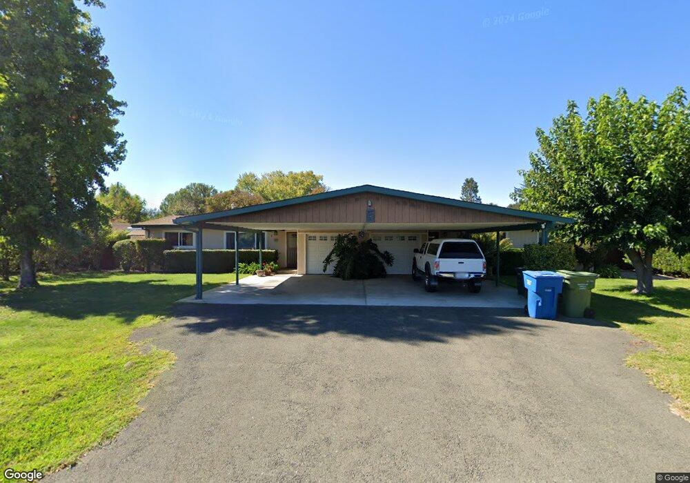
1930 Cooper Rd Sebastopol, CA 95472
Estimated Value: $559,000 - $1,109,000
4
Beds
2
Baths
2,324
Sq Ft
$404/Sq Ft
Est. Value
About This Home
This home is located at 1930 Cooper Rd, Sebastopol, CA 95472 and is currently estimated at $939,195, approximately $404 per square foot. 1930 Cooper Rd is a home located in Sonoma County with nearby schools including Analy High School, Sunridge Charter School, and Gravenstein Elementary School.
Ownership History
Date
Name
Owned For
Owner Type
Purchase Details
Closed on
Feb 21, 2021
Sold by
Lamirande Renee
Bought by
Lamirande Renee and Lamirande Mark
Current Estimated Value
Home Financials for this Owner
Home Financials are based on the most recent Mortgage that was taken out on this home.
Original Mortgage
$345,000
Outstanding Balance
$308,565
Interest Rate
2.7%
Mortgage Type
New Conventional
Estimated Equity
$630,630
Purchase Details
Closed on
Aug 7, 2003
Sold by
Birks Vernon L
Bought by
Lamirande Renee
Home Financials for this Owner
Home Financials are based on the most recent Mortgage that was taken out on this home.
Original Mortgage
$384,000
Interest Rate
5.29%
Mortgage Type
Purchase Money Mortgage
Create a Home Valuation Report for This Property
The Home Valuation Report is an in-depth analysis detailing your home's value as well as a comparison with similar homes in the area
Home Values in the Area
Average Home Value in this Area
Purchase History
| Date | Buyer | Sale Price | Title Company |
|---|---|---|---|
| Lamirande Renee | $172,500 | Chicago Title Insurance Co | |
| Lamirande Renee | $539,000 | Fidelity Natl Title Co |
Source: Public Records
Mortgage History
| Date | Status | Borrower | Loan Amount |
|---|---|---|---|
| Open | Lamirande Renee | $345,000 | |
| Previous Owner | Lamirande Renee | $384,000 |
Source: Public Records
Tax History
| Year | Tax Paid | Tax Assessment Tax Assessment Total Assessment is a certain percentage of the fair market value that is determined by local assessors to be the total taxable value of land and additions on the property. | Land | Improvement |
|---|---|---|---|---|
| 2025 | $8,856 | $766,326 | $270,130 | $496,196 |
| 2024 | $8,856 | $751,301 | $264,834 | $486,467 |
| 2023 | $8,856 | $736,571 | $259,642 | $476,929 |
| 2022 | $8,553 | $722,129 | $254,551 | $467,578 |
| 2021 | $8,462 | $707,970 | $249,560 | $458,410 |
| 2020 | $8,473 | $700,712 | $247,002 | $453,710 |
| 2019 | $7,998 | $686,973 | $242,159 | $444,814 |
| 2018 | $7,880 | $673,504 | $237,411 | $436,093 |
| 2017 | $7,541 | $660,299 | $232,756 | $427,543 |
| 2016 | $7,421 | $647,353 | $228,193 | $419,160 |
| 2015 | $6,049 | $534,000 | $188,000 | $346,000 |
| 2014 | $6,044 | $534,000 | $188,000 | $346,000 |
Source: Public Records
Map
Nearby Homes
- 1853 Cooper Rd
- 41 Sparkes Rd Unit 8
- 447 Sparkes Rd
- 5932 Fredricks Rd
- 1171 Gravenstein Hwy S
- 6820 Redwood Ave Unit 63
- 6363 Pond Hollow Rd
- 8061 Elphick Rd
- 830 Litchfield Ave
- 5301 Gravenstein Hwy S
- 7265 Hayden Ave
- 7576 Meadowlark Dr
- 5111 Todd Rd
- 486 S Main St
- 3640 Gravenstein Hwy S
- 601 First St
- 1979 Ludwig Ave
- 5200 California 116
- 3790 Gravenstein Hwy S
- 7671 Leland St
- 1950 Cooper Rd
- 1954 Cooper Rd
- 1955 Cooper Rd
- 1980 Cooper Rd
- 1966 Cooper Rd
- 1917 Cooper Rd
- 1960 Cooper Rd
- 1968 Cooper Rd
- 1898 Cooper Rd
- 1970 Cooper Rd
- 1975 Cooper Rd
- 1995 Cooper Rd
- 1990 Cooper Rd
- 1998 Cooper Rd
- 1965 Gravenstein Hwy S
- 2002 Cooper Rd
- 1963 Gravenstein Hwy S
- 1886 Cooper Rd
- 1858 Cooper Rd
- 1959 Gravenstein Hwy S
Your Personal Tour Guide
Ask me questions while you tour the home.