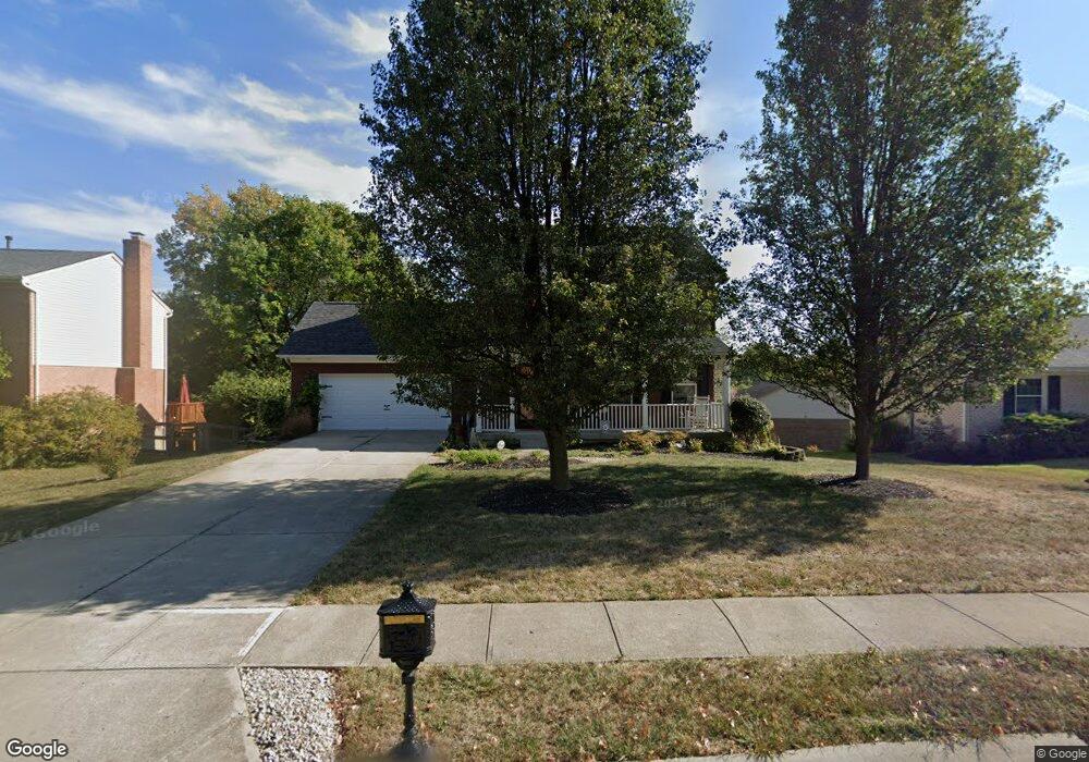
1930 Freedom Trail Independence, KY 41051
Estimated Value: $328,000 - $367,000
3
Beds
3
Baths
1,480
Sq Ft
$233/Sq Ft
Est. Value
About This Home
This home is located at 1930 Freedom Trail, Independence, KY 41051 and is currently estimated at $345,022, approximately $233 per square foot. 1930 Freedom Trail is a home located in Kenton County with nearby schools including Kenton Elementary School, Twenhofel Middle School, and Simon Kenton High School.
Ownership History
Date
Name
Owned For
Owner Type
Purchase Details
Closed on
Dec 8, 2021
Sold by
Lane Carol L
Bought by
Carol L Lane Trust and Lane
Current Estimated Value
Purchase Details
Closed on
Jul 22, 2004
Sold by
Lane Carol and Lane Lori
Bought by
Lane Carol L and Carol L Lane Trust Agreement
Purchase Details
Closed on
Mar 15, 2004
Sold by
Noll Builders Llc
Bought by
Lane Carol L
Home Financials for this Owner
Home Financials are based on the most recent Mortgage that was taken out on this home.
Original Mortgage
$133,500
Interest Rate
5.68%
Mortgage Type
Purchase Money Mortgage
Create a Home Valuation Report for This Property
The Home Valuation Report is an in-depth analysis detailing your home's value as well as a comparison with similar homes in the area
Home Values in the Area
Average Home Value in this Area
Purchase History
| Date | Buyer | Sale Price | Title Company |
|---|---|---|---|
| Carol L Lane Trust | $10,000 | Indecomm Global Services | |
| Lane Carol L | -- | None Listed On Document | |
| Lane Carol L | -- | -- | |
| Lane Carol L | $163,500 | Kentucky Land Title Agency |
Source: Public Records
Mortgage History
| Date | Status | Borrower | Loan Amount |
|---|---|---|---|
| Previous Owner | Lane Carol L | $133,500 |
Source: Public Records
Tax History Compared to Growth
Tax History
| Year | Tax Paid | Tax Assessment Tax Assessment Total Assessment is a certain percentage of the fair market value that is determined by local assessors to be the total taxable value of land and additions on the property. | Land | Improvement |
|---|---|---|---|---|
| 2024 | $2,353 | $192,100 | $40,000 | $152,100 |
| 2023 | $2,424 | $192,100 | $40,000 | $152,100 |
| 2022 | $2,485 | $192,100 | $40,000 | $152,100 |
| 2021 | $2,521 | $192,100 | $40,000 | $152,100 |
| 2020 | $2,202 | $163,500 | $40,000 | $123,500 |
| 2019 | $2,208 | $163,500 | $40,000 | $123,500 |
| 2018 | $2,220 | $163,500 | $40,000 | $123,500 |
| 2017 | $2,159 | $163,500 | $40,000 | $123,500 |
| 2015 | $2,096 | $163,500 | $35,000 | $128,500 |
| 2014 | $2,067 | $163,500 | $35,000 | $128,500 |
Source: Public Records
Map
Nearby Homes
- 60 Oby Dr
- 11553 Allaire Ct
- 11556 Allaire Ct
- 56 Apple Dr
- 11936 Cadillac Dr
- 11893 Wilson Rd
- 10741 Lakefront Cir
- 11923 Wilson Rd
- 12041 Wynola Dr
- 11147 Stafford Heights Rd
- 1427 Rosewynne Way
- 10737 Cypresswood Dr
- 1436 Rosewynne Way
- 1455 Thornberry Ct
- 1447 Thornberry Ct
- 11066 Pinebrook Place
- ALEXANDER Plan at Stonewater
- BEACHWOOD Plan at Stonewater - Stonewater Reserve
- ATWELL Plan at Stonewater - Stonewater Reserve
- WEMBLEY Plan at Stonewater - Stonewater Reserve
- 1926 Freedom Trail Dr
- 1926 Freedom Trail
- 1934 Freedom Trail
- 11547 Jamestown Ln
- 1922 Freedom Trail
- 1929 Freedom Trail
- 11527 Jamestown Ln
- 1933 Freedom Trail
- 11537 Jamestown Ln
- 1918 Freedom Trail
- 1925 Freedom Trail
- 1940 Freedom Trail
- 1937 Freedom Trail
- 1921 Freedom Trail
- 1941 Freedom Trail
- 49 Oby Dr
- 1914 Freedom Trail
- 1917 Freedom Trail
- 1944 Freedom Trail
- 53 Oby Dr