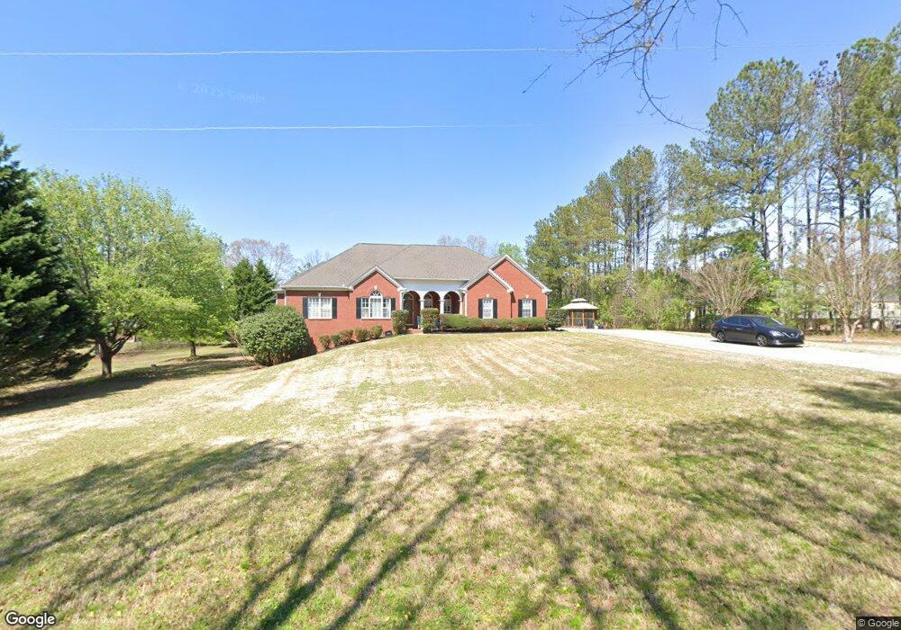
1930 Green Dr SW Marietta, GA 30064
Estimated Value: $475,000 - $609,897
4
Beds
4
Baths
2,342
Sq Ft
$235/Sq Ft
Est. Value
About This Home
This home is located at 1930 Green Dr SW, Marietta, GA 30064 and is currently estimated at $551,474, approximately $235 per square foot. 1930 Green Dr SW is a home located in Cobb County with nearby schools including Dowell Elementary School, Smitha Middle School, and Osborne High School.
Ownership History
Date
Name
Owned For
Owner Type
Purchase Details
Closed on
Apr 25, 2002
Sold by
Brown James Clinton and Brown Aleah C
Bought by
Brown James C and Brown Aleah C
Current Estimated Value
Home Financials for this Owner
Home Financials are based on the most recent Mortgage that was taken out on this home.
Original Mortgage
$292,000
Outstanding Balance
$124,067
Interest Rate
7.16%
Mortgage Type
New Conventional
Estimated Equity
$427,407
Create a Home Valuation Report for This Property
The Home Valuation Report is an in-depth analysis detailing your home's value as well as a comparison with similar homes in the area
Home Values in the Area
Average Home Value in this Area
Purchase History
| Date | Buyer | Sale Price | Title Company |
|---|---|---|---|
| Brown James C | -- | -- |
Source: Public Records
Mortgage History
| Date | Status | Borrower | Loan Amount |
|---|---|---|---|
| Open | Brown James C | $292,000 |
Source: Public Records
Tax History Compared to Growth
Tax History
| Year | Tax Paid | Tax Assessment Tax Assessment Total Assessment is a certain percentage of the fair market value that is determined by local assessors to be the total taxable value of land and additions on the property. | Land | Improvement |
|---|---|---|---|---|
| 2025 | $1,711 | $233,676 | $88,000 | $145,676 |
| 2024 | $1,716 | $233,676 | $88,000 | $145,676 |
| 2023 | $1,408 | $199,488 | $72,000 | $127,488 |
| 2022 | $1,525 | $169,728 | $49,600 | $120,128 |
| 2021 | $4,057 | $147,508 | $44,000 | $103,508 |
| 2020 | $3,865 | $138,708 | $35,200 | $103,508 |
| 2019 | $3,805 | $135,980 | $48,000 | $87,980 |
| 2018 | $3,300 | $117,740 | $35,200 | $82,540 |
| 2017 | $3,128 | $117,740 | $35,200 | $82,540 |
| 2016 | $2,692 | $102,540 | $20,000 | $82,540 |
| 2015 | $2,761 | $102,540 | $20,000 | $82,540 |
| 2014 | $2,222 | $83,636 | $0 | $0 |
Source: Public Records
Map
Nearby Homes
- 2050 Heritage Green Dr
- 2009 Freestone Way
- 2126 Green Dr SW
- 2250 Caneridge Trail SW
- 1985 Freestone Way
- Hillside Plan at Freestone Station
- Hendricks Plan at Freestone Station
- Antioch Plan at Freestone Station
- Hedgerow Plan at Freestone Station
- Monteluce Plan at Freestone Station
- Oakshire Plan at Freestone Station
- 1697 Dyeson Rd SW
- 1970 Powder Springs Rd SW
- 2409 Caneridge Point SW
- 1952 Freestone Way
- 2002 MacLand Square Dr Unit 1
- 1960 McEachern Manor Dr SW
- 2001 MacLand Square Dr Unit 11
- 0 Green Dr Unit 7181088
- 0 Green Dr Unit 8309984
- 0 Green Dr
- 1920 Green Dr SW
- 2290 Heritage Green Trail
- 2295 Heritage Green Trail
- 1991 Green Dr SW
- 0 Heritage Green Trail Unit 7467311
- 2300 Heritage Green Trail
- 2000 Heritage Green Dr SW
- 2305 Heritage Green Trail
- 2002 Green Dr SW
- 1990 Heritage Green Dr
- 1980 Heritage Green Dr
- 2001 Green Dr SW
- 2005 Heritage Green Dr
- 1970 Heritage Green Dr
- 1975 Heritage Green Dr
- 1960 Heritage Green Dr
- 2035 Heritage Green Dr SW