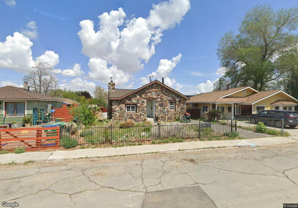
1930 H St Sparks, NV 89431
Downtown Sparks NeighborhoodEstimated Value: $277,000 - $324,000
1
Bed
1
Bath
878
Sq Ft
$342/Sq Ft
Est. Value
About This Home
This home is located at 1930 H St, Sparks, NV 89431 and is currently estimated at $300,640, approximately $342 per square foot. 1930 H St is a home located in Washoe County with nearby schools including Kate M Smith Elementary School, Sparks Middle School, and Sparks High School.
Ownership History
Date
Name
Owned For
Owner Type
Purchase Details
Closed on
Oct 14, 2010
Sold by
Vohland Lewis L
Bought by
Hartman Charles A
Current Estimated Value
Purchase Details
Closed on
Oct 10, 2000
Sold by
Vohland Lewis L
Bought by
Vohland Lewis L and The Lewis L Vohland Living Trust
Purchase Details
Closed on
Jul 19, 1995
Sold by
Vohland Blanche J and Vohland Janet
Bought by
Vohland Lewis L
Create a Home Valuation Report for This Property
The Home Valuation Report is an in-depth analysis detailing your home's value as well as a comparison with similar homes in the area
Home Values in the Area
Average Home Value in this Area
Purchase History
| Date | Buyer | Sale Price | Title Company |
|---|---|---|---|
| Hartman Charles A | $51,000 | First Centennial Reno | |
| Vohland Lewis L | -- | -- | |
| Vohland Lewis L | -- | -- |
Source: Public Records
Tax History Compared to Growth
Tax History
| Year | Tax Paid | Tax Assessment Tax Assessment Total Assessment is a certain percentage of the fair market value that is determined by local assessors to be the total taxable value of land and additions on the property. | Land | Improvement |
|---|---|---|---|---|
| 2025 | $600 | $48,103 | $31,675 | $16,428 |
| 2024 | $600 | $44,148 | $27,860 | $16,288 |
| 2023 | $583 | $45,647 | $30,625 | $15,022 |
| 2022 | $566 | $35,328 | $22,680 | $12,648 |
| 2021 | $554 | $28,124 | $16,275 | $11,849 |
| 2020 | $536 | $27,655 | $15,820 | $11,835 |
| 2019 | $521 | $24,851 | $13,615 | $11,236 |
| 2018 | $507 | $20,899 | $10,220 | $10,679 |
| 2017 | $493 | $20,131 | $9,555 | $10,576 |
| 2016 | $479 | $17,924 | $7,420 | $10,504 |
| 2015 | $478 | $16,087 | $5,775 | $10,312 |
| 2014 | $463 | $13,803 | $3,815 | $9,988 |
| 2013 | -- | $12,263 | $2,730 | $9,533 |
Source: Public Records
Map
Nearby Homes