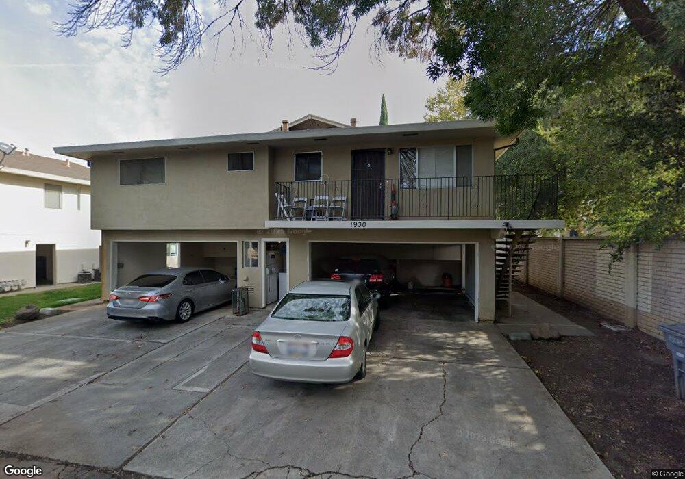
1930 Peabody Rd Unit 1 Vacaville, CA 95687
Estimated Value: $219,000 - $293,000
2
Beds
1
Bath
780
Sq Ft
$315/Sq Ft
Est. Value
About This Home
This home is located at 1930 Peabody Rd Unit 1, Vacaville, CA 95687 and is currently estimated at $245,725, approximately $315 per square foot. 1930 Peabody Rd Unit 1 is a home located in Solano County with nearby schools including Eugene Padan Elementary School, Orchard Elementary School, and Vaca Pena Middle School.
Ownership History
Date
Name
Owned For
Owner Type
Purchase Details
Closed on
Apr 28, 2025
Sold by
Sterns And Brendel Sterns Living Trust and Sterns Steven
Bought by
Sterns And Brendel Sterns Living Trust and Sterns
Current Estimated Value
Purchase Details
Closed on
Dec 4, 2023
Sold by
Sterns Mari Brendal and Sterns Steve
Bought by
Sterns And Brenda Sterns Living Trust and Sterns
Purchase Details
Closed on
May 12, 2010
Sold by
Federal National Mortgage Association
Bought by
Sterns Steve and Sterns Mari Brendel
Purchase Details
Closed on
Jun 10, 2009
Sold by
Woolums James S and Woolums Kristine L
Bought by
Federal National Mortgage Association
Purchase Details
Closed on
Oct 27, 1994
Sold by
First Mtg Corp
Bought by
Va
Purchase Details
Closed on
Oct 21, 1994
Sold by
First Mtg Corp and Samples Walter Leroy
Bought by
First Mtg Corp
Create a Home Valuation Report for This Property
The Home Valuation Report is an in-depth analysis detailing your home's value as well as a comparison with similar homes in the area
Home Values in the Area
Average Home Value in this Area
Purchase History
| Date | Buyer | Sale Price | Title Company |
|---|---|---|---|
| Sterns And Brendel Sterns Living Trust | -- | None Listed On Document | |
| Sterns And Brenda Sterns Living Trust | -- | None Listed On Document | |
| Sterns Steve | $45,000 | Stewart Title Of California | |
| Federal National Mortgage Association | $130,096 | Landsafe Title | |
| Va | -- | -- | |
| First Mtg Corp | $48,286 | -- |
Source: Public Records
Tax History Compared to Growth
Tax History
| Year | Tax Paid | Tax Assessment Tax Assessment Total Assessment is a certain percentage of the fair market value that is determined by local assessors to be the total taxable value of land and additions on the property. | Land | Improvement |
|---|---|---|---|---|
| 2025 | $757 | $57,947 | $19,355 | $38,592 |
| 2024 | $757 | $56,812 | $18,976 | $37,836 |
| 2023 | $739 | $55,699 | $18,605 | $37,094 |
| 2022 | $719 | $54,608 | $18,241 | $36,367 |
| 2021 | $718 | $53,538 | $17,884 | $35,654 |
| 2020 | $708 | $52,990 | $17,701 | $35,289 |
| 2019 | $695 | $51,952 | $17,354 | $34,598 |
| 2018 | $686 | $50,934 | $17,014 | $33,920 |
| 2017 | $664 | $49,936 | $16,681 | $33,255 |
| 2016 | $649 | $48,957 | $16,354 | $32,603 |
| 2015 | $640 | $48,223 | $16,109 | $32,114 |
| 2014 | $602 | $47,279 | $15,794 | $31,485 |
Source: Public Records
Map
Nearby Homes
- 1930 Duxburry Ln Unit 2
- 1950 Duxburry Ln Unit 2
- 1951 Aletha Ln Unit 4
- 1970 Peabody Rd Unit 1
- 1967 Southwood Dr Unit 2
- 1878 Southwood Dr
- 2001 Eastwood Dr Unit 38
- 571 Greenwood Dr
- 500 Gregory Dr
- 137 Valhalla Ct
- 224 Coronado Ct
- 1597 Alamo Dr #141 Dr
- 1607 California Dr
- 466 Bowline Dr
- 1597 Alamo Dr Unit 150
- 1597 Alamo Dr Unit 140
- 1597 Alamo Dr Unit 146
- 1597 Alamo Dr Unit 128
- 1597 Alamo Dr Unit 175
- 196 Caldwell Dr
- 1930 Peabody Rd
- 1930 Peabody Rd Unit 2
- 1930 Peabody Rd Unit 3
- 1940 Peabody Rd Unit 4
- 1940 Peabody Rd Unit 3
- 1940 Peabody Rd Unit 2
- 1940 Peabody Rd
- 1950 Peabody Rd Unit 4
- 1950 Peabody Rd Unit 2
- 1950 Peabody Rd Unit 3
- 1950 Peabody Rd Unit 1
- 1930 Duxburry Ln
- 1930 Duxburry Ln Unit 4
- 1930 Duxburry Ln Unit 3
- 1930 Duxburry Ln Unit 3
- 1930 Duxburry Ln Unit 1
- 1940 Duxburry Ln Unit 4
- 1940 Duxburry Ln Unit 2
- 1940 Duxburry Ln Unit 3
- 1940 Duxburry Ln Unit 1