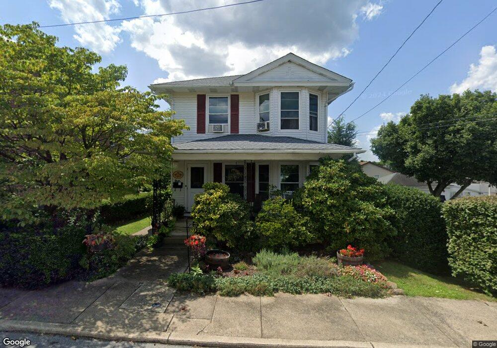
1930 S Aubrey St Unit 1936 Allentown, PA 18103
Southside NeighborhoodEstimated Value: $238,000 - $303,000
3
Beds
1
Bath
1,232
Sq Ft
$215/Sq Ft
Est. Value
About This Home
This home is located at 1930 S Aubrey St Unit 1936, Allentown, PA 18103 and is currently estimated at $264,899, approximately $215 per square foot. 1930 S Aubrey St Unit 1936 is a home located in Lehigh County with nearby schools including Hiram W Dodd Elementary School, South Mountain Middle School, and Louis E. Dieruff High School.
Ownership History
Date
Name
Owned For
Owner Type
Purchase Details
Closed on
Aug 13, 2025
Sold by
Nagle Richard E
Bought by
Nagle Richard E and Martin Matthew R
Current Estimated Value
Purchase Details
Closed on
Aug 4, 2015
Sold by
Wunderler Joseph C and Phy Mary E
Bought by
Nagle Richard E
Home Financials for this Owner
Home Financials are based on the most recent Mortgage that was taken out on this home.
Original Mortgage
$116,400
Interest Rate
3.79%
Mortgage Type
New Conventional
Purchase Details
Closed on
Aug 13, 1946
Bought by
Wunderler Joseph J and Wunderler Gisela J
Create a Home Valuation Report for This Property
The Home Valuation Report is an in-depth analysis detailing your home's value as well as a comparison with similar homes in the area
Home Values in the Area
Average Home Value in this Area
Purchase History
| Date | Buyer | Sale Price | Title Company |
|---|---|---|---|
| Nagle Richard E | -- | None Listed On Document | |
| Nagle Richard E | $120,000 | Attorney | |
| Wunderler Joseph J | -- | -- |
Source: Public Records
Mortgage History
| Date | Status | Borrower | Loan Amount |
|---|---|---|---|
| Previous Owner | Nagle Richard E | $116,400 |
Source: Public Records
Tax History Compared to Growth
Tax History
| Year | Tax Paid | Tax Assessment Tax Assessment Total Assessment is a certain percentage of the fair market value that is determined by local assessors to be the total taxable value of land and additions on the property. | Land | Improvement |
|---|---|---|---|---|
| 2025 | $4,114 | $112,400 | $33,700 | $78,700 |
| 2024 | $4,114 | $112,400 | $33,700 | $78,700 |
| 2023 | $4,114 | $112,400 | $33,700 | $78,700 |
| 2022 | $3,986 | $112,400 | $78,700 | $33,700 |
| 2021 | $3,915 | $112,400 | $33,700 | $78,700 |
| 2020 | $3,825 | $112,400 | $33,700 | $78,700 |
| 2019 | $3,770 | $112,400 | $33,700 | $78,700 |
| 2018 | $3,454 | $112,400 | $33,700 | $78,700 |
| 2017 | $3,376 | $112,400 | $33,700 | $78,700 |
| 2016 | -- | $112,400 | $33,700 | $78,700 |
| 2015 | -- | $112,400 | $33,700 | $78,700 |
| 2014 | -- | $112,400 | $33,700 | $78,700 |
Source: Public Records
Map
Nearby Homes
- 1865 Chapel Ave
- 206 208 W Emaus Ave
- 102 W Brookdale St
- 121 Woodcrest Cir
- 2429 S Front St
- 2421 S Wood St
- 1852 S 2nd St
- 148 W Brookdale St
- 203 W Brookdale St
- 135 W Wabash St
- 2441 S 4th St
- 316 W Mountain Rd
- 320 E Paoli St
- 127 E Lynnwood St
- 2416 S Alice St Unit 2418
- 2347 S Law St Unit 2349
- 566 W Emaus Ave
- 566 588 W Emaus Ave
- 2331 S Filbert St
- 1831 S Church St
- 1934 S Aubrey St
- 1927 S Albert St Unit 1929
- 1938 S Aubrey St Unit 1944
- 1926 S Aubrey St
- 1940 S Aubrey St
- 1944 S Aubrey St Unit 1950
- 1935 S Aubrey St Unit 1937
- 1940 S Albert St Unit 1936
- 1923 S Aubrey St Unit 1925
- 120 E Emmaus Ave
- 1941 S Aubrey St Unit 1943
- 102 E Emmaus Ave
- 1952 S Aubrey St Unit 1958
- 1929 S Aubrey St Unit 1931
- 34 E Emaus Ave
- 1947 S Aubrey St
- 28 E Emaus Ave
- 34 E Emmaus Ave
- 26 E Emaus Ave
- 26 E Emmaus Ave