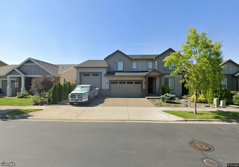
1930 Silverstone Dr Forest Grove, OR 97116
Estimated Value: $684,000 - $745,000
5
Beds
3
Baths
2,778
Sq Ft
$255/Sq Ft
Est. Value
About This Home
This home is located at 1930 Silverstone Dr, Forest Grove, OR 97116 and is currently estimated at $709,635, approximately $255 per square foot. 1930 Silverstone Dr is a home with nearby schools including Harvey Clarke Elementary School, Tom McCall Upper Elementary School, and Neil Armstrong Middle School.
Ownership History
Date
Name
Owned For
Owner Type
Purchase Details
Closed on
Mar 12, 2024
Sold by
Bailey Alee and Ibrekic Alma
Bought by
Bailey Living Trust and Bailey
Current Estimated Value
Purchase Details
Closed on
Jun 9, 2017
Sold by
Stone Bridge Homes Nw Llc
Bought by
Bailey Alec and Ibrekic Alma
Home Financials for this Owner
Home Financials are based on the most recent Mortgage that was taken out on this home.
Original Mortgage
$424,100
Interest Rate
4.05%
Mortgage Type
New Conventional
Create a Home Valuation Report for This Property
The Home Valuation Report is an in-depth analysis detailing your home's value as well as a comparison with similar homes in the area
Purchase History
| Date | Buyer | Sale Price | Title Company |
|---|---|---|---|
| Bailey Living Trust | -- | None Listed On Document | |
| Bailey Alec | $547,000 | First American |
Source: Public Records
Mortgage History
| Date | Status | Borrower | Loan Amount |
|---|---|---|---|
| Previous Owner | Bailey Alec | $424,100 |
Source: Public Records
Tax History
| Year | Tax Paid | Tax Assessment Tax Assessment Total Assessment is a certain percentage of the fair market value that is determined by local assessors to be the total taxable value of land and additions on the property. | Land | Improvement |
|---|---|---|---|---|
| 2026 | $7,613 | $427,490 | -- | -- |
| 2025 | $7,613 | $415,040 | -- | -- |
| 2024 | $7,344 | $402,960 | -- | -- |
| 2023 | $7,344 | $391,230 | $0 | $0 |
| 2022 | $6,422 | $391,230 | $0 | $0 |
| 2021 | $6,338 | $368,780 | $0 | $0 |
| 2020 | $6,304 | $358,040 | $0 | $0 |
| 2019 | $6,164 | $347,620 | $0 | $0 |
| 2018 | $5,975 | $337,500 | $0 | $0 |
| 2017 | $783 | $44,290 | $0 | $0 |
Source: Public Records
Map
Nearby Homes
- 1952 Silverstone Dr
- 2032 Silverstone Dr
- 3594 Ash St Unit Lot 25
- 2043 35th Ave
- 3605 Main St
- 2081 Silverstone Dr
- 3456 Birch St
- 3612 Ash St Unit Lot 16
- 2091 35th Ave
- 2170 36th Ave
- 2149 36th Unit Lot 59
- 2123 Colby Ln Unit Lot 74
- 3654 Ash St Unit Lot 118
- 2190 36th Ave
- 2165 36th Ave Unit Lot 57
- 2129 Colby Ln Unit Lot 75
- 2159 Colby Ln Unit Lot 79
- 3613 Chestnut St Unit Lot 48
- 2171 Colby Ln Unit Lot 81
- 1722 Hartford Dr
Your Personal Tour Guide
Ask me questions while you tour the home.