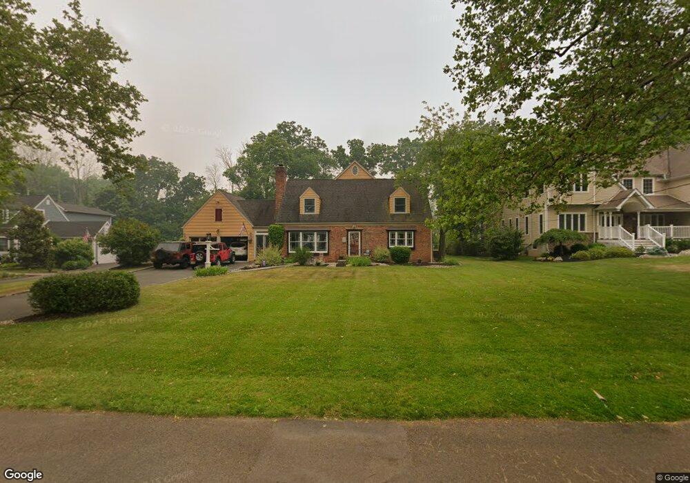
1930 Stony Brook Cir Scotch Plains, NJ 07076
Estimated Value: $892,364 - $1,445,000
--
Bed
--
Bath
3,060
Sq Ft
$384/Sq Ft
Est. Value
About This Home
This home is located at 1930 Stony Brook Cir, Scotch Plains, NJ 07076 and is currently estimated at $1,174,091, approximately $383 per square foot. 1930 Stony Brook Cir is a home located in Union County with nearby schools including William J. McGinn Elementary School, Terrill Middle School, and Scotch Plains-Fanwood High School.
Ownership History
Date
Name
Owned For
Owner Type
Purchase Details
Closed on
Nov 28, 2001
Sold by
Nickles Meta and Riekehof Ruth
Bought by
Dietz Robert C and Dietz Catherine A
Current Estimated Value
Home Financials for this Owner
Home Financials are based on the most recent Mortgage that was taken out on this home.
Original Mortgage
$210,000
Outstanding Balance
$82,241
Interest Rate
6.6%
Mortgage Type
Stand Alone First
Estimated Equity
$1,091,850
Create a Home Valuation Report for This Property
The Home Valuation Report is an in-depth analysis detailing your home's value as well as a comparison with similar homes in the area
Home Values in the Area
Average Home Value in this Area
Purchase History
| Date | Buyer | Sale Price | Title Company |
|---|---|---|---|
| Dietz Robert C | $360,000 | -- |
Source: Public Records
Mortgage History
| Date | Status | Borrower | Loan Amount |
|---|---|---|---|
| Open | Dietz Robert C | $210,000 |
Source: Public Records
Tax History Compared to Growth
Tax History
| Year | Tax Paid | Tax Assessment Tax Assessment Total Assessment is a certain percentage of the fair market value that is determined by local assessors to be the total taxable value of land and additions on the property. | Land | Improvement |
|---|---|---|---|---|
| 2025 | $19,982 | $169,800 | $46,500 | $123,300 |
| 2024 | $19,393 | $169,800 | $46,500 | $123,300 |
| 2023 | $19,393 | $169,800 | $46,500 | $123,300 |
| 2022 | $19,162 | $169,800 | $46,500 | $123,300 |
| 2021 | $19,130 | $169,800 | $46,500 | $123,300 |
| 2020 | $19,038 | $169,800 | $46,500 | $123,300 |
| 2019 | $18,897 | $169,800 | $46,500 | $123,300 |
| 2018 | $18,580 | $169,800 | $46,500 | $123,300 |
| 2017 | $18,167 | $169,800 | $46,500 | $123,300 |
| 2016 | $17,817 | $169,800 | $46,500 | $123,300 |
| 2015 | $17,525 | $169,800 | $46,500 | $123,300 |
| 2014 | $16,948 | $169,800 | $46,500 | $123,300 |
Source: Public Records
Map
Nearby Homes
- 2 Dutch Ln
- 57 Rambling Dr
- 2 Brookside Ct
- 2 Unami Ln
- 1466 Lamberts Mill Rd
- 1840 Raritan Rd
- 1933 W Broad St
- 314 Highgate Ave
- 1701 Raritan Rd
- 2154 W Broad St
- 1840 Lake Ave
- 1933 Mary Ellen Ln
- 119 Lamberts Mill Rd
- 1621 Terrill Rd
- 1380 Terrill Rd
- 2116 Newark Ave
- 1148 Tanglewood Ln
- 676 Vermont St
- 187 King St
- 525 Edgar Rd
- 1936 Stony Brook Cir
- 1920 Stony Brook Cir
- 1912 Stony Brook Cir
- 1942 Stony Brook Cir
- 1929 Stony Brook Cir
- 1551 Martine Ave
- 1921 Stony Brook Cir
- 1937 Stony Brook Cir
- 1917 Stony Brook Cir
- 1545 Martine Ave
- 1913 Stony Brook Cir
- 1941 Stony Brook Cir
- 1533 Martine Ave
- 1521 Martine Ave
- 1918 Inverness Dr
- 1926 Inverness Dr
- 1511 Martine Ave
- 1 Rambling Dr
- 1934 Inverness Dr
- 2 Rambling Dr