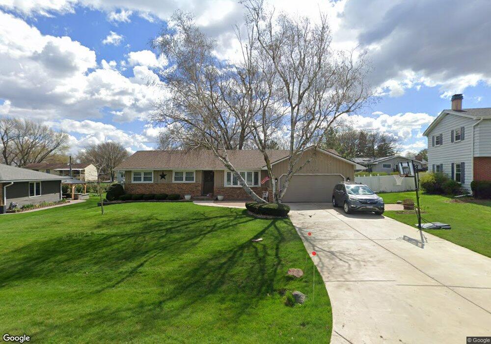
1930 Swarthmore Dr Unit 6 Aurora, IL 60506
Pine Knoll NeighborhoodEstimated Value: $302,000 - $338,000
3
Beds
2
Baths
1,310
Sq Ft
$245/Sq Ft
Est. Value
About This Home
This home is located at 1930 Swarthmore Dr Unit 6, Aurora, IL 60506 and is currently estimated at $320,509, approximately $244 per square foot. 1930 Swarthmore Dr Unit 6 is a home located in Kane County with nearby schools including Freeman Elementary School, Washington Middle School, and West Aurora High School.
Ownership History
Date
Name
Owned For
Owner Type
Purchase Details
Closed on
Mar 19, 2025
Sold by
Mcdonough Kevin P and Mcdonough Sheri L
Bought by
Kevin And Sheri Mcdonough Trust and Mcdonough
Current Estimated Value
Purchase Details
Closed on
Nov 18, 2002
Sold by
Mcdonough Lois E
Bought by
Mcdonough Kevin P and Mcdonough Sheri L
Home Financials for this Owner
Home Financials are based on the most recent Mortgage that was taken out on this home.
Original Mortgage
$124,400
Interest Rate
6.08%
Mortgage Type
Seller Take Back
Purchase Details
Closed on
Jul 13, 1999
Sold by
Mcdonough Lois E
Bought by
Mcdonough Lois E and Lois E Mcdonough Living Trust
Create a Home Valuation Report for This Property
The Home Valuation Report is an in-depth analysis detailing your home's value as well as a comparison with similar homes in the area
Home Values in the Area
Average Home Value in this Area
Purchase History
| Date | Buyer | Sale Price | Title Company |
|---|---|---|---|
| Kevin And Sheri Mcdonough Trust | -- | None Listed On Document | |
| Mcdonough Kevin P | $144,500 | Republic Title | |
| Mcdonough Lois E | -- | -- |
Source: Public Records
Mortgage History
| Date | Status | Borrower | Loan Amount |
|---|---|---|---|
| Previous Owner | Mcdonough Kevin P | $124,400 |
Source: Public Records
Tax History Compared to Growth
Tax History
| Year | Tax Paid | Tax Assessment Tax Assessment Total Assessment is a certain percentage of the fair market value that is determined by local assessors to be the total taxable value of land and additions on the property. | Land | Improvement |
|---|---|---|---|---|
| 2024 | $4,604 | $85,678 | $13,260 | $72,418 |
| 2023 | $4,328 | $76,553 | $11,848 | $64,705 |
| 2022 | $4,342 | $69,847 | $10,810 | $59,037 |
| 2021 | $4,107 | $65,028 | $10,064 | $54,964 |
| 2020 | $4,242 | $60,401 | $9,348 | $51,053 |
| 2019 | $4,092 | $55,963 | $8,661 | $47,302 |
| 2018 | $4,174 | $55,497 | $8,011 | $47,486 |
| 2017 | $400,598 | $52,043 | $7,381 | $44,662 |
| 2016 | $3,892 | $49,141 | $6,327 | $42,814 |
| 2015 | -- | $46,680 | $5,441 | $41,239 |
| 2014 | -- | $43,762 | $5,233 | $38,529 |
| 2013 | -- | $46,060 | $5,158 | $40,902 |
Source: Public Records
Map
Nearby Homes
- 977 Lindenwood Dr
- 2021 Radcliffe Dr
- 430 Cottrell Ln
- 422 Cottrell Ln
- 408 Cottrell Ln
- 399 S Constitution Dr
- 892 Audubon Ln Unit 1
- 1243 Jericho Rd
- Rutherford Plan at Prairie Meadows
- Napa Plan at Prairie Meadows
- Sonoma Plan at Prairie Meadows
- Siena Plan at Prairie Meadows
- 888 Summerhill Dr Unit 2
- 2451 Roseglen Way
- 381 S Constitution Dr
- 369 S Constitution Dr
- 381 Constitution Dr
- 375 Constitution Dr
- 369 Constitution Dr
- 336 S Constitution Dr
- 1940 Swarthmore Dr
- 1920 Swarthmore Dr Unit 6
- 2051 Radcliffe Dr
- 2041 Radcliffe Dr
- 2061 Radcliffe Dr
- 1958 Swarthmore Dr
- 2031 Radcliffe Dr
- 1935 Swarthmore Dr
- 1910 Swarthmore Dr
- 1915 Swarthmore Dr
- 2071 Radcliffe Dr
- 1945 Swarthmore Dr
- 1964 Swarthmore Dr
- 1900 Swarthmore Dr
- 1905 Swarthmore Dr
- 2050 Radcliffe Dr Unit 8
- 1955 Swarthmore Dr
- 2068 Radcliffe Dr Unit 8
- 2040 Radcliffe Dr Unit 9
- 1051 Lindenwood Dr Unit 5