Estimated Value: $356,000 - $428,000
3
Beds
3
Baths
2,527
Sq Ft
$152/Sq Ft
Est. Value
About This Home
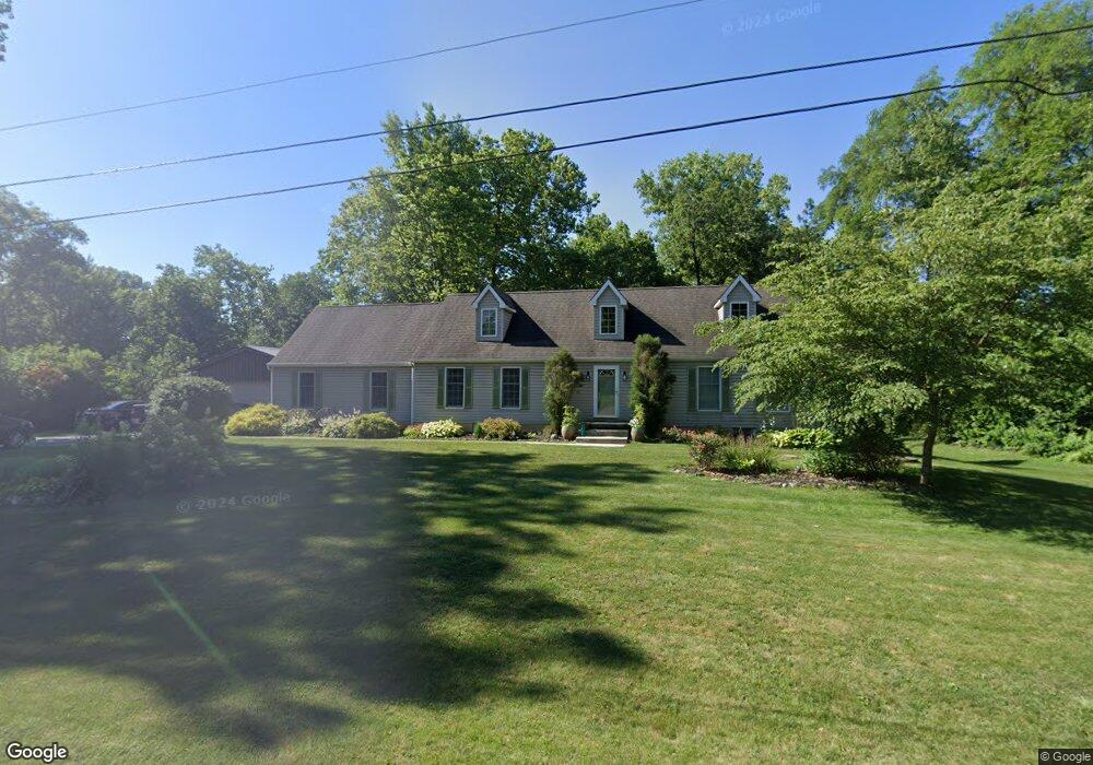
This home is located at 1930 Westwood Rd, Troy, OH 45373 and is currently estimated at $385,326, approximately $152 per square foot. 1930 Westwood Rd is a home located in Miami County with nearby schools including Concord Elementary School, Van Cleve Elementary School, and Troy Junior High School.
Ownership History
Date
Name
Owned For
Owner Type
Purchase Details
Closed on
Sep 22, 2025
Sold by
Peura Karl R and Peura Rebecca L
Bought by
Peura Family Revocable Living Trust and Peura
Current Estimated Value
Purchase Details
Closed on
Mar 22, 2019
Sold by
Quilter William J and Quilter Wenda J
Bought by
Peura Karl R and Peura Rebecca L
Home Financials for this Owner
Home Financials are based on the most recent Mortgage that was taken out on this home.
Original Mortgage
$157,000
Interest Rate
4.3%
Mortgage Type
New Conventional
Purchase Details
Closed on
May 25, 1993
Bought by
Quilter William J
Create a Home Valuation Report for This Property
The Home Valuation Report is an in-depth analysis detailing your home's value as well as a comparison with similar homes in the area
Home Values in the Area
Average Home Value in this Area
Purchase History
| Date | Buyer | Sale Price | Title Company |
|---|---|---|---|
| Peura Family Revocable Living Trust | -- | None Listed On Document | |
| Peura Karl R | $227,250 | Wave Title Agency | |
| Quilter William J | $167,000 | -- |
Source: Public Records
Mortgage History
| Date | Status | Borrower | Loan Amount |
|---|---|---|---|
| Previous Owner | Peura Karl R | $157,000 |
Source: Public Records
Tax History Compared to Growth
Tax History
| Year | Tax Paid | Tax Assessment Tax Assessment Total Assessment is a certain percentage of the fair market value that is determined by local assessors to be the total taxable value of land and additions on the property. | Land | Improvement |
|---|---|---|---|---|
| 2024 | $3,861 | $99,200 | $13,690 | $85,510 |
| 2023 | $3,861 | $93,460 | $13,690 | $79,770 |
| 2022 | $3,043 | $93,460 | $13,690 | $79,770 |
| 2021 | $2,495 | $71,900 | $10,540 | $61,360 |
| 2020 | $2,497 | $71,900 | $10,540 | $61,360 |
| 2019 | $2,586 | $71,900 | $10,540 | $61,360 |
| 2018 | $1,951 | $61,750 | $11,380 | $50,370 |
| 2017 | $1,969 | $61,750 | $11,380 | $50,370 |
| 2016 | $1,941 | $61,750 | $11,380 | $50,370 |
| 2015 | $1,844 | $57,160 | $10,540 | $46,620 |
| 2014 | $1,844 | $57,160 | $10,540 | $46,620 |
| 2013 | $1,856 | $57,160 | $10,540 | $46,620 |
Source: Public Records
Map
Nearby Homes
- 00 W
- 1585 Lexington Ave
- 1465 Wayne St
- 1481 Lantern Ln
- 1479 Lantern Ln Unit 1479
- 1463 Lantern Ln Unit 1463
- 410 Armand Dr
- 2244 Blackoak Dr
- 349 Armand Dr
- 2290 Murphy Ln E
- 609 Old Newton Pike
- 2365 Murphy Ln W
- 1965 Quail Nest Ct
- 2380 Patterson Ln W
- 1985 Fox Run
- 422 Lake St
- Holcombe Plan at Reserve at Cliff Oaks
- Chatham Plan at Reserve at Cliff Oaks
- 1914 Westwood Rd
- 755 Barnhart Rd
- 1915 Woodlawn Dr
- 1875 Woodlawn Dr
- 1945 Westwood Rd
- 1927 Westwood Rd
- 1900 Westwood Rd
- 1971 Westwood Rd
- 1909 Westwood Rd
- 1855 Woodlawn Dr
- 1975 Woodlawn Dr
- 1981 Westwood Rd
- 1893 Westwood Rd
- 1870 Westwood Rd
- 1845 Woodlawn Dr
- 1900 Woodlawn Dr
- 1875 Westwood Rd
- 1940 Woodlawn Dr
- 1890 Woodlawn Dr
- 1920 Jillane Dr