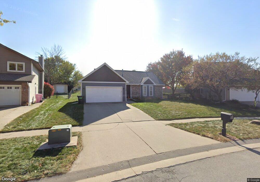
1930 Windfield Dr Ames, IA 50010
Bloomington Heights NeighborhoodEstimated Value: $315,703 - $335,000
3
Beds
3
Baths
1,167
Sq Ft
$281/Sq Ft
Est. Value
About This Home
This home is located at 1930 Windfield Dr, Ames, IA 50010 and is currently estimated at $327,926, approximately $280 per square foot. 1930 Windfield Dr is a home located in Story County with nearby schools including Gilbert Elementary School, Gilbert Intermediate School, and Gilbert Middle School.
Ownership History
Date
Name
Owned For
Owner Type
Purchase Details
Closed on
Jul 9, 2009
Sold by
Henderson Eric N and Henderson Alicia M
Bought by
Alvarez Gustavo and Alvarez Adriana Hernandez
Current Estimated Value
Home Financials for this Owner
Home Financials are based on the most recent Mortgage that was taken out on this home.
Original Mortgage
$169,866
Outstanding Balance
$112,599
Interest Rate
5.62%
Mortgage Type
FHA
Estimated Equity
$215,327
Purchase Details
Closed on
Sep 6, 2006
Sold by
Ross Terry L and Ross Anne Freund
Bought by
Henderson Eric N and Henderson Alicia M
Create a Home Valuation Report for This Property
The Home Valuation Report is an in-depth analysis detailing your home's value as well as a comparison with similar homes in the area
Home Values in the Area
Average Home Value in this Area
Purchase History
| Date | Buyer | Sale Price | Title Company |
|---|---|---|---|
| Alvarez Gustavo | $173,000 | -- | |
| Henderson Eric N | $167,500 | None Available |
Source: Public Records
Mortgage History
| Date | Status | Borrower | Loan Amount |
|---|---|---|---|
| Open | Alvarez Gustavo | $169,866 |
Source: Public Records
Tax History
| Year | Tax Paid | Tax Assessment Tax Assessment Total Assessment is a certain percentage of the fair market value that is determined by local assessors to be the total taxable value of land and additions on the property. | Land | Improvement |
|---|---|---|---|---|
| 2025 | $4,362 | $291,700 | $74,000 | $217,700 |
| 2024 | $4,154 | $266,400 | $52,600 | $213,800 |
| 2023 | $3,870 | $266,400 | $52,600 | $213,800 |
| 2022 | $3,812 | $210,400 | $52,600 | $157,800 |
| 2021 | $3,982 | $210,400 | $52,600 | $157,800 |
| 2020 | $4,022 | $207,300 | $51,800 | $155,500 |
| 2019 | $4,022 | $207,300 | $51,800 | $155,500 |
| 2018 | $4,146 | $207,300 | $51,800 | $155,500 |
| 2017 | $4,146 | $207,300 | $51,800 | $155,500 |
| 2016 | $3,804 | $188,700 | $43,200 | $145,500 |
| 2015 | $3,804 | $188,700 | $43,200 | $145,500 |
| 2014 | $3,450 | $172,600 | $39,500 | $133,100 |
Source: Public Records
Map
Nearby Homes
- 3714 Columbine Cir
- 3916 Fletcher Blvd
- 4033 Fletcher Blvd
- 1525 Top O Hollow Rd
- 4131 Stone Brooke Rd
- 4231 Stone Brooke Rd
- 2425 Dalton Cir
- 4227 Eisenhower Ct
- 4255 Eisenhower Ln Unit 17
- 2426 Yorkshire Cir
- 1125 Kinyon Cir
- 2723 Laurel St
- 2817 Clayton Dr
- 3705 Ashton Dr
- 2509 Kent Ave
- 2505 Pierce Ave
- 3022 Beckley St
- 3031 Bayberry Rd
- 3120 Roxboro Dr
- 3025 Weston Dr
- 2008 Windfield Dr
- 1924 Windfield Dr
- 2007 Taylor Cir
- 1918 Windfield Dr
- 2013 Taylor Cir
- 3718 Eisenhower Ave
- 3724 Eisenhower Ave
- 3730 Eisenhower Ave
- 3802 Brookdale Ave
- 2001 Taylor Cir
- 3803 Brookdale Ave
- 2019 Taylor Cir
- 3715 Columbine Cir
- 3721 Columbine Cir
- 3709 Columbine Cir
- 3808 Brookdale Ave
- 3811 Brookdale Ave
- 3801 Columbine Ave
- 2000 Taylor Cir
- 3804 Eisenhower Ave
Your Personal Tour Guide
Ask me questions while you tour the home.