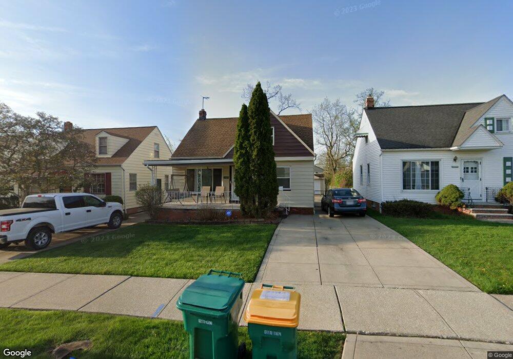
19304 Beverly Ave Maple Heights, OH 44137
Estimated Value: $115,000 - $146,000
3
Beds
2
Baths
1,092
Sq Ft
$114/Sq Ft
Est. Value
About This Home
This home is located at 19304 Beverly Ave, Maple Heights, OH 44137 and is currently estimated at $125,017, approximately $114 per square foot. 19304 Beverly Ave is a home located in Cuyahoga County with nearby schools including Abraham Lincoln Elementary School, Rockside/ J.F. Kennedy School, and Barack Obama School.
Ownership History
Date
Name
Owned For
Owner Type
Purchase Details
Closed on
Sep 22, 2017
Sold by
Martinez Victor M and Martinez Zaida
Bought by
Woodfolk Joe A and Woodfolk Teresa L
Current Estimated Value
Home Financials for this Owner
Home Financials are based on the most recent Mortgage that was taken out on this home.
Original Mortgage
$58,913
Outstanding Balance
$49,197
Interest Rate
3.9%
Mortgage Type
FHA
Estimated Equity
$75,820
Purchase Details
Closed on
Mar 9, 1993
Sold by
Skelley Robert T
Bought by
Martinez Victor M
Purchase Details
Closed on
Oct 19, 1978
Sold by
Furino Lazzaro L and Furino Grace E
Bought by
Skelley Robert T
Purchase Details
Closed on
Jan 1, 1975
Bought by
Furino Lazzaro L and Furino Grace E
Create a Home Valuation Report for This Property
The Home Valuation Report is an in-depth analysis detailing your home's value as well as a comparison with similar homes in the area
Home Values in the Area
Average Home Value in this Area
Purchase History
| Date | Buyer | Sale Price | Title Company |
|---|---|---|---|
| Woodfolk Joe A | $60,000 | None Available | |
| Martinez Victor M | $56,000 | -- | |
| Skelley Robert T | $41,000 | -- | |
| Furino Lazzaro L | -- | -- |
Source: Public Records
Mortgage History
| Date | Status | Borrower | Loan Amount |
|---|---|---|---|
| Open | Woodfolk Joe A | $58,913 |
Source: Public Records
Tax History Compared to Growth
Tax History
| Year | Tax Paid | Tax Assessment Tax Assessment Total Assessment is a certain percentage of the fair market value that is determined by local assessors to be the total taxable value of land and additions on the property. | Land | Improvement |
|---|---|---|---|---|
| 2024 | $3,431 | $38,360 | $6,720 | $31,640 |
| 2023 | $2,573 | $24,440 | $4,800 | $19,640 |
| 2022 | $2,564 | $24,430 | $4,800 | $19,640 |
| 2021 | $2,735 | $24,430 | $4,800 | $19,640 |
| 2020 | $2,332 | $18,520 | $3,640 | $14,880 |
| 2019 | $2,320 | $52,900 | $10,400 | $42,500 |
| 2018 | $2,210 | $18,520 | $3,640 | $14,880 |
| 2017 | $2,277 | $17,820 | $4,730 | $13,090 |
| 2016 | $2,203 | $17,820 | $4,730 | $13,090 |
| 2015 | $2,402 | $17,820 | $4,730 | $13,090 |
| 2014 | $2,402 | $19,570 | $5,180 | $14,390 |
Source: Public Records
Map
Nearby Homes
- 19221 Stafford Ave
- 19289 Stafford Ave
- 19288 Stockton Ave
- 19812 Stockton Ave
- 19806 Mountville Dr
- 5571 Oakwood Ave
- 20006 Mountville Dr
- 19807 Gardenview Dr
- 20107 Libby Rd
- 5234 Erwin St
- 19309 Nitra Ave
- 17912 North Blvd
- 5239 Arch St
- 5199 Arch St
- 20625 Centuryway Rd
- 46 Thames Ave
- 20634 Centuryway Rd
- 5493 Thomas St
- 20701 Kenyon Dr
- 5615 South Blvd
- 19308 Beverly Ave
- 19300 Beverly Ave
- 19216 Beverly Ave
- 19312 Beverly Ave
- 19212 Beverly Ave
- 19316 Beverly Ave
- 19208 Beverly Ave
- 19400 Beverly Ave
- 19305 Beverly Ave
- 19309 Beverly Ave
- 19301 Beverly Ave
- 19313 Beverly Ave
- 19217 Beverly Ave
- 19204 Beverly Ave
- 19404 Beverly Ave
- 19317 Beverly Ave
- 19213 Beverly Ave
- 19401 Beverly Ave
- 19200 Beverly Ave
- 19209 Beverly Ave