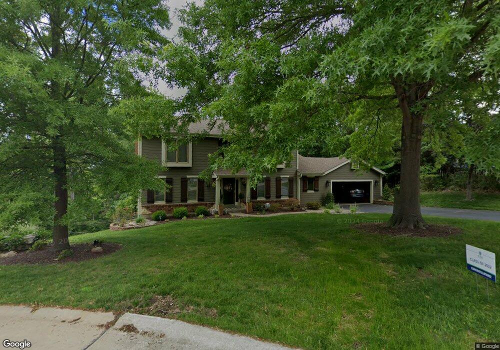
1931 Arapahoe Basin Ct Ballwin, MO 63011
Estimated Value: $588,000 - $627,000
4
Beds
4
Baths
2,934
Sq Ft
$205/Sq Ft
Est. Value
About This Home
This home is located at 1931 Arapahoe Basin Ct, Ballwin, MO 63011 and is currently estimated at $601,016, approximately $204 per square foot. 1931 Arapahoe Basin Ct is a home located in St. Louis County with nearby schools including Babler Elementary School, Rockwood Valley Middle School, and Lafayette High School.
Ownership History
Date
Name
Owned For
Owner Type
Purchase Details
Closed on
Dec 19, 2025
Sold by
Lipscomb David S and Lipscomb Lori K
Bought by
Lipscomb Family Revocable Trust and Lipscomb
Current Estimated Value
Purchase Details
Closed on
Mar 30, 2010
Sold by
Prudential Relocation Inc
Bought by
Lipscomb David S and Lipscomb Lori K
Home Financials for this Owner
Home Financials are based on the most recent Mortgage that was taken out on this home.
Original Mortgage
$236,000
Interest Rate
5%
Mortgage Type
New Conventional
Purchase Details
Closed on
Jul 19, 2007
Sold by
Pierson Roger A and Pierson Barbara D
Bought by
Bainbridge Graeme and Bainbridge Sharmila K
Home Financials for this Owner
Home Financials are based on the most recent Mortgage that was taken out on this home.
Original Mortgage
$295,920
Interest Rate
6.54%
Mortgage Type
Purchase Money Mortgage
Create a Home Valuation Report for This Property
The Home Valuation Report is an in-depth analysis detailing your home's value as well as a comparison with similar homes in the area
Home Values in the Area
Average Home Value in this Area
Purchase History
| Date | Buyer | Sale Price | Title Company |
|---|---|---|---|
| Lipscomb Family Revocable Trust | -- | None Listed On Document | |
| Lipscomb David S | $295,000 | Title Partners Agency Llc | |
| Prudential Relocation Inc | $295,000 | Title Partners Agency Llc | |
| Bainbridge Graeme | $369,900 | None Available |
Source: Public Records
Mortgage History
| Date | Status | Borrower | Loan Amount |
|---|---|---|---|
| Previous Owner | Lipscomb David S | $236,000 | |
| Previous Owner | Bainbridge Graeme | $295,920 |
Source: Public Records
Tax History
| Year | Tax Paid | Tax Assessment Tax Assessment Total Assessment is a certain percentage of the fair market value that is determined by local assessors to be the total taxable value of land and additions on the property. | Land | Improvement |
|---|---|---|---|---|
| 2025 | $6,397 | $105,170 | $26,240 | $78,930 |
| 2024 | $6,397 | $92,000 | $21,870 | $70,130 |
| 2023 | $6,392 | $92,000 | $21,870 | $70,130 |
| 2022 | $5,591 | $74,740 | $15,310 | $59,430 |
| 2021 | $5,330 | $71,780 | $15,310 | $56,470 |
| 2020 | $5,107 | $65,570 | $16,070 | $49,500 |
| 2019 | $5,127 | $65,570 | $16,070 | $49,500 |
| 2018 | $5,159 | $62,220 | $16,070 | $46,150 |
| 2017 | $5,036 | $62,220 | $16,070 | $46,150 |
| 2016 | $4,604 | $54,700 | $16,070 | $38,630 |
| 2015 | $4,510 | $54,700 | $16,070 | $38,630 |
| 2014 | $4,792 | $56,680 | $7,130 | $49,550 |
Source: Public Records
Map
Nearby Homes
- 16537 Clayton Rd
- 1839 Sullivan Pointe Dr
- 519 Black Canyon Ct
- 16404 Clayton Rd
- 1504 Englebrook Dr
- 220 Timber Meadow Dr
- 1800 Wade Ct
- 215 Cobblefield Ct
- 2470 Indian Tree Cir
- 2525 Peppermill Ridge Dr
- 16277 Autumn View Terrace Dr
- 16621 Green Pines Dr
- 16532 Branchwood Dr
- 1635 Clayton Spur Ct
- 2319 Paradise Peak Cir
- 1605 Ridge Bend Dr
- 2347 Paradise Peak Cir
- 16641 Wycliffe Place Dr
- 17824 Valley View Ln
- 32 Hickory Valley Ct
- 609 Shadowridge Dr
- 1937 Arapahoe Basin Ct
- 603 Shadowridge Dr
- 1926 Arapahoe Basin Ct
- 1932 Arapahoe Basin Ct
- 1938 Arapahoe Basin Ct
- 621 Shadowridge Dr
- 604 Shadowridge Dr
- 610 Shadowridge Dr
- 579 Shadowridge Dr
- 564 Eagles Nest Ct
- 582 Shadowridge Dr
- 616 Shadowridge Dr
- 556 Eagles Nest Ct
- 627 Shadowridge Dr
- 1913 Arapahoe Basin Ct
- 573 Shadowridge Dr
- 1928 Berthoud Pass Ct
- 1914 Arapahoe Basin Ct
- 574 Shadowridge Dr
Your Personal Tour Guide
Ask me questions while you tour the home.