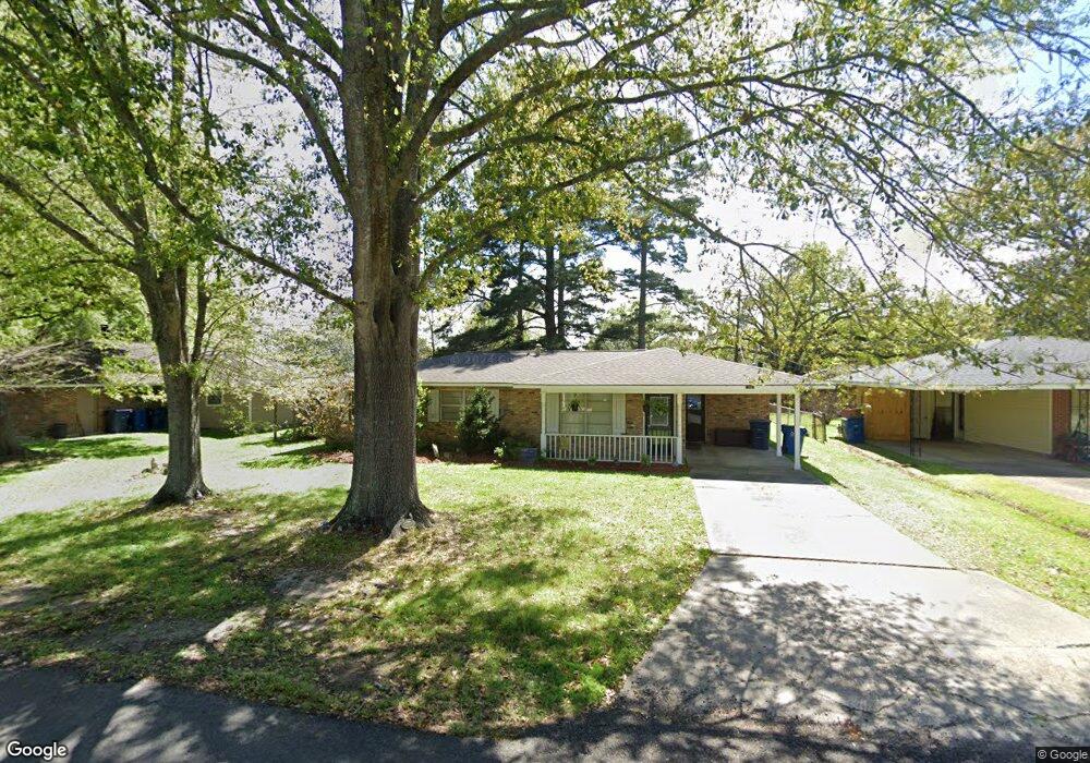
1931 Lansdown Ave Port Allen, LA 70767
West Baton Rouge Parish NeighborhoodEstimated Value: $195,958 - $216,000
--
Bed
--
Bath
1,257
Sq Ft
$163/Sq Ft
Est. Value
About This Home
This home is located at 1931 Lansdown Ave, Port Allen, LA 70767 and is currently estimated at $205,240, approximately $163 per square foot. 1931 Lansdown Ave is a home located in West Baton Rouge Parish with nearby schools including Brusly Elementary School, Lukeville Upper Elementary School, and Brusly Middle School.
Ownership History
Date
Name
Owned For
Owner Type
Purchase Details
Closed on
Sep 3, 2024
Sold by
Lusk Daniel Joseph and Halloran-Lusk Erin Michelle
Bought by
Li Rurui
Current Estimated Value
Home Financials for this Owner
Home Financials are based on the most recent Mortgage that was taken out on this home.
Original Mortgage
$119,000
Outstanding Balance
$117,739
Interest Rate
6.78%
Mortgage Type
New Conventional
Estimated Equity
$87,501
Purchase Details
Closed on
Mar 20, 2006
Sold by
Lusk Daniel Joseph
Bought by
Lusk Lisa Levert
Create a Home Valuation Report for This Property
The Home Valuation Report is an in-depth analysis detailing your home's value as well as a comparison with similar homes in the area
Home Values in the Area
Average Home Value in this Area
Purchase History
| Date | Buyer | Sale Price | Title Company |
|---|---|---|---|
| Li Rurui | $170,000 | Cypress Title | |
| Lusk Lisa Levert | -- | None Available |
Source: Public Records
Mortgage History
| Date | Status | Borrower | Loan Amount |
|---|---|---|---|
| Open | Li Rurui | $119,000 |
Source: Public Records
Tax History Compared to Growth
Tax History
| Year | Tax Paid | Tax Assessment Tax Assessment Total Assessment is a certain percentage of the fair market value that is determined by local assessors to be the total taxable value of land and additions on the property. | Land | Improvement |
|---|---|---|---|---|
| 2024 | $1,522 | $15,710 | $4,000 | $11,710 |
| 2023 | $526 | $12,570 | $3,500 | $9,070 |
| 2022 | $1,318 | $12,570 | $3,500 | $9,070 |
| 2021 | $1,348 | $12,570 | $3,500 | $9,070 |
| 2020 | $1,225 | $11,310 | $3,150 | $8,160 |
| 2019 | $932 | $8,260 | $1,390 | $6,870 |
| 2018 | $949 | $8,260 | $1,390 | $6,870 |
| 2017 | $876 | $8,260 | $1,390 | $6,870 |
| 2015 | $698 | $8,130 | $1,260 | $6,870 |
| 2014 | $687 | $8,130 | $1,260 | $6,870 |
| 2013 | $687 | $8,130 | $1,260 | $6,870 |
Source: Public Records
Map
Nearby Homes
- 1959 Fairview Ave
- 4747 Evergreen Dr
- 2218 Silverstone Ave
- 2217 Silverstone Ave
- 1394 Rue Riviere
- 1152 Freeman Ln
- 2742 Emily Dr
- 2488 Oak Alley Dr
- 4000 Lake Beau Pre Blvd Unit 110
- 4000 Lake Beau Pre Blvd Unit 198
- 6455 Louisiana 1
- 6312 Louisiana 1
- 5565 Ducros Dr
- 3926 Northshore Ave
- 526 Gwin St
- 540 Bourgeois St
- 5024 Myrtle Trail Dr
- 3822 Southpass Ave
- 3839 Southpass Ave
- 5129 Amberlyn Dr
- 1931 Lansdowne Dr
- 1941 Lansdown Dr
- 4222 Stanton Ave
- 1922 Rowcliff Ave
- 1951 Landsdown Dr
- 1951 Lansdown Ave
- 4242 Stanton Ave
- 1932 Rowcliff Ave
- 1920 Landsdown Drive3
- 1930 Lansdown Ave
- 1920 Lansdown Ave
- 1940 Lansdown Ave
- 1910 Lansdown Ave
- 4223 Stanton Ave
- 2005 Lansdown Ave
- 4233 Stanton Ave
- TBD Arlington Ave
- 2014 Rowcliff Ave
- 2014 Lansdown Ave
- 1921 Rowcliff Ave