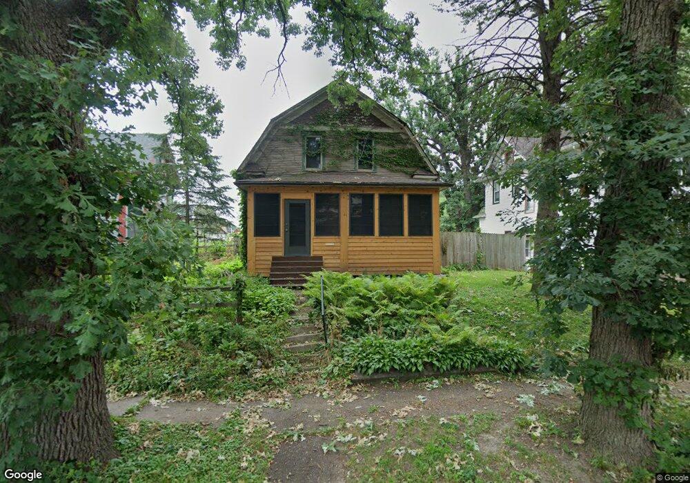
1931 N Myrtle St Davenport, IA 52804
Near North Side NeighborhoodEstimated Value: $159,000 - $170,000
3
Beds
1
Bath
1,459
Sq Ft
$114/Sq Ft
Est. Value
About This Home
This home is located at 1931 N Myrtle St, Davenport, IA 52804 and is currently estimated at $165,794, approximately $113 per square foot. 1931 N Myrtle St is a home located in Scott County with nearby schools including Tygart Creek Elementary School, Adams Elementary School, and Christian County Day Treatment Center Alt.
Ownership History
Date
Name
Owned For
Owner Type
Purchase Details
Closed on
May 6, 2025
Sold by
Vance John C
Bought by
Vance John C and Vance Christina M
Current Estimated Value
Create a Home Valuation Report for This Property
The Home Valuation Report is an in-depth analysis detailing your home's value as well as a comparison with similar homes in the area
Home Values in the Area
Average Home Value in this Area
Purchase History
| Date | Buyer | Sale Price | Title Company |
|---|---|---|---|
| Vance John C | -- | None Listed On Document |
Source: Public Records
Tax History Compared to Growth
Tax History
| Year | Tax Paid | Tax Assessment Tax Assessment Total Assessment is a certain percentage of the fair market value that is determined by local assessors to be the total taxable value of land and additions on the property. | Land | Improvement |
|---|---|---|---|---|
| 2025 | $2,484 | $157,470 | $22,310 | $135,160 |
| 2024 | $2,420 | $149,230 | $22,310 | $126,920 |
| 2023 | $2,298 | $149,230 | $22,310 | $126,920 |
| 2022 | $2,306 | $116,460 | $18,380 | $98,080 |
| 2021 | $2,306 | $116,460 | $18,380 | $98,080 |
| 2020 | $2,206 | $110,330 | $18,380 | $91,950 |
| 2019 | $2,284 | $110,330 | $18,380 | $91,950 |
| 2018 | $2,232 | $110,330 | $18,380 | $91,950 |
| 2017 | $614 | $110,330 | $18,380 | $91,950 |
| 2016 | $2,130 | $105,950 | $0 | $0 |
| 2015 | $2,130 | $113,100 | $0 | $0 |
| 2014 | $2,318 | $113,100 | $0 | $0 |
| 2013 | $2,274 | $0 | $0 | $0 |
| 2012 | -- | $110,980 | $19,220 | $91,760 |
Source: Public Records
Map
Nearby Homes
- 1925 Vine St
- 1921 Lillie Ave
- 2038 N Myrtle St
- 1203 W Locust St
- 2026 N Marquette St
- 2133 Warren St
- 734 W 17th St
- 922 W Lombard St
- 2230 Warren St
- 1118 W 15th St
- 1514 N Marquette St
- 816 Spalding Blvd
- 1034 W 14th St
- 2325 N Marquette St
- 930 W 14th St
- 822 W 14th St
- 822 W Rusholme St
- 2015 Washington St
- 1319 Warren St
- 2218 Western Ave
- 1937 N Myrtle St
- 1925 N Myrtle St
- 1923 N Myrtle St
- 2003 N Myrtle St
- 1928 Vine St
- 1926 Vine St
- 1936 Vine St
- 1938 N Myrtle St
- 1920 Vine St
- 2007 N Myrtle St
- 1026 W Locust St
- 1020 W Locust St
- 1030 W Locust St
- 1920 N Myrtle St
- 2002 Vine St
- 2015 N Myrtle St
- 1111 W Pleasant St
- 2002 N Myrtle St
- 2008 Vine St
- 1104 W Locust St