Estimated Value: $158,000 - $177,000
3
Beds
1
Bath
1,015
Sq Ft
$168/Sq Ft
Est. Value
About This Home
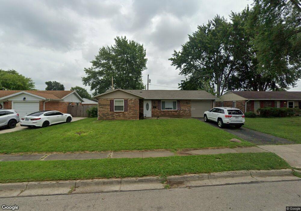
This home is located at 1931 Nebraska Dr, Xenia, OH 45385 and is currently estimated at $170,594, approximately $168 per square foot. 1931 Nebraska Dr is a home located in Greene County with nearby schools including Xenia High School and Summit Academy Community School for Alternative Learners - Xenia.
Ownership History
Date
Name
Owned For
Owner Type
Purchase Details
Closed on
Feb 5, 2014
Sold by
Jp Morgan Chase Bank Na
Bought by
Capital Residential Equities Llc
Current Estimated Value
Purchase Details
Closed on
Dec 10, 2013
Sold by
Fugate Steven D
Bought by
Jpmorgan Chase Bank Na
Purchase Details
Closed on
Sep 5, 1995
Sold by
Mobley Sylvia J
Bought by
Fugate Steven D
Home Financials for this Owner
Home Financials are based on the most recent Mortgage that was taken out on this home.
Original Mortgage
$62,500
Interest Rate
7.55%
Mortgage Type
New Conventional
Create a Home Valuation Report for This Property
The Home Valuation Report is an in-depth analysis detailing your home's value as well as a comparison with similar homes in the area
Home Values in the Area
Average Home Value in this Area
Purchase History
| Date | Buyer | Sale Price | Title Company |
|---|---|---|---|
| Capital Residential Equities Llc | $45,100 | None Available | |
| Jpmorgan Chase Bank Na | $46,000 | None Available | |
| Fugate Steven D | $64,500 | -- |
Source: Public Records
Mortgage History
| Date | Status | Borrower | Loan Amount |
|---|---|---|---|
| Previous Owner | Fugate Steven D | $62,500 |
Source: Public Records
Tax History Compared to Growth
Tax History
| Year | Tax Paid | Tax Assessment Tax Assessment Total Assessment is a certain percentage of the fair market value that is determined by local assessors to be the total taxable value of land and additions on the property. | Land | Improvement |
|---|---|---|---|---|
| 2024 | $1,798 | $42,030 | $10,680 | $31,350 |
| 2023 | $1,798 | $42,030 | $10,680 | $31,350 |
| 2022 | $1,487 | $29,640 | $6,280 | $23,360 |
| 2021 | $1,507 | $29,640 | $6,280 | $23,360 |
| 2020 | $1,444 | $29,640 | $6,280 | $23,360 |
| 2019 | $1,299 | $25,100 | $6,240 | $18,860 |
| 2018 | $1,304 | $25,100 | $6,240 | $18,860 |
| 2017 | $1,266 | $25,100 | $6,240 | $18,860 |
| 2016 | $1,196 | $22,600 | $6,240 | $16,360 |
| 2015 | $1,200 | $22,600 | $6,240 | $16,360 |
| 2014 | $1,149 | $22,600 | $6,240 | $16,360 |
Source: Public Records
Map
Nearby Homes
- 1769 Gayhart Dr
- 1829 Gayhart Dr
- 2142 Michigan Dr
- 1403 Texas Dr
- 1908 Whitt St
- 2257 Maryland Dr
- 1653 Seneca Dr
- 1107 Arkansas Dr
- 2545 Harmony Dr
- 414 Whisper Ln
- 1255 Colorado Dr
- 1778 Arapaho Dr
- 1866 Roxbury Dr
- 1618 Navajo Dr
- 2758 Wyoming Dr
- 2345 Tennessee Dr
- 219 Kansas Dr
- 161 Montana Dr
- 2499 Jenny Marie Dr
- 1568 Cheyenne Dr
- 1945 Nebraska Dr
- 1917 Nebraska Dr
- 1306 Commonwealth Dr
- 1959 Nebraska Dr
- 1320 Commonwealth Dr
- 1934 Nebraska Dr
- 1948 Nebraska Dr
- 1920 Nebraska Dr
- 1973 Nebraska Dr
- 1962 Nebraska Dr
- 1334 Commonwealth Dr
- 1291 Commonwealth Dr
- 1305 Commonwealth Dr
- 1319 Commonwealth Dr
- 1976 Nebraska Dr
- 1987 Nebraska Dr
- 1892 Nebraska Dr
- 1969 Florida Dr
- 1983 Florida Dr
- 1333 Commonwealth Dr