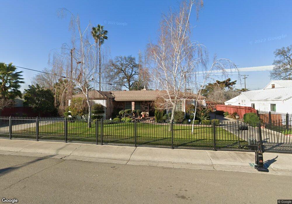
1931 Orwood St Stockton, CA 95205
Estimated Value: $268,000 - $393,000
3
Beds
1
Bath
1,526
Sq Ft
$224/Sq Ft
Est. Value
About This Home
This home is located at 1931 Orwood St, Stockton, CA 95205 and is currently estimated at $342,245, approximately $224 per square foot. 1931 Orwood St is a home located in San Joaquin County with nearby schools including Grunsky Elementary School, Harrison Elementary School, and August Elementary School.
Ownership History
Date
Name
Owned For
Owner Type
Purchase Details
Closed on
Aug 27, 2024
Sold by
Hernandez Denise M
Bought by
Alberto Hernandez And Denise M Hernandez Revo and Hernandez
Current Estimated Value
Purchase Details
Closed on
Jul 9, 2024
Sold by
2009 Alice J Mountjoy Revocable Trust and Hernandez Denise M
Bought by
Hernandez Denise M
Purchase Details
Closed on
Apr 13, 2009
Sold by
Mountjoy Alice J
Bought by
Mountjoy Alice J and The 2009 Alice J Mountjoy Revo
Purchase Details
Closed on
Dec 18, 2002
Sold by
Mountjoy Artie and Mountjoy Alice
Bought by
Mountjoy Artie D and Mountjoy Alice J
Create a Home Valuation Report for This Property
The Home Valuation Report is an in-depth analysis detailing your home's value as well as a comparison with similar homes in the area
Home Values in the Area
Average Home Value in this Area
Purchase History
| Date | Buyer | Sale Price | Title Company |
|---|---|---|---|
| Alberto Hernandez And Denise M Hernandez Revo | -- | None Listed On Document | |
| Hernandez Denise M | -- | None Listed On Document | |
| Mountjoy Alice J | -- | None Available | |
| Mountjoy Alice J | -- | None Available | |
| Mountjoy Artie D | -- | -- |
Source: Public Records
Tax History Compared to Growth
Tax History
| Year | Tax Paid | Tax Assessment Tax Assessment Total Assessment is a certain percentage of the fair market value that is determined by local assessors to be the total taxable value of land and additions on the property. | Land | Improvement |
|---|---|---|---|---|
| 2025 | $869 | $67,774 | $10,415 | $57,359 |
| 2024 | $853 | $66,446 | $10,211 | $56,235 |
| 2023 | $833 | $65,144 | $10,011 | $55,133 |
| 2022 | $776 | $63,867 | $9,815 | $54,052 |
| 2021 | $746 | $62,616 | $9,623 | $52,993 |
| 2020 | $758 | $61,975 | $9,525 | $52,450 |
| 2019 | $783 | $60,761 | $9,339 | $51,422 |
| 2018 | $768 | $59,570 | $9,156 | $50,414 |
| 2017 | $731 | $58,403 | $8,977 | $49,426 |
| 2016 | $740 | $57,258 | $8,801 | $48,457 |
| 2014 | $706 | $55,293 | $8,499 | $46,794 |
Source: Public Records
Map
Nearby Homes
- 1751 Sunnyside Ave
- 1751 Sycamore Ave
- 1702 Sunnyside Ave
- 1711 E Walnut St
- 1620 Sycamore Ave
- 1600 Sunnyside Ave
- 1372 Bradford St
- 2340 Sanguinetti Ln Unit 54
- 1902 E Harding Way
- 1818 West Ln
- 1257 Sunnyside Ave
- 1404 Williams St
- 1450 Belvedere Ave
- 1272 N Airport Way
- 1825 N Filbert St
- 1561 N Filbert St
- 1813 E Anita St
- 2484 Francis St
- 2819 Belle Ave
- 2525 Vail Ave
- 2010 N Funston Ave
- 1945 Orwood St
- 2000 N Funston Ave
- 2036 N Funston Ave
- 2005 Orwood St
- 2044 N Funston Ave
- 1946 Orwood St
- 1933 Hiawatha Ave
- 1926 Orwood St
- 2019 Orwood St
- 1930 Orwood St
- 1946 N Funston Ave
- 1930 Hiawatha Ave
- 2014 Webb St
- 2012 Orwood St
- 2062 N Funston Ave
- 2027 Orwood St
- 2020 Webb St
- 2021 N Funston Ave
- 1944 N Funston Ave