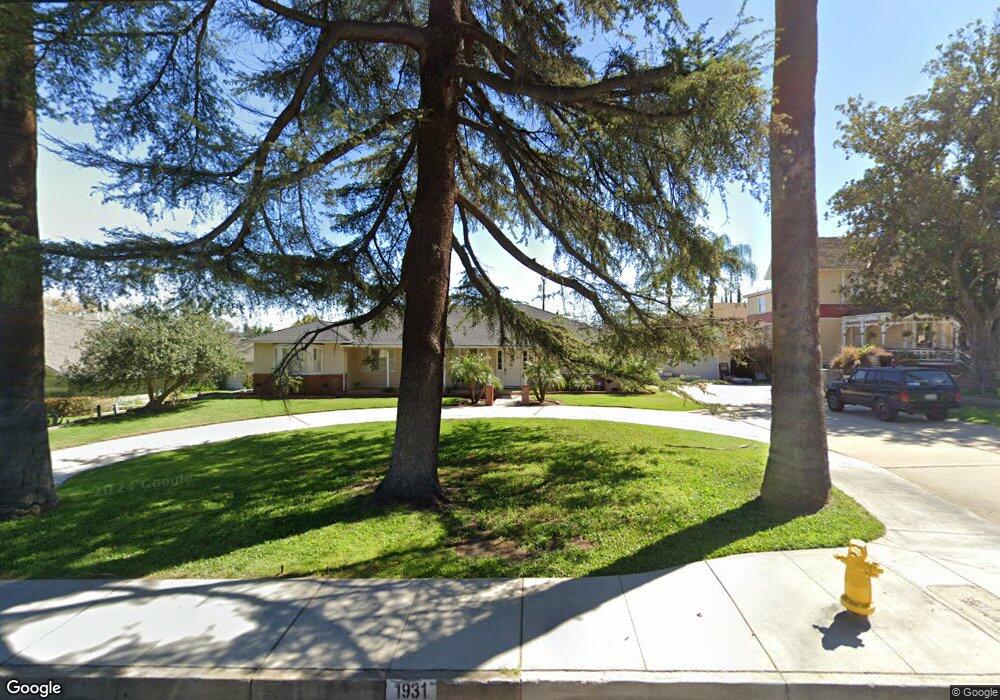
1931 S Main St Corona, CA 92882
Central Corona NeighborhoodEstimated Value: $879,000 - $1,003,000
4
Beds
3
Baths
2,596
Sq Ft
$364/Sq Ft
Est. Value
About This Home
This home is located at 1931 S Main St, Corona, CA 92882 and is currently estimated at $946,026, approximately $364 per square foot. 1931 S Main St is a home located in Riverside County with nearby schools including Garretson Elementary School, Auburndale Intermediate, and Centennial High School.
Ownership History
Date
Name
Owned For
Owner Type
Purchase Details
Closed on
Sep 20, 2013
Sold by
Chaffin Herbert Glen and Chaffin Theresa Lynn
Bought by
Family Trust Of Herbert Glen Chaffin & T
Current Estimated Value
Purchase Details
Closed on
Jun 1, 2010
Sold by
Federal National Mortgage Association
Bought by
Chaffin Herbert Glen and Chaffin Theresa Lynn
Purchase Details
Closed on
Jan 25, 2010
Sold by
Mcfate Diane L
Bought by
Federal National Mortgage Association
Create a Home Valuation Report for This Property
The Home Valuation Report is an in-depth analysis detailing your home's value as well as a comparison with similar homes in the area
Home Values in the Area
Average Home Value in this Area
Purchase History
| Date | Buyer | Sale Price | Title Company |
|---|---|---|---|
| Family Trust Of Herbert Glen Chaffin & T | -- | None Available | |
| Chaffin Herbert Glen | $360,000 | Stewart Title Of California | |
| Federal National Mortgage Association | $352,061 | None Available |
Source: Public Records
Tax History
| Year | Tax Paid | Tax Assessment Tax Assessment Total Assessment is a certain percentage of the fair market value that is determined by local assessors to be the total taxable value of land and additions on the property. | Land | Improvement |
|---|---|---|---|---|
| 2025 | $5,041 | $461,208 | $102,485 | $358,723 |
| 2023 | $5,041 | $443,301 | $98,506 | $344,795 |
| 2022 | $4,881 | $434,610 | $96,575 | $338,035 |
| 2021 | $4,783 | $426,089 | $94,682 | $331,407 |
| 2020 | $4,731 | $421,721 | $93,712 | $328,009 |
| 2019 | $4,621 | $413,453 | $91,875 | $321,578 |
| 2018 | $4,517 | $405,347 | $90,075 | $315,272 |
| 2017 | $4,406 | $397,400 | $88,309 | $309,091 |
| 2016 | $4,362 | $389,609 | $86,578 | $303,031 |
| 2015 | $4,266 | $383,759 | $85,279 | $298,480 |
| 2014 | $4,188 | $376,243 | $83,609 | $292,634 |
Source: Public Records
Map
Nearby Homes
- 340 E Old Mill Rd
- 2014 Melba Ct
- 2163 Summerset St
- 2106 S Belle Ave
- 2101 Skylark Cir
- 1710 Garretson Ave
- 2272 Mary Clare St
- 1429 Garretson Ave
- 2295 Shanna Carle Dr
- 1925 S Starfire Ave
- 1310 S Belle Ave
- 701 W Crestview St
- 1153 E Grand Blvd
- 506 W Olive St
- 303 Sunburst Ln
- 1185 W Grand Blvd
- 1211 S Merrill St
- 2097 Santa Barbara St
- 1017 S Washburn Ave
- 645 Lancer Ln
- 1939 S Main St
- 1925 S Main St
- 1930 Pamela St
- 1936 Pamela St
- 2015 S Main St
- 1924 Pamela St
- 155 E Mission Rd
- 1919 S Main St
- 175 E Mission Rd
- 202 E Monterey Rd
- 160 Greengate St
- 1934 S Main St
- 1944 S Main St
- 205 E Monterey Rd
- 205 E Mission Rd
- 1926 S Main St
- 2008 S Main St
- 206 E Monterey Rd
- 206 Greengate St
- 2025 S Main St
Your Personal Tour Guide
Ask me questions while you tour the home.