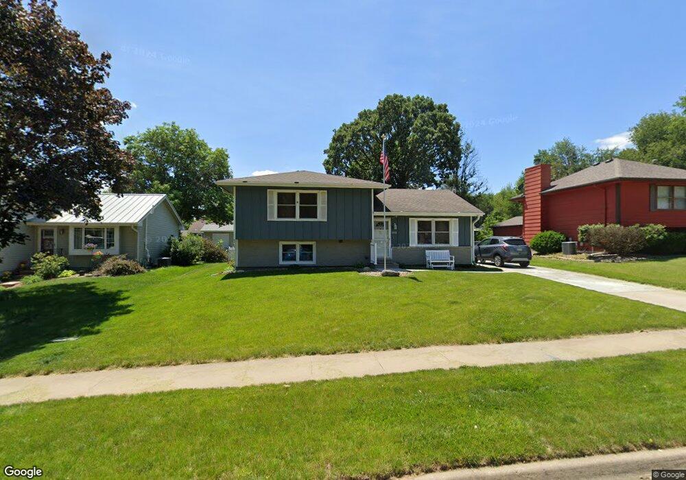
1931 Thornton Ct Des Moines, IA 50320
Ewing Woods-Evergreen NeighborhoodEstimated Value: $232,000 - $257,097
4
Beds
2
Baths
1,004
Sq Ft
$243/Sq Ft
Est. Value
About This Home
This home is located at 1931 Thornton Ct, Des Moines, IA 50320 and is currently estimated at $244,024, approximately $243 per square foot. 1931 Thornton Ct is a home located in Polk County with nearby schools including Jackson Elementary School, Weeks Middle School, and St. Anthony Elementary School.
Ownership History
Date
Name
Owned For
Owner Type
Purchase Details
Closed on
Dec 13, 2010
Sold by
The Trustee Of Poller Family Trust
Bought by
Hook Roger L and Hook Cindy L
Current Estimated Value
Purchase Details
Closed on
Jun 25, 2010
Sold by
Poller Blanca and Poller Todd M
Bought by
Poller Family Trust
Purchase Details
Closed on
Jul 29, 2004
Sold by
Norris Thomas P and Norris Novajean
Bought by
Poller Todd M and Poller Blanca
Home Financials for this Owner
Home Financials are based on the most recent Mortgage that was taken out on this home.
Original Mortgage
$107,200
Interest Rate
10.3%
Mortgage Type
Purchase Money Mortgage
Create a Home Valuation Report for This Property
The Home Valuation Report is an in-depth analysis detailing your home's value as well as a comparison with similar homes in the area
Home Values in the Area
Average Home Value in this Area
Purchase History
| Date | Buyer | Sale Price | Title Company |
|---|---|---|---|
| Hook Roger L | $122,500 | None Available | |
| Poller Family Trust | -- | None Available | |
| Poller Todd M | $133,500 | -- |
Source: Public Records
Mortgage History
| Date | Status | Borrower | Loan Amount |
|---|---|---|---|
| Previous Owner | Poller Todd M | $107,200 | |
| Closed | Poller Todd M | $26,800 |
Source: Public Records
Tax History Compared to Growth
Tax History
| Year | Tax Paid | Tax Assessment Tax Assessment Total Assessment is a certain percentage of the fair market value that is determined by local assessors to be the total taxable value of land and additions on the property. | Land | Improvement |
|---|---|---|---|---|
| 2025 | $3,828 | $235,400 | $43,700 | $191,700 |
| 2024 | $3,828 | $212,100 | $38,800 | $173,300 |
| 2023 | $3,854 | $212,100 | $38,800 | $173,300 |
| 2022 | $3,822 | $172,400 | $33,000 | $139,400 |
| 2021 | $3,644 | $172,400 | $33,000 | $139,400 |
| 2020 | $3,780 | $154,600 | $29,500 | $125,100 |
| 2019 | $3,236 | $154,600 | $29,500 | $125,100 |
| 2018 | $3,198 | $128,900 | $24,100 | $104,800 |
| 2017 | $2,972 | $128,900 | $24,100 | $104,800 |
| 2016 | $2,890 | $118,400 | $21,700 | $96,700 |
| 2015 | $2,890 | $118,400 | $21,700 | $96,700 |
| 2014 | $2,958 | $120,000 | $21,900 | $98,100 |
Source: Public Records
Map
Nearby Homes
- 3506 SE 20th St
- 1843 Evergreen Ave
- 1905 E Maish Ave
- 3406 SE 19th Ct
- 3507 SE 18th Ct
- 1902 E Marion St
- 3624 SE 18th St
- 3307 SE 19th St
- 3214 SE 20th St
- 4113 SE 23rd St
- 4212 SE 23rd St
- 4225 SE 22nd St
- 1834 E Park Ave
- 4401 SW 23rd St
- 2218 E Caulder Ct
- 1617 Evergreen Ave
- 1847 Virginia Cir
- 1600 Evergreen Ave
- 1635 E Virginia Ave
- 1943 E Bell Ave
- 1937 Thornton Ct
- 1925 Thornton Ct
- 1919 Thornton Ct
- 1924 E Rose Ave
- 1943 Thornton Ct
- 1930 E Rose Ave
- 1918 E Rose Ave
- 1936 E Rose Ave
- 1930 Thornton Ct
- 1912 E Rose Ave
- 1936 Thornton Ct
- 1913 Thornton Ct
- 1918 Thornton Ct
- 3514 SE 20th St
- 1906 E Rose Ave
- 1912 Thornton Ct
- 3601 SE 20th St
- 1900 Thornton Ct
- 3607 SE 20th St
- 1925 E Rose Ave