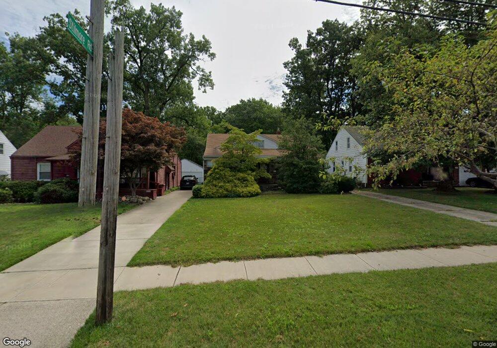
1931 Wrenford Rd Cleveland, OH 44121
Estimated Value: $191,000 - $221,000
4
Beds
2
Baths
1,561
Sq Ft
$131/Sq Ft
Est. Value
About This Home
This home is located at 1931 Wrenford Rd, Cleveland, OH 44121 and is currently estimated at $204,065, approximately $130 per square foot. 1931 Wrenford Rd is a home located in Cuyahoga County with nearby schools including Rowland Elementary School, Greenview Upper Elementary School, and Memorial Junior High School.
Ownership History
Date
Name
Owned For
Owner Type
Purchase Details
Closed on
Apr 22, 2005
Sold by
Millstein Dianne L
Bought by
Jackson Mamie
Current Estimated Value
Home Financials for this Owner
Home Financials are based on the most recent Mortgage that was taken out on this home.
Original Mortgage
$140,200
Outstanding Balance
$73,660
Interest Rate
6.06%
Mortgage Type
Purchase Money Mortgage
Estimated Equity
$130,405
Purchase Details
Closed on
Feb 23, 2000
Sold by
Millstein Bernard H
Bought by
Millstein Dianne L
Purchase Details
Closed on
Mar 22, 1993
Sold by
Millstein Dianne L
Bought by
Millstein Dianne L
Purchase Details
Closed on
Jan 1, 1975
Bought by
Millstein Dianne L
Create a Home Valuation Report for This Property
The Home Valuation Report is an in-depth analysis detailing your home's value as well as a comparison with similar homes in the area
Home Values in the Area
Average Home Value in this Area
Purchase History
| Date | Buyer | Sale Price | Title Company |
|---|---|---|---|
| Jackson Mamie | $165,000 | Real Living Title Agency L | |
| Millstein Dianne L | -- | -- | |
| Millstein Dianne L | -- | -- | |
| Millstein Dianne L | -- | -- | |
| Millstein Dianne L | -- | -- |
Source: Public Records
Mortgage History
| Date | Status | Borrower | Loan Amount |
|---|---|---|---|
| Open | Jackson Mamie | $140,200 |
Source: Public Records
Tax History Compared to Growth
Tax History
| Year | Tax Paid | Tax Assessment Tax Assessment Total Assessment is a certain percentage of the fair market value that is determined by local assessors to be the total taxable value of land and additions on the property. | Land | Improvement |
|---|---|---|---|---|
| 2024 | $4,590 | $60,165 | $12,670 | $47,495 |
| 2023 | $3,952 | $41,580 | $8,750 | $32,830 |
| 2022 | $3,931 | $41,580 | $8,750 | $32,830 |
| 2021 | $3,901 | $41,580 | $8,750 | $32,830 |
| 2020 | $3,650 | $33,810 | $7,110 | $26,710 |
| 2019 | $3,334 | $96,600 | $20,300 | $76,300 |
| 2018 | $3,317 | $33,810 | $7,110 | $26,710 |
| 2017 | $3,138 | $29,190 | $5,810 | $23,380 |
| 2016 | $3,119 | $29,190 | $5,810 | $23,380 |
| 2015 | $3,172 | $29,190 | $5,810 | $23,380 |
| 2014 | $3,172 | $30,740 | $6,130 | $24,610 |
Source: Public Records
Map
Nearby Homes
- 4237 Verona Rd
- 1940 Temblethurst Rd
- 4206 Verona Rd
- 4194 Stilmore Rd
- 4210 Stonehaven Rd
- 1895 Temblethurst Rd
- 4233 Bayard Rd
- 4158 Wyncote Rd
- 2091 S Belvoir Blvd
- 4124 Bayard Rd
- 2108 S Belvoir Blvd
- 4197 Okalona Rd
- 4121 Hinsdale Rd
- 14213 Cedar Rd
- 2015 S Green Rd
- 4201 Lambert Rd
- 4033 Stonehaven Rd
- 1744 S Green Rd
- 4084 Okalona Rd
- 4040 Bayard Rd
- 1927 Wrenford Rd
- 1935 Wrenford Rd
- 1923 Wrenford Rd
- 1943 Wrenford Rd
- 1917 Wrenford Rd
- 1947 Wrenford Rd
- 1911 Wrenford Rd
- 1951 Wrenford Rd
- 4252 Stilmore Rd
- 4249 Stilmore Rd
- 4246 Stilmore Rd
- 1930 S Belvoir Blvd
- 1940 S Belvoir Blvd
- 4245 Stilmore Rd
- 4249 Verona Rd
- 1903 Wrenford Rd
- 4242 Stilmore Rd
- 1920 S Belvoir Blvd
- 4250 Wilmington Rd
- 4241 Stilmore Rd