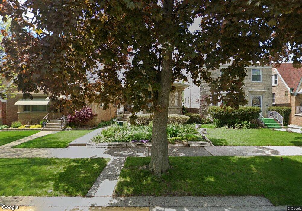
1932 N New England Ave Chicago, IL 60707
Galewood NeighborhoodEstimated Value: $350,000 - $385,000
2
Beds
2
Baths
1,271
Sq Ft
$283/Sq Ft
Est. Value
About This Home
This home is located at 1932 N New England Ave, Chicago, IL 60707 and is currently estimated at $360,218, approximately $283 per square foot. 1932 N New England Ave is a home located in Cook County with nearby schools including Sayre Elementary Language Academy, Steinmetz College Prep, and Acero - Roberto Clemente Elementary School.
Ownership History
Date
Name
Owned For
Owner Type
Purchase Details
Closed on
Jan 28, 2015
Sold by
Fus Michael
Bought by
Fus Michael R and The Michael R Fus Trust
Current Estimated Value
Purchase Details
Closed on
Jul 31, 1998
Sold by
Hurka Guy and Hurka Kathleen S
Bought by
Fus Michael
Home Financials for this Owner
Home Financials are based on the most recent Mortgage that was taken out on this home.
Original Mortgage
$120,800
Outstanding Balance
$25,465
Interest Rate
7.04%
Estimated Equity
$334,753
Create a Home Valuation Report for This Property
The Home Valuation Report is an in-depth analysis detailing your home's value as well as a comparison with similar homes in the area
Home Values in the Area
Average Home Value in this Area
Purchase History
| Date | Buyer | Sale Price | Title Company |
|---|---|---|---|
| Fus Michael R | -- | None Available | |
| Fus Michael | $151,000 | Prairie Title |
Source: Public Records
Mortgage History
| Date | Status | Borrower | Loan Amount |
|---|---|---|---|
| Open | Fus Michael | $120,800 |
Source: Public Records
Tax History Compared to Growth
Tax History
| Year | Tax Paid | Tax Assessment Tax Assessment Total Assessment is a certain percentage of the fair market value that is determined by local assessors to be the total taxable value of land and additions on the property. | Land | Improvement |
|---|---|---|---|---|
| 2024 | $4,150 | $29,000 | $11,625 | $17,375 |
| 2023 | $4,024 | $22,975 | $9,375 | $13,600 |
| 2022 | $4,024 | $22,975 | $9,375 | $13,600 |
| 2021 | $4,206 | $24,233 | $9,375 | $14,858 |
| 2020 | $3,735 | $19,861 | $4,687 | $15,174 |
| 2019 | $3,797 | $22,316 | $4,687 | $17,629 |
| 2018 | $3,732 | $22,316 | $4,687 | $17,629 |
| 2017 | $4,015 | $22,015 | $4,125 | $17,890 |
| 2016 | $3,911 | $22,015 | $4,125 | $17,890 |
| 2015 | $3,556 | $22,015 | $4,125 | $17,890 |
| 2014 | $3,567 | $21,779 | $3,750 | $18,029 |
| 2013 | $3,485 | $21,779 | $3,750 | $18,029 |
Source: Public Records
Map
Nearby Homes
- 1941 N New England Ave
- 1905 N Nordica Ave
- 1916 N Rutherford Ave
- 1709 N Newland Ave
- 2048 N Oak Park Ave
- 1701 N Newland Ave
- 1733 N Oak Park Ave
- 1937 N Normandy Ave
- 2054 N Nordica Ave
- 1600 N New England Ave Unit 4
- 2218 N Newland Ave Unit 203
- 2037 N Harlem Ave Unit 3E
- 1930 N Harlem Ave Unit 306
- 1930 N Harlem Ave Unit 402
- 1700 N Natoma Ave
- 7182 W Dickens Ave Unit 2W
- 1639 N Normandy Ave
- 2016 N Harlem Ave Unit 7W
- 2224 N Nordica Ave
- 7036 W Belden Ave
- 1928 N New England Ave
- 1934 N New England Ave
- 1924 N New England Ave
- 1938 N New England Ave
- 1940 N New England Ave
- 1922 N New England Ave
- 1944 N New England Ave
- 1918 N New England Ave
- 1933 N Newland Ave
- 1929 N Newland Ave
- 1935 N Newland Ave
- 1939 N Newland Ave
- 1923 N Newland Ave
- 1941 N Newland Ave
- 1914 N New England Ave
- 1921 N Newland Ave
- 1945 N Newland Ave
- 1933 N New England Ave
- 1929 N New England Ave
- 1939 N New England Ave