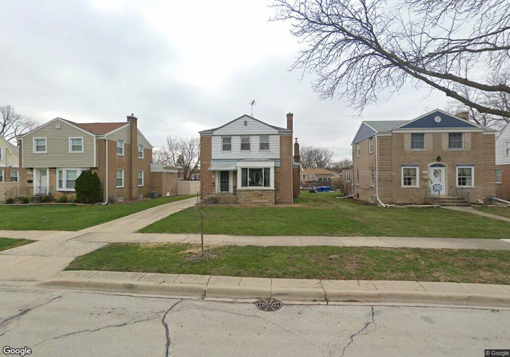
1932 Portsmouth Ave Westchester, IL 60154
Estimated Value: $394,000 - $456,000
4
Beds
2
Baths
1,682
Sq Ft
$246/Sq Ft
Est. Value
About This Home
This home is located at 1932 Portsmouth Ave, Westchester, IL 60154 and is currently estimated at $414,384, approximately $246 per square foot. 1932 Portsmouth Ave is a home located in Cook County with nearby schools including Westchester Primary School, Westchester Intermediate School, and Westchester Middle School.
Ownership History
Date
Name
Owned For
Owner Type
Purchase Details
Closed on
Feb 18, 2022
Sold by
Martinez Louis M and Martinez Marta I
Bought by
Martinez Louis M and The Louis M Martinez Jr 2007 Declaration
Current Estimated Value
Purchase Details
Closed on
Nov 13, 2021
Sold by
Martinez Louis M and The Louis M Martinez Jr 2007 Declaration
Bought by
Martinez Louis M and Martinez Marta I
Home Financials for this Owner
Home Financials are based on the most recent Mortgage that was taken out on this home.
Original Mortgage
$240,000
Interest Rate
3.05%
Purchase Details
Closed on
Oct 13, 2021
Sold by
Martinez Louis M and Martinez Marta I
Bought by
Martinez Louis M and The Louis M Martinez Jr 2007 Declaration
Home Financials for this Owner
Home Financials are based on the most recent Mortgage that was taken out on this home.
Original Mortgage
$240,000
Interest Rate
3.05%
Purchase Details
Closed on
Oct 31, 2007
Sold by
Martinez Louis M and Martinez Marta I
Bought by
The Louis M Martinez Jr 2007 Declaration
Purchase Details
Closed on
Aug 30, 2004
Sold by
Martinez Louis M and Martinez Marta I
Bought by
Martinez Louis M and Martinez Marta I
Home Financials for this Owner
Home Financials are based on the most recent Mortgage that was taken out on this home.
Original Mortgage
$290,000
Interest Rate
6.5%
Mortgage Type
New Conventional
Purchase Details
Closed on
Dec 18, 1998
Sold by
Martinez Louis M and Martinez Martha I
Bought by
Martinez Louis M and Martinez Maria I
Home Financials for this Owner
Home Financials are based on the most recent Mortgage that was taken out on this home.
Original Mortgage
$48,200
Interest Rate
6.75%
Mortgage Type
Stand Alone Second
Purchase Details
Closed on
Oct 18, 1996
Sold by
Walsh William M
Bought by
Martinez Louis M and Martinez Martha I
Home Financials for this Owner
Home Financials are based on the most recent Mortgage that was taken out on this home.
Original Mortgage
$149,250
Interest Rate
8.32%
Mortgage Type
FHA
Create a Home Valuation Report for This Property
The Home Valuation Report is an in-depth analysis detailing your home's value as well as a comparison with similar homes in the area
Home Values in the Area
Average Home Value in this Area
Purchase History
| Date | Buyer | Sale Price | Title Company |
|---|---|---|---|
| Martinez Louis M | -- | -- | |
| Martinez Louis M | -- | -- | |
| Martinez Louis M | -- | -- | |
| Martinez Louis M | -- | -- | |
| The Louis M Martinez Jr 2007 Declaration | -- | None Available | |
| Martinez Louis M | -- | Residential Title Services | |
| Martinez Louis M | -- | -- | |
| Martinez Louis M | $157,000 | Attorneys Natl Title Network |
Source: Public Records
Mortgage History
| Date | Status | Borrower | Loan Amount |
|---|---|---|---|
| Previous Owner | Martinez Louis M | $240,000 | |
| Previous Owner | Martinez Louis M | $290,000 | |
| Previous Owner | Martinez Louis M | $48,200 | |
| Previous Owner | Martinez Louis M | $149,250 |
Source: Public Records
Tax History Compared to Growth
Tax History
| Year | Tax Paid | Tax Assessment Tax Assessment Total Assessment is a certain percentage of the fair market value that is determined by local assessors to be the total taxable value of land and additions on the property. | Land | Improvement |
|---|---|---|---|---|
| 2024 | $6,017 | $28,893 | $4,655 | $24,238 |
| 2023 | $4,925 | $28,893 | $4,655 | $24,238 |
| 2022 | $4,925 | $22,302 | $3,990 | $18,312 |
| 2021 | $4,816 | $22,301 | $3,990 | $18,311 |
| 2020 | $4,823 | $22,301 | $3,990 | $18,311 |
| 2019 | $5,047 | $24,039 | $3,657 | $20,382 |
| 2018 | $4,978 | $24,039 | $3,657 | $20,382 |
| 2017 | $5,194 | $25,069 | $3,657 | $21,412 |
| 2016 | $4,833 | $20,851 | $3,325 | $17,526 |
| 2015 | $4,708 | $20,851 | $3,325 | $17,526 |
| 2014 | $4,626 | $20,851 | $3,325 | $17,526 |
| 2013 | $4,400 | $22,012 | $3,325 | $18,687 |
Source: Public Records
Map
Nearby Homes
- 1932 Newcastle Ave
- 1907 Suffolk Ave
- 1900 Manchester Ave
- 2128 Hull Ave
- 1840 Gardner Rd
- 1623 Manchester Ave
- 1601 Bristol Ave
- 1500 Bristol Ave
- 1433 Bristol Ave
- 10567 Waterford Dr
- 10072 Drury Ln
- 1860 Buckingham Ave
- 10531 Camelot St
- 10630 W Cermak Rd Unit 2E
- 10524 Camelot St
- 1811 Downing Ave
- 1542 Homestead Rd
- 1245 S Mannheim Rd Unit 2
- 1247 S Mannheim Rd Unit 3
- 10551 Essex St
- 1936 Portsmouth Ave
- 1926 Portsmouth Ave
- 1942 Portsmouth Ave
- 1920 Portsmouth Ave
- 1933 Newcastle Ave
- 1937 Newcastle Ave
- 1927 Newcastle Ave
- 1946 Portsmouth Ave
- 1916 Portsmouth Ave
- 1943 Newcastle Ave
- 1923 Newcastle Ave
- 1933 Portsmouth Ave
- 1952 Portsmouth Ave
- 1912 Portsmouth Ave
- 1947 Newcastle Ave
- 1917 Newcastle Ave
- 1937 Portsmouth Ave
- 1927 Portsmouth Ave
- 1943 Portsmouth Ave
- 1923 Portsmouth Ave