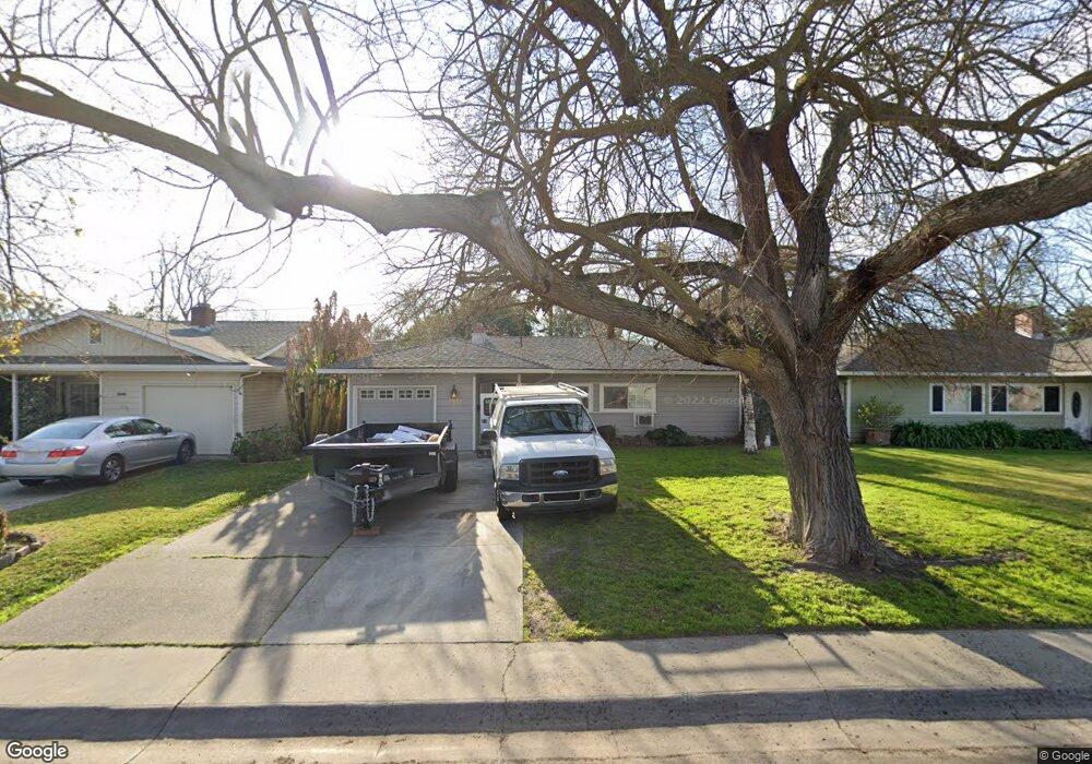
1932 Rutledge Way Stockton, CA 95207
Lincoln Village NeighborhoodEstimated Value: $273,000 - $349,000
2
Beds
1
Bath
898
Sq Ft
$354/Sq Ft
Est. Value
About This Home
This home is located at 1932 Rutledge Way, Stockton, CA 95207 and is currently estimated at $317,578, approximately $353 per square foot. 1932 Rutledge Way is a home located in San Joaquin County with nearby schools including Tully C. Knoles School, Sierra Middle School, and Lincoln High School.
Ownership History
Date
Name
Owned For
Owner Type
Purchase Details
Closed on
Nov 15, 2014
Sold by
Peluso John N and Peluso Suzanne A
Bought by
Peluso Family Trust and Peluso Suzanne
Current Estimated Value
Purchase Details
Closed on
Oct 25, 2007
Sold by
Citimortgage Inc
Bought by
Peluso John N and Peluso Suzanne A
Purchase Details
Closed on
Sep 11, 2007
Sold by
Cabrales Saul
Bought by
Citimortgage Inc
Purchase Details
Closed on
Jan 19, 2005
Sold by
Miller Harold I
Bought by
Cabrales Saul
Home Financials for this Owner
Home Financials are based on the most recent Mortgage that was taken out on this home.
Original Mortgage
$199,200
Interest Rate
5.5%
Mortgage Type
Purchase Money Mortgage
Create a Home Valuation Report for This Property
The Home Valuation Report is an in-depth analysis detailing your home's value as well as a comparison with similar homes in the area
Home Values in the Area
Average Home Value in this Area
Purchase History
| Date | Buyer | Sale Price | Title Company |
|---|---|---|---|
| Peluso Family Trust | -- | None Available | |
| Peluso John N | $166,500 | Fidelity National Title Co | |
| Citimortgage Inc | $212,924 | Accommodation | |
| Cabrales Saul | -- | Alliance Title Co | |
| Cabrales Saul | -- | Alliance Title Co |
Source: Public Records
Mortgage History
| Date | Status | Borrower | Loan Amount |
|---|---|---|---|
| Previous Owner | Cabrales Saul | $199,200 |
Source: Public Records
Tax History Compared to Growth
Tax History
| Year | Tax Paid | Tax Assessment Tax Assessment Total Assessment is a certain percentage of the fair market value that is determined by local assessors to be the total taxable value of land and additions on the property. | Land | Improvement |
|---|---|---|---|---|
| 2025 | $4,591 | $218,067 | $86,685 | $131,382 |
| 2024 | $4,452 | $213,792 | $84,986 | $128,806 |
| 2023 | $4,356 | $209,601 | $83,320 | $126,281 |
| 2022 | $4,207 | $205,492 | $81,687 | $123,805 |
| 2021 | $4,135 | $201,464 | $80,086 | $121,378 |
| 2020 | $4,101 | $199,399 | $79,265 | $120,134 |
| 2019 | $4,064 | $195,490 | $77,711 | $117,779 |
| 2018 | $3,973 | $191,658 | $76,188 | $115,470 |
| 2017 | $3,926 | $187,901 | $74,695 | $113,206 |
| 2016 | $3,286 | $153,000 | $61,000 | $92,000 |
| 2015 | $3,355 | $142,000 | $56,000 | $86,000 |
| 2014 | $2,941 | $112,000 | $34,000 | $78,000 |
Source: Public Records
Map
Nearby Homes
- 1864 Polk Way
- 1703 Polk Way
- 2252 W Benjamin Holt Dr
- 1633 Porter Way
- 1629 Porter Way
- 1545 Douglas Rd
- 1720 Mcclellan Way
- 1707 W Swain Rd Unit 5
- 1719 W Swain Rd Unit A
- 1608 Porter Way
- 1583 W Swain Rd
- 1489 W Swain Rd
- 2447 Calhoun Way
- 2316 W Swain Rd
- 6523 Vicksburg Place
- 5860 Alexandria Place
- 2423 W Swain Rd
- 7012 Richmond Place
- 1140 Douglas Rd Unit 3
- 1720 Silver Creek Cir
- 1922 Rutledge Way
- 1942 Rutledge Way
- 1914 Rutledge Way
- 1952 Rutledge Way
- 1921 Calhoun Way
- 1931 Calhoun Way
- 1913 Calhoun Way Unit 9
- 1939 Calhoun Way
- 1931 Rutledge Way
- 1904 Rutledge Way
- 1960 Rutledge Way
- 1939 Rutledge Way
- 1921 Rutledge Way
- 1949 Calhoun Way
- 1903 Calhoun Way Unit 9
- 1949 Rutledge Way
- 1913 Rutledge Way
- 1864 Rutledge Way
- 1959 Calhoun Way
- 2006 Rutledge Way