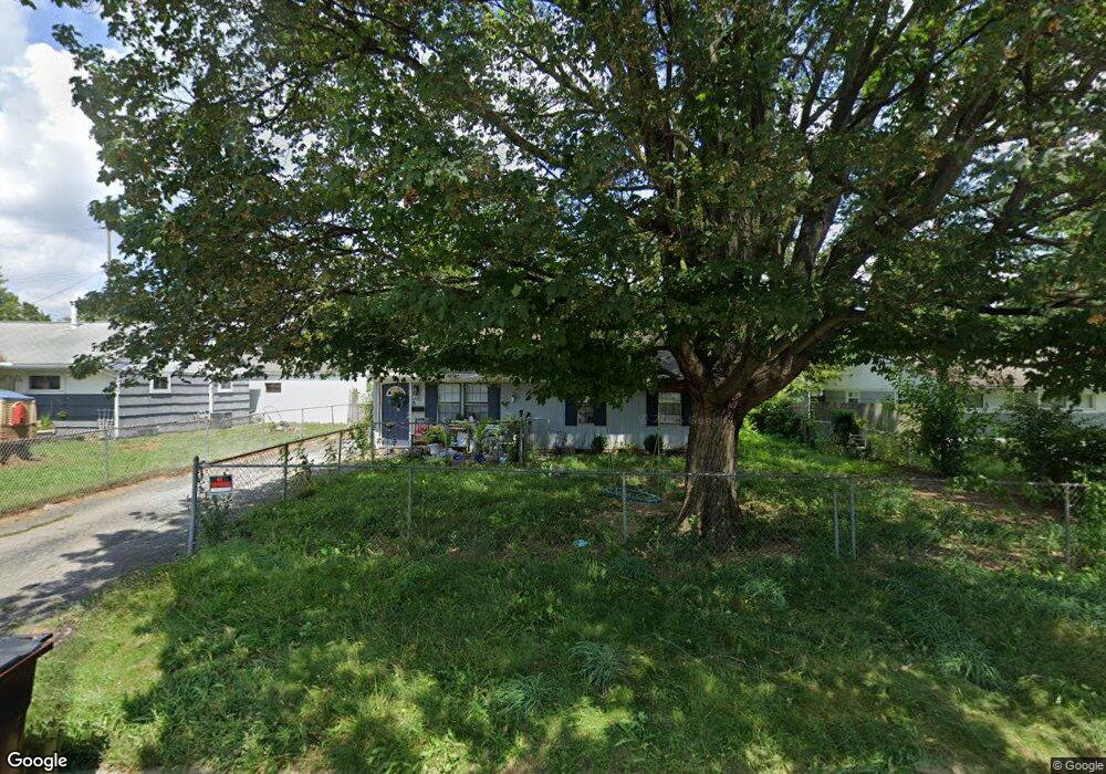
1932 Westfield Dr S Columbus, OH 43223
Estimated Value: $161,000 - $210,000
3
Beds
1
Bath
925
Sq Ft
$190/Sq Ft
Est. Value
About This Home
This home is located at 1932 Westfield Dr S, Columbus, OH 43223 and is currently estimated at $175,538, approximately $189 per square foot. 1932 Westfield Dr S is a home located in Franklin County with nearby schools including Finland Elementary School, Franklin Woods Intermediate School, and Finland Middle School.
Ownership History
Date
Name
Owned For
Owner Type
Purchase Details
Closed on
Dec 19, 2023
Sold by
Vb Six Llc
Bought by
Vinebrook Homes Borrower 1 Llc
Current Estimated Value
Purchase Details
Closed on
Nov 2, 2022
Sold by
Vb One Llc
Bought by
Vb Six Llc
Purchase Details
Closed on
Aug 1, 2022
Sold by
Lormar Investments Llc
Bought by
Vb One Llc
Purchase Details
Closed on
Sep 18, 2009
Sold by
Dorsey Alex and Dorsey Karmon
Bought by
Lormar Investments Llc
Purchase Details
Closed on
Aug 12, 2009
Sold by
Bloomfield Fredric L and Bloomfield Ladonna K
Bought by
Dorsey Alex
Purchase Details
Closed on
Aug 14, 2003
Sold by
Raines Michael S and Raines Freda M
Bought by
Bloomfield Fredric L and Bloomfield Ladonna K
Purchase Details
Closed on
Jun 28, 1994
Sold by
Capital City Investments
Bought by
Raines Michael S and Raines Freda M
Home Financials for this Owner
Home Financials are based on the most recent Mortgage that was taken out on this home.
Original Mortgage
$52,950
Interest Rate
8.78%
Mortgage Type
FHA
Purchase Details
Closed on
Jun 14, 1989
Purchase Details
Closed on
Apr 1, 1987
Create a Home Valuation Report for This Property
The Home Valuation Report is an in-depth analysis detailing your home's value as well as a comparison with similar homes in the area
Home Values in the Area
Average Home Value in this Area
Purchase History
| Date | Buyer | Sale Price | Title Company |
|---|---|---|---|
| Vinebrook Homes Borrower 1 Llc | $4,308,000 | Os National | |
| Vb Six Llc | -- | Total Title Services | |
| Vb One Llc | $326,800 | Total Title Services | |
| Lormar Investments Llc | -- | Trinity Tit | |
| Dorsey Alex | $35,000 | Chicago Tit | |
| Bloomfield Fredric L | $83,000 | Independent Title | |
| Raines Michael S | $53,000 | -- | |
| -- | $46,000 | -- | |
| -- | $44,600 | -- |
Source: Public Records
Mortgage History
| Date | Status | Borrower | Loan Amount |
|---|---|---|---|
| Previous Owner | Raines Michael S | $52,950 |
Source: Public Records
Tax History Compared to Growth
Tax History
| Year | Tax Paid | Tax Assessment Tax Assessment Total Assessment is a certain percentage of the fair market value that is determined by local assessors to be the total taxable value of land and additions on the property. | Land | Improvement |
|---|---|---|---|---|
| 2024 | $2,218 | $42,530 | $7,460 | $35,070 |
| 2023 | $2,207 | $42,530 | $7,460 | $35,070 |
| 2022 | $1,605 | $21,280 | $8,330 | $12,950 |
| 2021 | $1,915 | $21,280 | $8,330 | $12,950 |
| 2020 | $1,792 | $21,280 | $8,330 | $12,950 |
| 2019 | $1,391 | $17,400 | $6,930 | $10,470 |
| 2018 | $1,271 | $17,400 | $6,930 | $10,470 |
| 2017 | $1,311 | $17,400 | $6,930 | $10,470 |
| 2016 | $1,244 | $14,700 | $3,640 | $11,060 |
| 2015 | $1,157 | $14,700 | $3,640 | $11,060 |
| 2014 | $1,158 | $14,700 | $3,640 | $11,060 |
| 2013 | $569 | $14,700 | $3,640 | $11,060 |
Source: Public Records
Map
Nearby Homes
- 1607 Red Leaf Ln
- 1543 Red Leaf Ln
- 1948 Big Run Bluffs Blvd
- 2210 October Ridge Dr
- 1949 Big Run Bluffs Blvd
- 0 S Central Ave
- 1417 Fahy Dr
- 4745 Big Run Rd E
- 1390 Gray Meadow Dr
- 1723 Farberdale Dr
- 2436 Onyx Ct
- 1994 Little Ave
- 2336 Woodbrook Cir N Unit 92 B
- 2362 Woodbrook Cir N Unit 81
- 1532 Westmeadow Dr
- 2180 Eakin Rd
- 1119 Hardesty Place E Unit 1
- 2382 Hardesty Dr S Unit Q-5
- 1085 Hardesty Place E Unit 4
- 2103 Keller Place W
- 1940 Westfield Dr S
- 1926 Westfield Dr S
- 1923 Marsdale Ave
- 1933 Marsdale Ave
- 1915 Marsdale Ave
- 1946 Westfield Dr S
- 1918 Westfield Dr S
- 1984 Westfield Dr S
- 1933 Westfield Dr S
- 1939 Marsdale Ave
- 1911 Marsdale Ave
- 1943 Westfield Dr S Unit 945
- 1952 Westfield Dr S
- 1947 Marsdale Ave
- 1917 Westfield Dr S Unit 919
- 1951 Westfield Dr S Unit 1953
- 1951-1953 Westfield Dr S
- 1928 Marsdale Ave
- 1938 Frank Rd
- 1920 Marsdale Ave