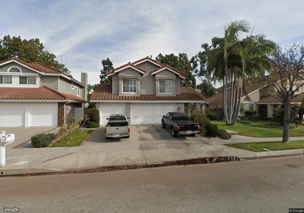
19320 Segal St Cerritos, CA 90703
Estimated Value: $1,597,161 - $2,086,000
4
Beds
3
Baths
3,154
Sq Ft
$567/Sq Ft
Est. Value
About This Home
This home is located at 19320 Segal St, Cerritos, CA 90703 and is currently estimated at $1,789,040, approximately $567 per square foot. 19320 Segal St is a home located in Los Angeles County with nearby schools including Carver Elementary School, Tetzlaff (Martin B.) Middle School, and Cerritos High School.
Ownership History
Date
Name
Owned For
Owner Type
Purchase Details
Closed on
Oct 31, 2017
Sold by
Consunji Eduardo D
Bought by
Consunji Eduardo D and Consunji Amelia B
Current Estimated Value
Home Financials for this Owner
Home Financials are based on the most recent Mortgage that was taken out on this home.
Original Mortgage
$424,100
Interest Rate
3.85%
Mortgage Type
New Conventional
Purchase Details
Closed on
Dec 9, 2004
Sold by
Consunji Eduardo D
Bought by
Consunji Eduardo D and Consunji Amelia B
Create a Home Valuation Report for This Property
The Home Valuation Report is an in-depth analysis detailing your home's value as well as a comparison with similar homes in the area
Home Values in the Area
Average Home Value in this Area
Purchase History
| Date | Buyer | Sale Price | Title Company |
|---|---|---|---|
| Consunji Eduardo D | -- | First American Title Company | |
| Consunji Eduardo D | -- | First American Title Company | |
| Consunji Eduardo D | -- | -- |
Source: Public Records
Mortgage History
| Date | Status | Borrower | Loan Amount |
|---|---|---|---|
| Closed | Consunji Eduardo D | $424,100 |
Source: Public Records
Tax History Compared to Growth
Tax History
| Year | Tax Paid | Tax Assessment Tax Assessment Total Assessment is a certain percentage of the fair market value that is determined by local assessors to be the total taxable value of land and additions on the property. | Land | Improvement |
|---|---|---|---|---|
| 2025 | $6,912 | $570,066 | $175,698 | $394,368 |
| 2024 | $6,912 | $558,889 | $172,253 | $386,636 |
| 2023 | $6,689 | $547,931 | $168,876 | $379,055 |
| 2022 | $6,587 | $537,188 | $165,565 | $371,623 |
| 2021 | $6,471 | $526,656 | $162,319 | $364,337 |
| 2019 | $6,272 | $511,037 | $157,505 | $353,532 |
| 2018 | $5,811 | $501,017 | $154,417 | $346,600 |
| 2017 | $26 | $491,194 | $151,390 | $339,804 |
| 2016 | $5,558 | $481,564 | $148,422 | $333,142 |
| 2015 | $5,488 | $474,331 | $146,193 | $328,138 |
| 2014 | $5,380 | $465,041 | $143,330 | $321,711 |
Source: Public Records
Map
Nearby Homes
- 19335 Derbyshire Ln
- 12711 Castleford Ln
- 19657 Sequoia Ave
- 12361 Caravel Place
- 12967 Moorshire Dr
- 12132 Cambrian Cir
- 19008 Jeffrey Ave
- 7862 Squaw Valley Way
- 12360 Hedda Dr
- 11974 Bos St
- 0 Parcel: 7016-014-017 Ave Unit PW25183248
- 13044 Hedda Ln
- 12356 Reva St
- 19118 Martha Ave
- 12523 Lemming St
- 19518 Nancy Cir
- 18035 Horst Ave
- 4322 Fontainbleau Ave
- 18425 Devlin Ave
- 18403 Devlin Ave
- 19328 Segal St
- 19316 Segal St
- 19308 Segal St
- 19332 Segal St
- 12546 Sinatra St
- 12545 Pacino St
- 19304 Segal St
- 12540 Sinatra St
- 12539 Pacino St
- 19322 Bloomfield Ave
- 19318 Bloomfield Ave
- 19402 Segal St
- 12534 Sinatra St
- 19330 Bloomfield Ave
- 19310 Bloomfield Ave
- 19413 Bloomfield Ave
- 12533 Pacino St
- 12539 Sinatra St
- 19340 Bloomfield Ave
- 19304 Bloomfield Ave